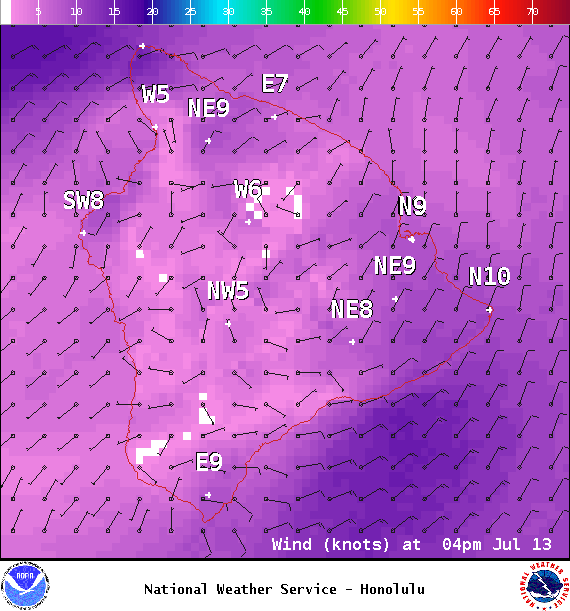
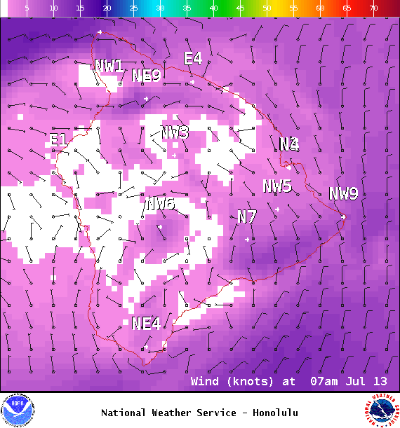
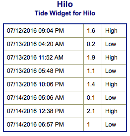
**Click directly on the images below to make them larger. Charts include: Big Island projected winds, tides, swell direction & period and expected wave heights.**
ARTICLE CONTINUES BELOW AD
ARTICLE CONTINUES BELOW AD
+
SWIPE LEFT OR RIGHT
Big Island Surf Forecast
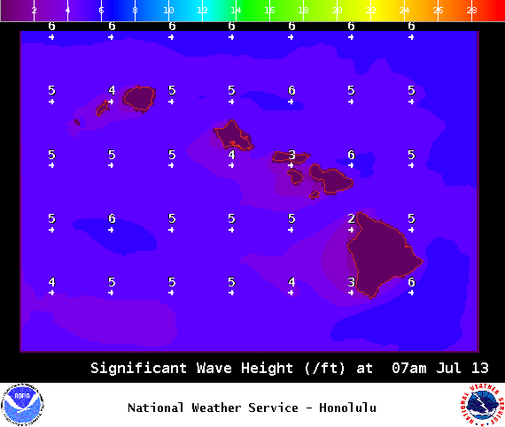
Hilo side: Wave heights for spots exposed to the trade swell are expected to be around waist/head high. The best breaks could get slightly overhead on the sets in the morning.
ARTICLE CONTINUES BELOW AD
Kona side: Wave heights are expected to be knee/thigh high today with the best breaks catching maybe a waist high wave on the sets.
South: Wave heights are expected to be knee/thigh high today with the best breaks catching maybe a waist high wave on the sets.
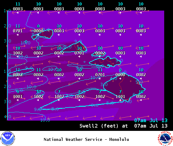
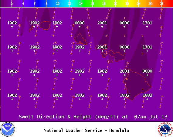
Old south-southwest is fading while a new one builds in and peaks late Thursday into Friday.
Trade swell will bring surf to northeast exposures but onshore breeze will pick up quickly during the day to chop it up.
ARTICLE CONTINUES BELOW AD
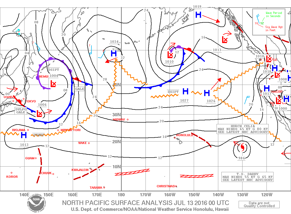
Quiet in the North Pacific at this time.
East swell from Blas continues into the middle of this week. Hurricane Celia will generate more swell. For now, east swell is expected to build Friday into Saturday and peak Sunday. Darby is also likely to generate swell for us. Will keep an eye on the development and bring you details as they become clearer.
Keep in mind, surf heights are measured on the face of the wave from trough to crest. Heights vary from beach to beach, and at the same beach, from break to break.
This comments section is a public community forum for the purpose of free expression. Although Big Island Now encourages respectful communication only, some content may be considered offensive. Please view at your own discretion. View Comments


 Big Island Surf Forecast
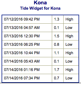 Old south-southwest is fading while a new one builds in and peaks late Thursday into Friday.