A Small Craft Advisory is posted for the ʻAlenuihāhā channel as well as waters to the west and south of the Big Island through 6 p.m. Monday. Trade wind speeds are expected to increase during this time.
A Flash Flood Watch has been posted for Hawaii County through Monday afternoon. Abundant moisture upstream of the islands is expected to bring heavy rain. Periods of heavy rain and saturated soils from recent rainfall will increase the risk for flash flooding during this time. A Flash Flood Watch means that conditions may develop that lead to flash flooding.
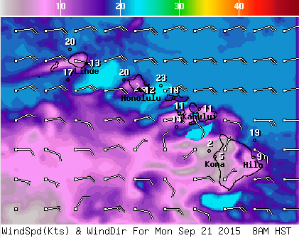
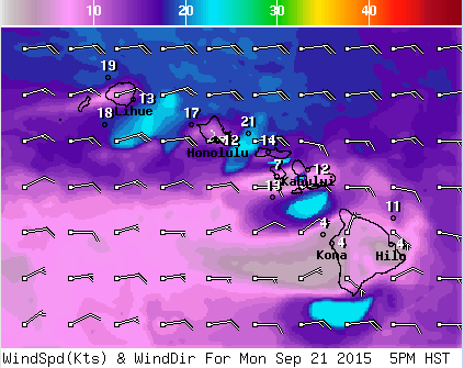
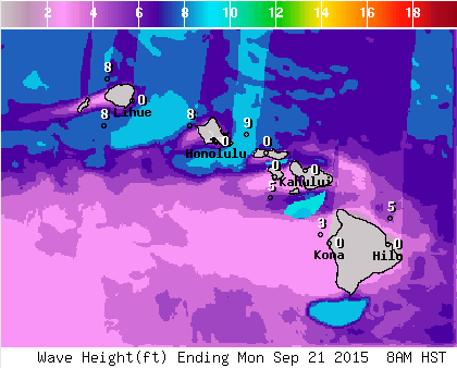
**Click directly on the images below to make them larger. Charts include: Big Island high/low forecasted temperatures, projected winds, chance of cloud cover, projected localized weather conditions, vog/SO2 forecast and expected wave heights.**
+
SWIPE LEFT OR RIGHT
ARTICLE CONTINUES BELOW AD
ARTICLE CONTINUES BELOW AD
Looking Ahead
Breezy trades are expected to keep bringing mainly windward and mauka showers during the next couple of days with the heaviest rainfall expected over the eastern half of the island chain. Periods of heavy rain are also possible, mainly over Maui county and the Big Island. Some of the larger showers may reach leeward locations at times. The wet trade wind pattern may continue during the second half of the work week as another area of enhanced moisture approaches the aloha state from the east.
Today
ARTICLE CONTINUES BELOW AD
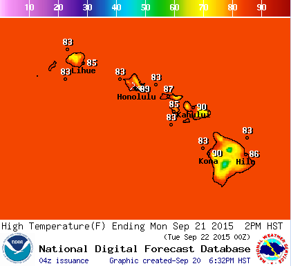
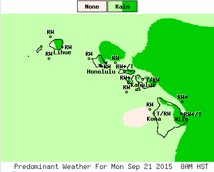
We expect mostly cloudy skies for windward Big Island with showers likely. Locally heavy rainfall is possible with a slight chance of thunderstorms. The Kona side will be partly cloudy to start and mostly cloudy with scattered showers each afternoon. Some of those showers may be heavy. High temperatures from 86° to 91°. East winds are around 15 mph.
UV index at 11 (“extreme” exposure level)
Tonight
ARTICLE CONTINUES BELOW AD
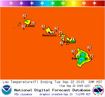
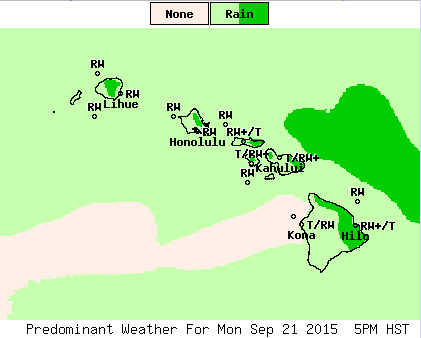
East winds are expected in the evening around 15 mph. Low temperatures from 78° to 83°. Mostly cloudy skies are expected in the evening with frequent showers for windward spots. Locally heavy rainfall is possible. Leeward spots should get scattered showers in the evening with a clearing trend as the night goes on.
This comments section is a public community forum for the purpose of free expression. Although Big Island Now encourages respectful communication only, some content may be considered offensive. Please view at your own discretion. View Comments