Hawai’i County Civil Defense says that despite continued June 27 lava flow activity, including breakouts along both margins of the flow in upslope areas, the main downslope areas continue to see no advancement.
The breakout reported Sunday along the south margin, located about 600 yards upslope from the original stalled flow front, remained sluggish during Civil Defense’s morning overflight. This flow has not advanced since Monday morning.
Officials say that surface breakouts, as well as breakouts along the north and south margins of the flow, show that lava is continuing to be supplied from the source and is making its way down to downslope areas.
At the current time, no lava activity poses a threat to communities in the area. Civil Defense, along with Hawaiian Volcano Observatory, will continue to monitor conditions and keep the public informed of any changes.
ARTICLE CONTINUES BELOW AD
ARTICLE CONTINUES BELOW AD
Light to moderate smoke conditions were reported Wednesday morning as a light northwest wind was blowing smoke in a southeast direction. As usual, these conditions have the possibility of changing and those who are sensitive or have respiratory issues should take necessary precautions.
As of Civil Defense’s overflight, burning activity was limited to vegetation that was burning along the edges of the breakouts. Fire conditions will continue to be monitored.
+
SWIPE LEFT OR RIGHT
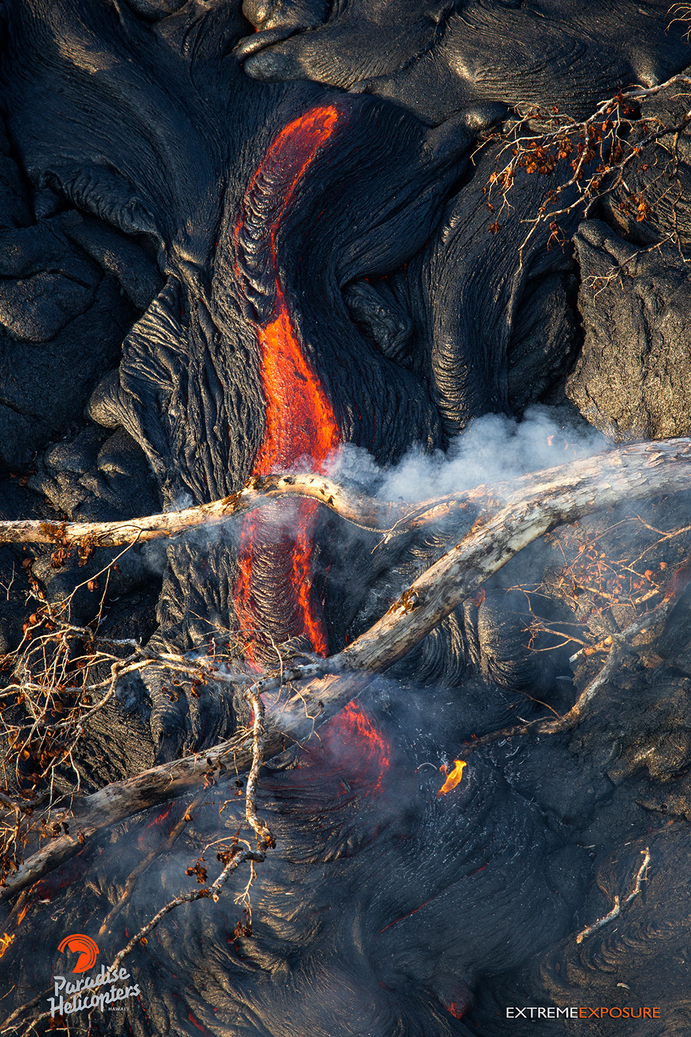
This photo, taken Feb. 16, shows intense heat rising from a little river of lava igniting a fallen tree above it. Photo credit: Extreme Exposure Media/Paradise Helicopters.
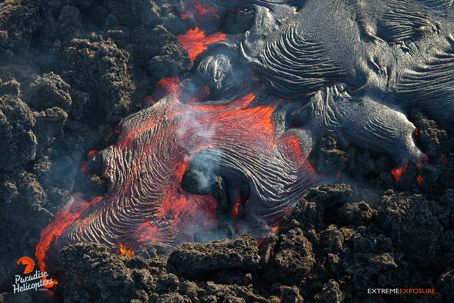
In this photo, taken Feb. 16, Pahoehoe covers an old ‘a‘a field just downslope of Pu‘u ‘O‘o. Photo credit: Extreme Exposure Media/Paradise Helicopters.
In this photo, taken Feb. 16, pahoehoe covers an old ‘a‘a field just downslope of Pu‘u ‘O‘o. Photo credit: Extreme Exposure Media/Paradise Helicopters.
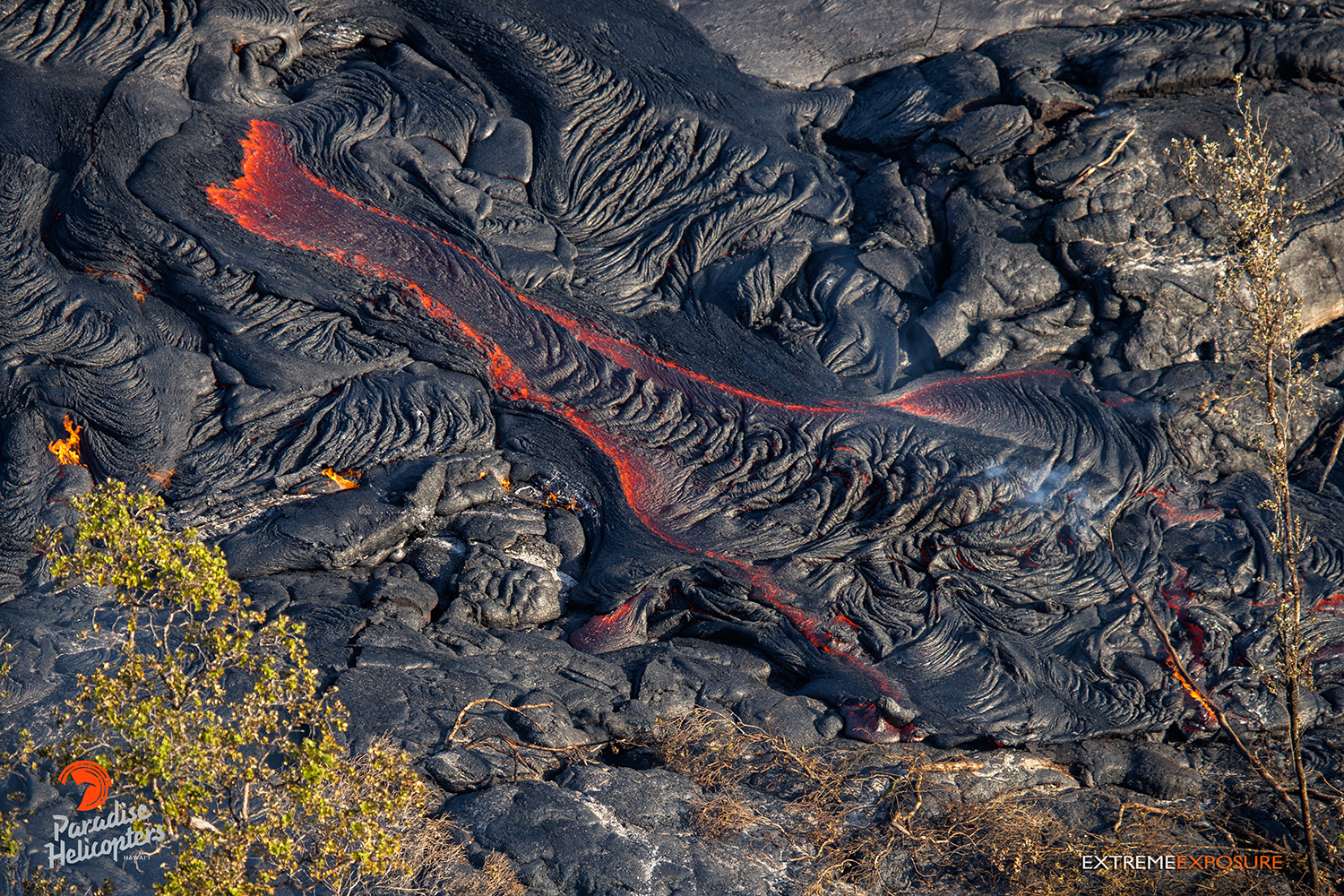
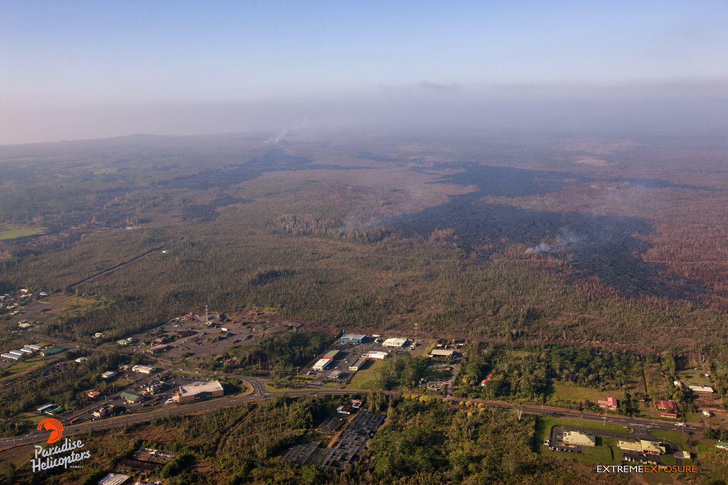
In this photo, taken Feb. 16, activity picked up a little as a finger of lava on the southern margin of the Pahoa Marketplace flow advanced about 100 yards the two days prior. Photo credit: Extreme Exposure Media/Paradise Helicopters.
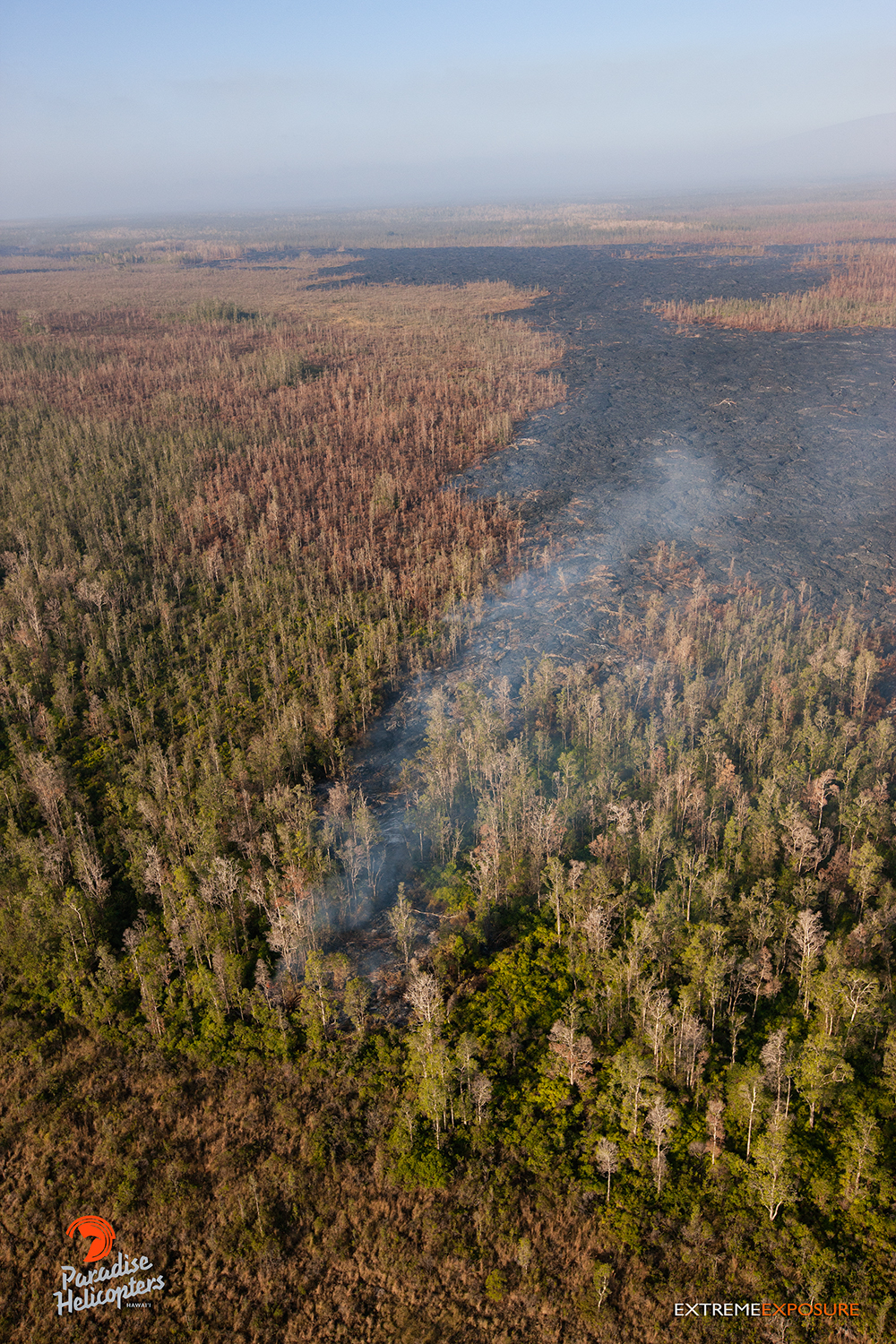
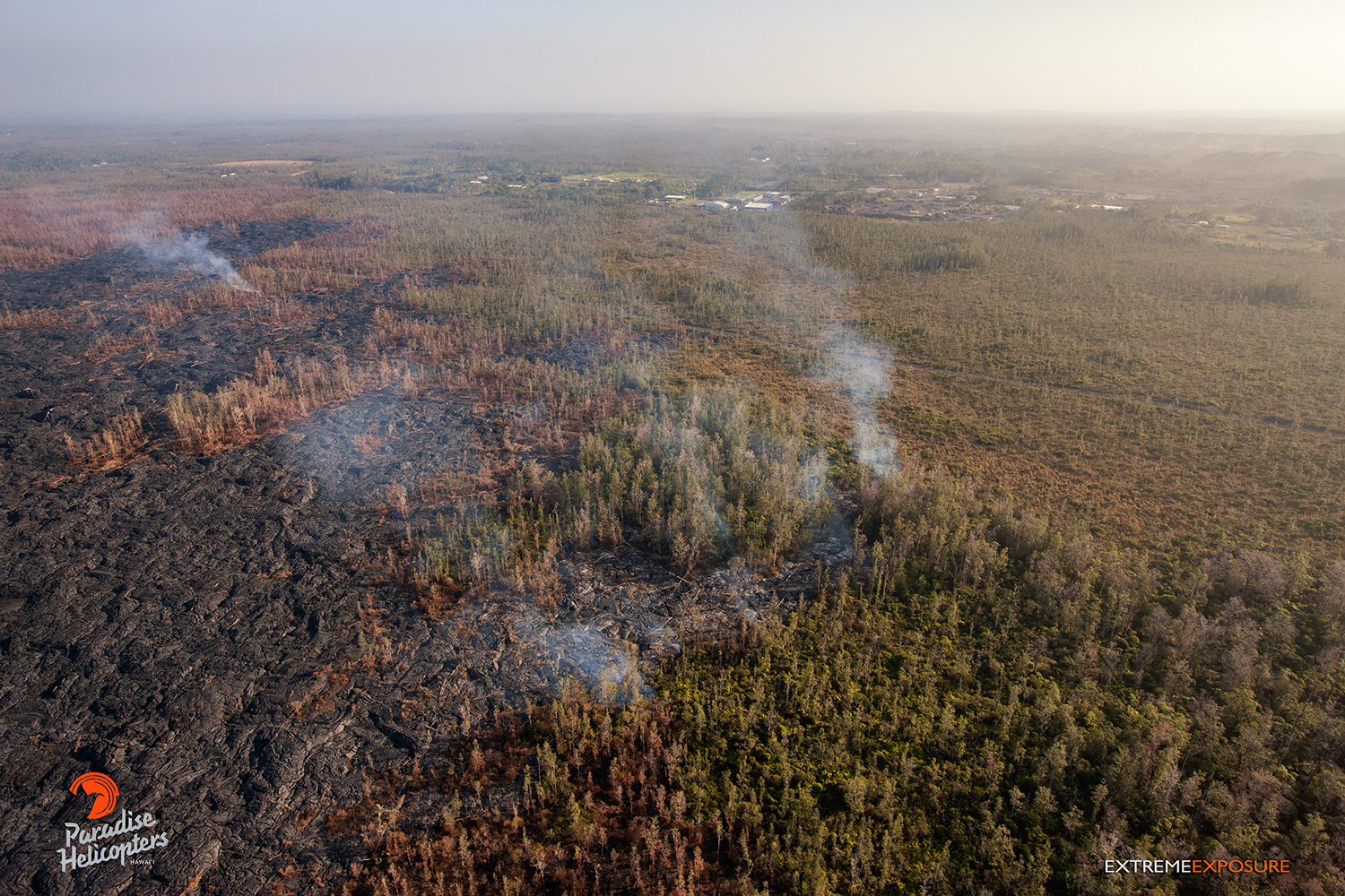
In this photo, taken Feb. 16, a few hot spots continue to expand the flow field just upslope of the Pahoa Marketplace. Photo credit: Extreme Exposure Media/Paradise Helicopters.
In this photo, taken Feb. 16, an active finger progressed through an ohia forest roughly 600 yards upslope of the distal tip of the Pahoa Marketplace lobe. Photo credit: Extreme Exposure Media/Paradise Helicopters.
This photo, taken Feb. 16, shows a few hot spots that continued to expand the flow field just upslope of the Pahoa Marketplace. Photo credit: Extreme Exposure Media/Paradise Helicopters.
This photo, taken Feb. 16, shows a few hot spots that continued to expand the flow field just upslope of the Pahoa Marketplace. Photo credit: Extreme Exposure Media/Paradise Helicopters.
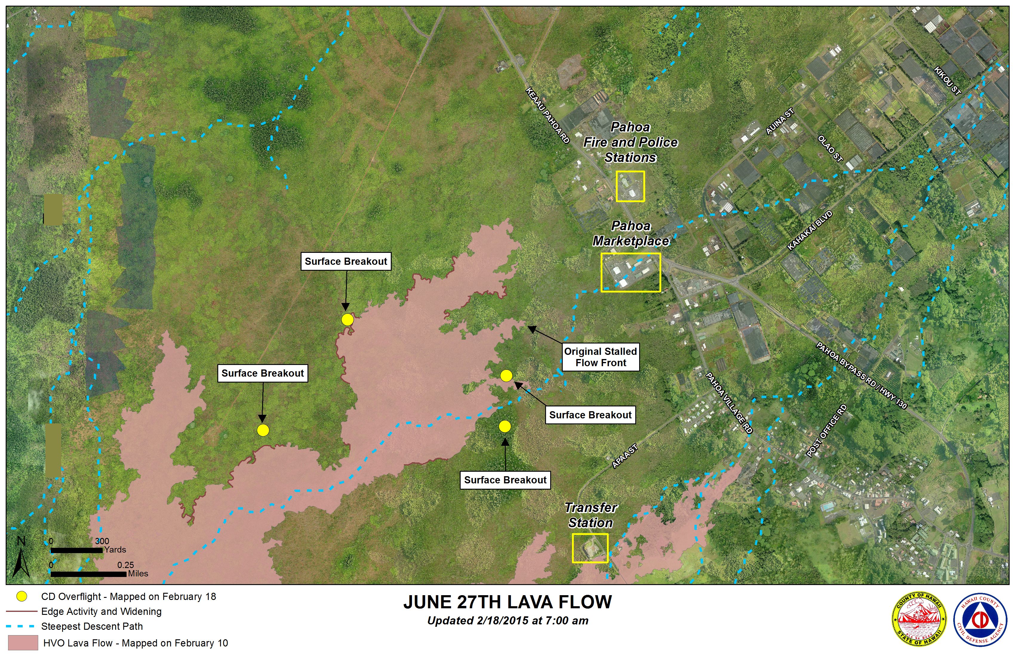
Hawai’i County Civil Defense lava flow map, as of Feb. 18 at 7 a.m. Civil Defense image.
Hawai’i County Civil Defense lava flow map, as of Feb. 18 at 7 a.m. Civil Defense image.
This comments section is a public community forum for the purpose of free expression. Although Big Island Now encourages respectful communication only, some content may be considered offensive. Please view at your own discretion. View Comments