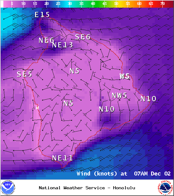
A Small Craft Advisory is posted for all Hawaii County waters until Wednesday at 6 p.m. Winds of 20 to 25 knots are expected and rough seas up to 14 feet. Inexperienced mariners should avoid navigating in these conditions.
The High Surf Advisory has been extended for the east facing shores of the Big Island until 6 p.m. Monday. Surf along east facing shores could reach heights of 5 to 8 feet. Expect strong breaking waves, shore break and dangerous currents that make getting into the water hazardous and swimming difficult.
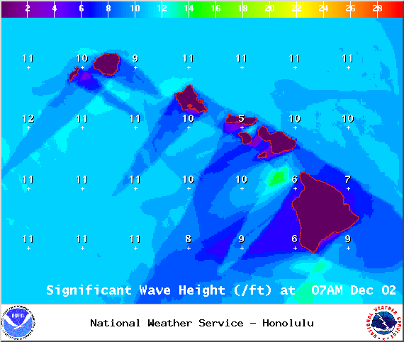
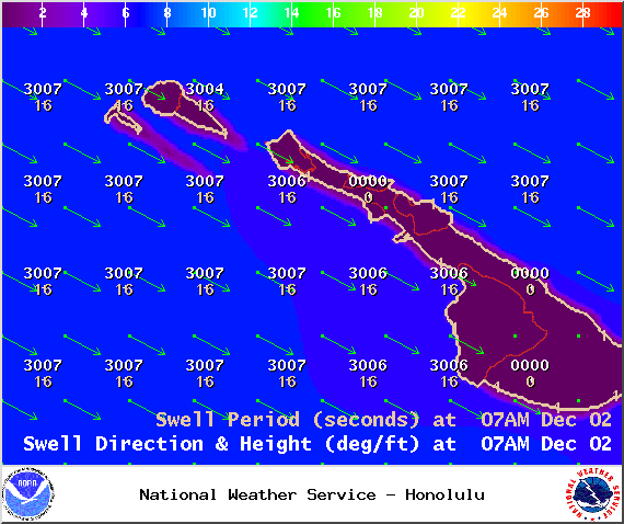
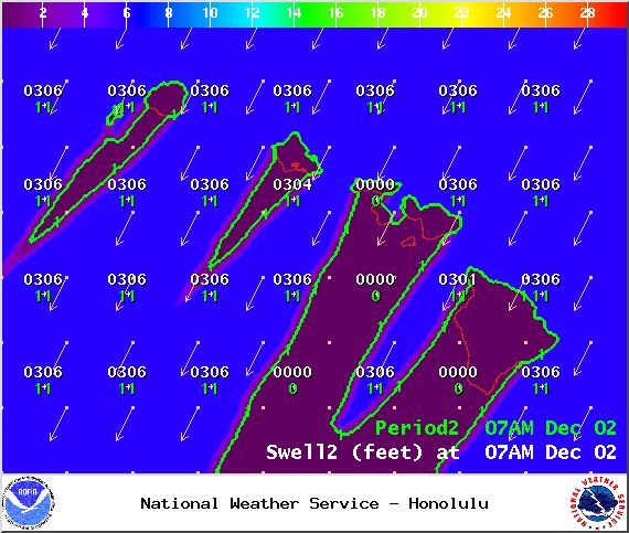
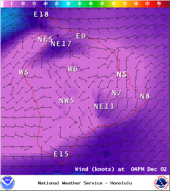
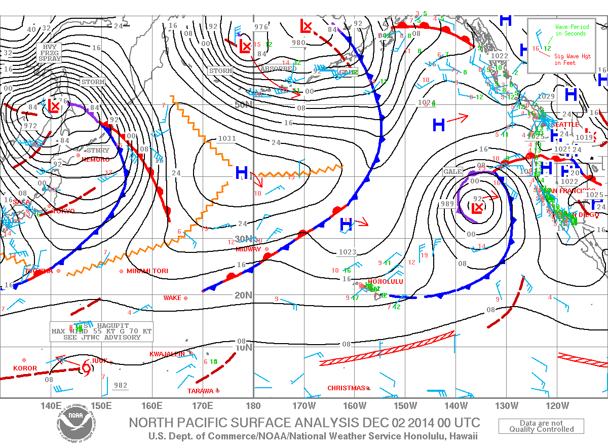
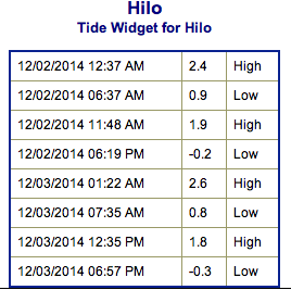
**Click directly on the images below to make them larger. Charts include: Big Island projected winds, tides, swell direction & period and expected wave heights.**
+
SWIPE LEFT OR RIGHT
ARTICLE CONTINUES BELOW AD
ARTICLE CONTINUES BELOW AD
Big Island Surf Forecast, Tuesday December 2
Hilo side: Surf is expected head high to possibly a couple of feet overhead at the best breaks. Expected to be a bit larger late in the day.
Kona side: Surf is expected head high to a couple of feet overhead for the best exposures. Expected to be a bit larger late in the day.
ARTICLE CONTINUES BELOW AD
South: Southeast shores open to the trade swell could see waves shoulder to head high, though sloppy and choppy conditions are expected. Minimal surf out of the southern hemisphere – knee high or less. Some wrap from the west-northwest swell.
Trade winds are generating swell for windward spots on the Big Island. Conditions will be choppy and sloppy.
A west-northwest swell is expected to peak today. Surf is expected a couple feet overhead at the best breaks and should show best on the Kona side. Swell is expected to shift tomorrow into Thursday and will swing some it’s energy away from the Kona coast and toward northwest exposures.
A north-northeast swell is expected to maintain wave heights a couple feet overhead the next couple of days, peaking Wednesday with double overhead + sets at the best exposures (especially on the Hilo side).
ARTICLE CONTINUES BELOW AD
A new north-northwest swell is expected to build Friday into Saturday.
Super small trace amounts of swell expected out of the SPAC. Not much to get excited about.
Keep in mind, surf heights are measured on the face of the wave from trough to crest. Heights vary from beach to beach, and at the same beach, from break to break.
This comments section is a public community forum for the purpose of free expression. Although Big Island Now encourages respectful communication only, some content may be considered offensive. Please view at your own discretion. View Comments


 Big Island Surf Forecast, Tuesday December 2
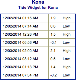 Trade winds are generating swell for windward spots on the Big Island. Conditions will be choppy and sloppy.