After spending much of the night rattling Big Island rooftops with heavy wind gusts, Hurricane Iselle has deteriorated into a tropical storm, soaking Hawai`i County and leading to extended flash-flood warnings.
Flash Flood Warning Extended
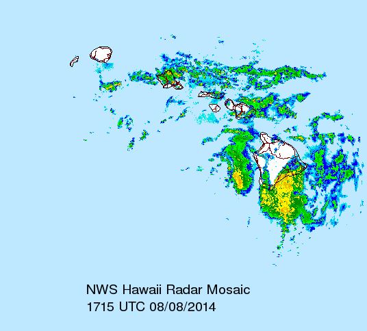
At 6:21 a.m. on August 8, NOAA weather radar showed continued heavy rains pounding sections of Ka`u, Puna and Hilo, with stream gauges indicating signs of flash-flooding.
A flash flood warning issued overnight has been extended until at least 8:30 a.m., with areas of impact expected to be (but not limited to) Hilo, Keaau, Pahoa, Mountain View, Volcano, Pahala, Wood Valley and Na`alehu.
ARTICLE CONTINUES BELOW AD
ARTICLE CONTINUES BELOW AD
Officials said that low water crossings from Wood Valley to Pahala, and Hawaii Belt Highway near Kawa Flats (mile markers 58 and 59) were especially vulnerable to flood conditions at this time.
Tropical Storm Iselle, as seen via NOAA weather radar on August 8, 2014. NOAA image.
Friday Forecast
NOAA officials predicted that wet weather and high winds would continue on the Big Island throughout the day, with frequent showers and thunderstorms before noon.
ARTICLE CONTINUES BELOW AD
Up to 1 to 2 inches of additional rainfall are expected Friday, while wind speeds could reach 26 to 36 mph, with gusts as high as 50 mph.
Forecasters expect that showers will continue into the evening, with occasional heavy rainfall. Wind speeds will slowly decrease, with a southeast wind of 10 to 14 mph after midnight.
This comments section is a public community forum for the purpose of free expression. Although Big Island Now encourages respectful communication only, some content may be considered offensive. Please view at your own discretion. View Comments