The U.S. Geological Survey released the following weekly update on Tuesday, April 9, 2019.
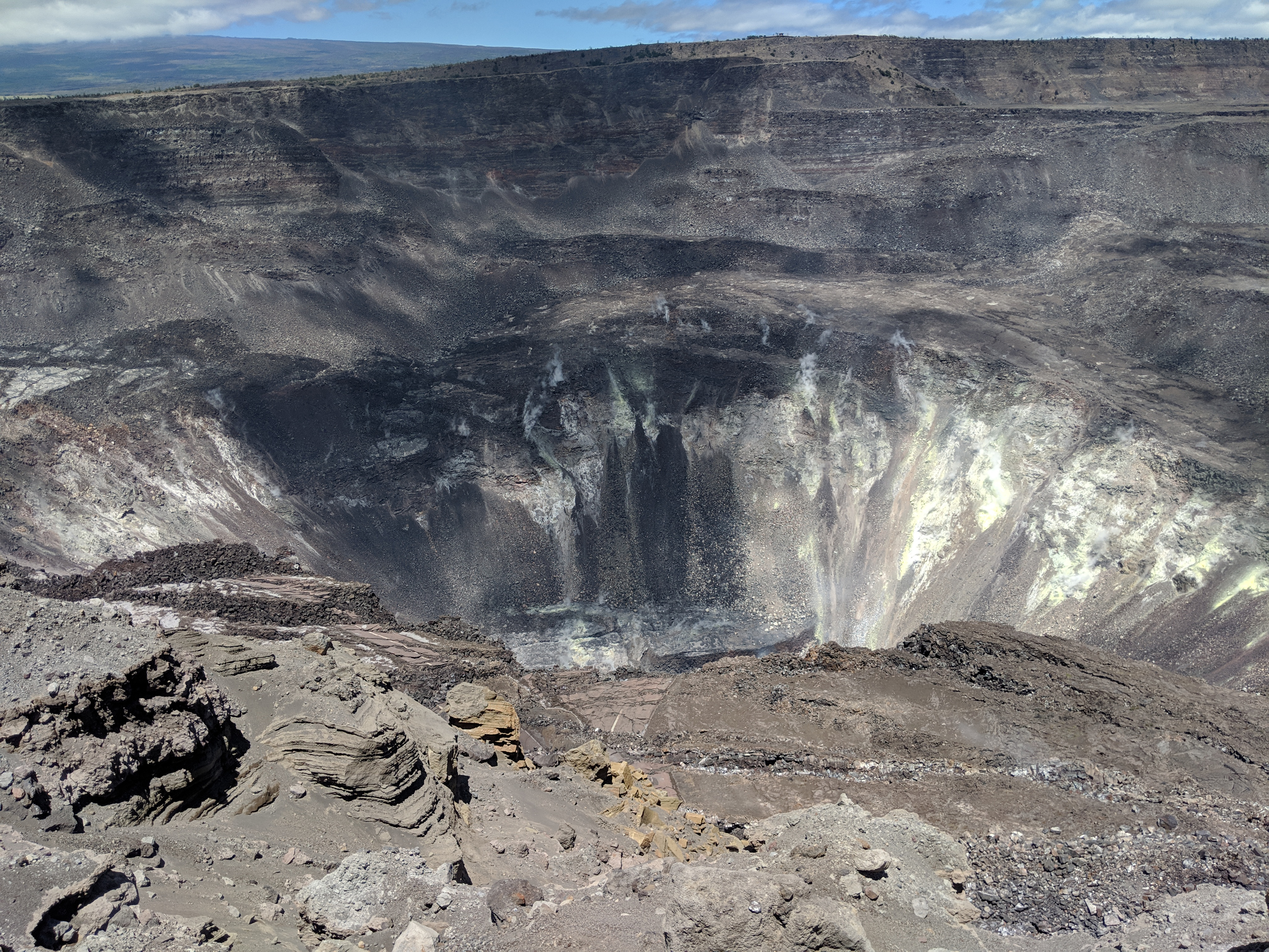
Only small amounts of sulfur dioxide (SO2) and hydrogen sulfide (H2S) are currently being released from Kīlauea, but those gases chemically react with each other to form the bright yellow sulfur deposits on the crater walls within Halema‘uma‘u. PC: USGS photo by M. Poland, March, 22, 2019.
Kīlauea Volcano is not erupting. Monitoring data over the past eight months have shown relatively low rates of seismicity, deformation, and gas emission at the summit and East Rift Zone (ERZ) including the area of the 2018 eruption.
As of March 26, 2019, Kīlauea Volcano is at NORMAL/GREEN. For definitions of USGS Volcano Alert Levels and Aviation Color Codes, go online.
Despite this classification, Kīlauea remains an active volcano, and it will erupt again. Although we expect clear signs prior to a return to eruption, the time frame of warning may be short. Island of Hawaiʻi residents should be familiar with the long-term hazard map for Kīlauea Volcano and how to stay informed about Kīlauea activity.
ARTICLE CONTINUES BELOW AD
ARTICLE CONTINUES BELOW AD
Observations: This past week saw no significant change in monitoring data or volcanic activity. Low rates of seismicity continue across the volcano, with earthquakes occurring primarily in the summit and south flank regions. GPS stations and tiltmeters continue to show motions consistent with refilling of the deep East Rift Zone magma reservoir. Sulfur dioxide emission rates from the summit and from Puʻu ʻŌʻō remain low. These rates have been steady over the past several months.
A GPS station on the north flank of Puʻu ʻŌʻō has been showing steady slumping of the craters edge, and the motion has continued this week. This motion is not directly related to magmatic activity, but is interpreted to be sliding of the unstable edge of Puʻu ʻŌʻō cone. Small collapses at Puʻu ʻŌʻō have occurred since the eruption due to instability.
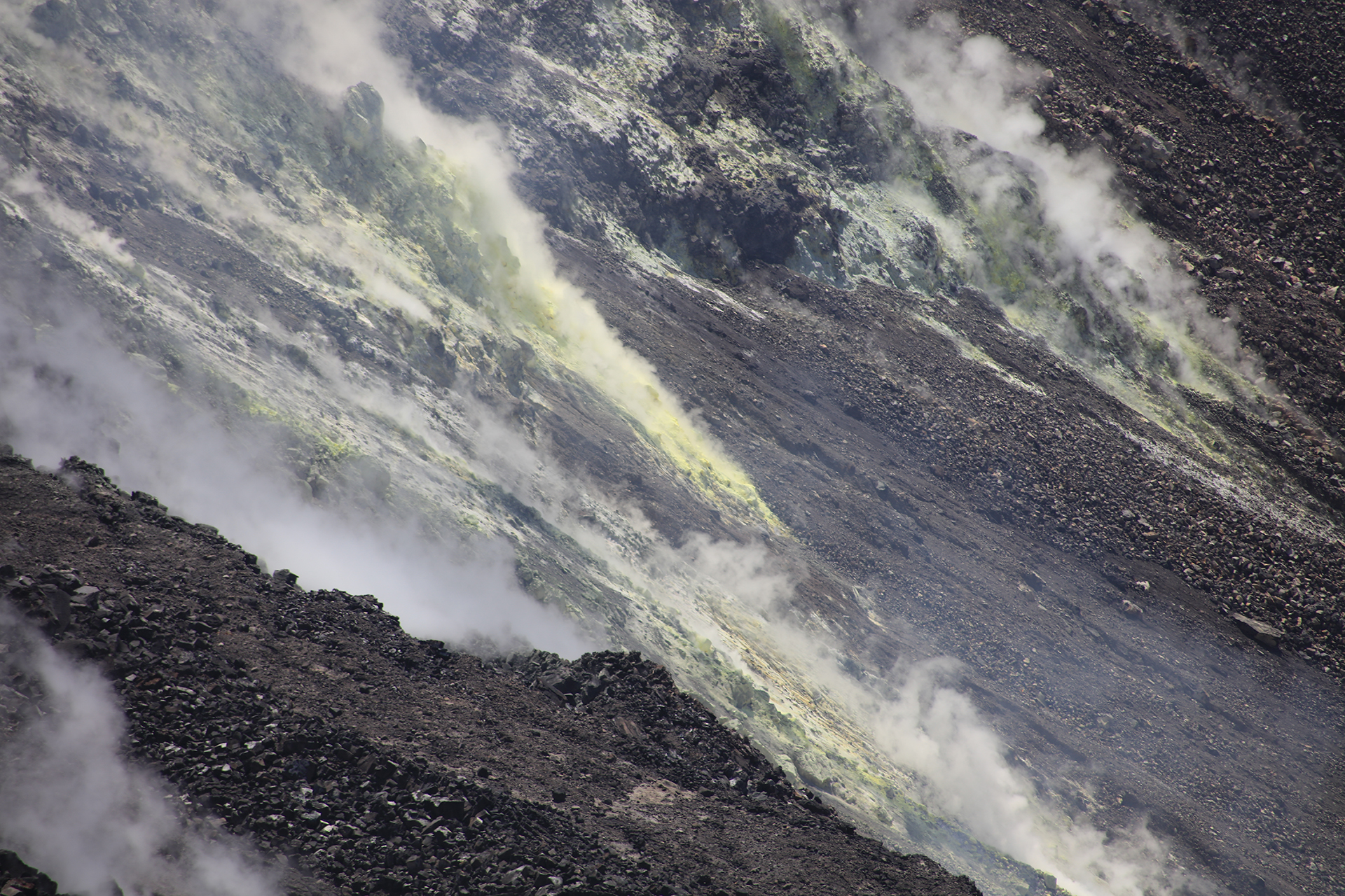
A telephoto view of the sulfur deposits forming on the walls of Halema‘uma‘u. PC: USGSby C. Parcheta, April 2, 2019.
Hazards remain in the lower East Rift Zone eruption area and at the Kīlauea summit. Residents and visitors near the 2018 fissures, lava flows, and summit collapse area should heed Hawaii County Civil Defense and National Park warnings. Hawaii County Civil Defense advises that lava flows and features created by the 2018 eruption are primarily on private property and persons are asked to be respectful and not enter or park on private property.
ARTICLE CONTINUES BELOW AD
The Hawaiian Volcano Observatory (HVO) continues to closely monitor Kīlauea’s seismicity, deformation, and gas emissions for any sign of increased activity. HVO maintains visual surveillance of the volcano with web cameras and occasional field visits. HVO will continue to issue a weekly update (every Tuesday) until further notice, and we will issue additional messages as warranted by changing activity.
This comments section is a public community forum for the purpose of free expression. Although Big Island Now encourages respectful communication only, some content may be considered offensive. Please view at your own discretion. View Comments