The National Weather Service Hurricane Centers issued updates on Hurricane Norman and Olivia at 5 a.m. on Friday, Sept. 7, 2018.
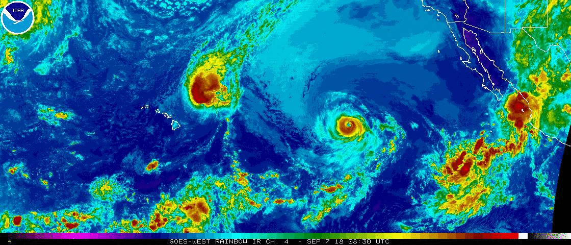
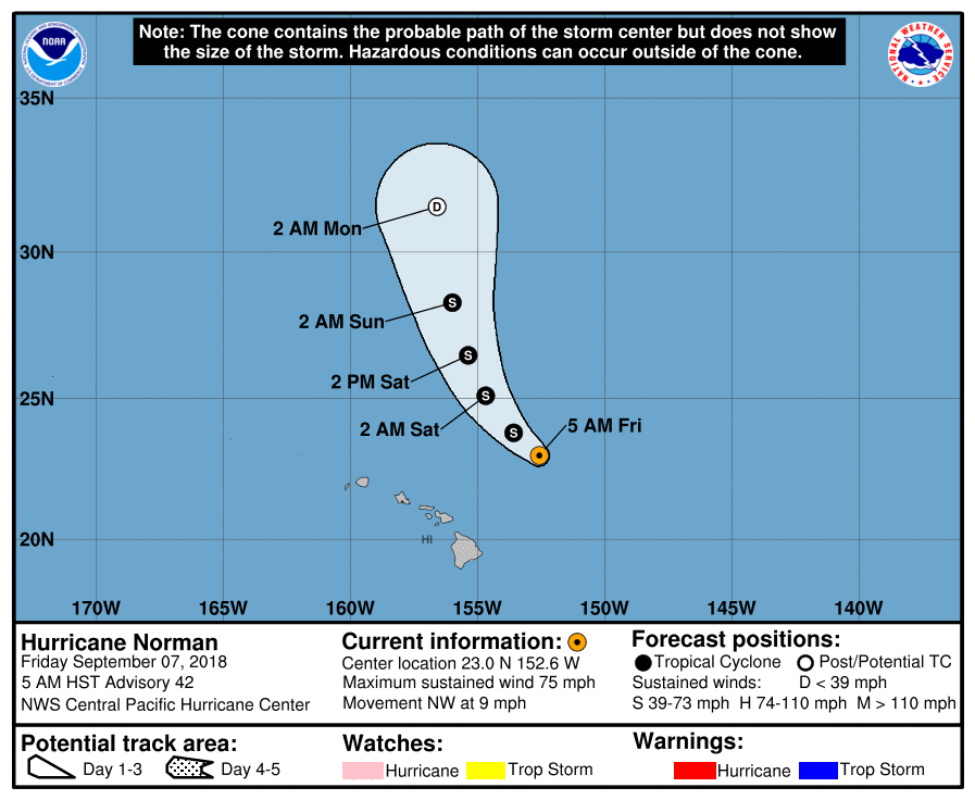
NWS Central Pacific Hurricane Center in Honolulu reported that Hurricane Norman, NE of the Hawaiian Island, is weakening as it continues its NW path.
The center of Hurricane Norman at 5 a.m. was located near latitude 23.0 north, longitude 152.6 west, 280 miles NE of Hilo. Norman is moving toward the NW near 9 mph and this motion is expected to continue through Saturday, becoming NNW on Sunday.
Maximum sustained winds are near 75 mph with higher gusts. Weakening is forecast through Sunday.
ARTICLE CONTINUES BELOW AD
ARTICLE CONTINUES BELOW AD
Hurricane-force winds extend outward up to 30 miles from the center and tropical-storm-force winds extend outward up to 140 miles.
A large swell generated by Norman will continue across the main Hawaiian Islands today, causing large and potentially dangerous surf along east-facing shores. A High Surf Warning is in effect for north- and east-facing shores. The surf will diminish tonight.
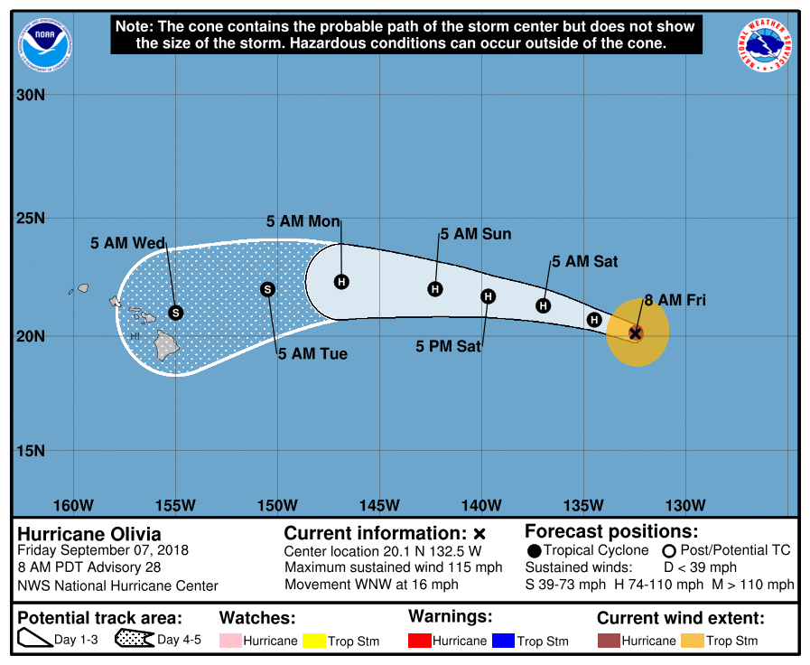
The NWS NHC in Miami, Florida, reported that Olivia is weakening but remains a major hurricane. Although Olivia is still a major hurricane, the eye is not quite as distinct as it was overnight.
At 5 a.m., the center of Category 3 Hurricane Olivia was located near latitude 20.1 north, longitude 132.5 west, about 1,465 miles east of Hilo.
Olivia has the potential to track very close to Hawai‘i as a hurricane or strong tropical storm.
ARTICLE CONTINUES BELOW AD
IF Olivia maintains a westerly course through next week, the storm would approach Hawai‘i Tuesday and Wednesday.
Olivia is moving toward the WNW near 16 mph, and this general motion is forecast to continue through Saturday; it is expected to cross into the Central Pacific basin by late Saturday.
A gradual turn toward the west is expected Saturday night or Sunday. A turn to the west-southwest is also expected.
Olivia is an annular hurricane with a well organized inner core and symmetrical appearance, but lacking outer rainbands.
ARTICLE CONTINUES BELOW AD
Maximum sustained winds have decreased to near 115 mph, with higher gusts. A slow weakening trend is expected during the next few days.
Hurricane-force winds extend outward up to 30 miles from the center and tropical-storm-force winds extend outward up to 115 miles.
Annular hurricanes like Olivia weaken slower than normal in the existing conditions.
This comments section is a public community forum for the purpose of free expression. Although Big Island Now encourages respectful communication only, some content may be considered offensive. Please view at your own discretion. View Comments