

Norman Weakening; Cat 3 Olivia May Strengthen
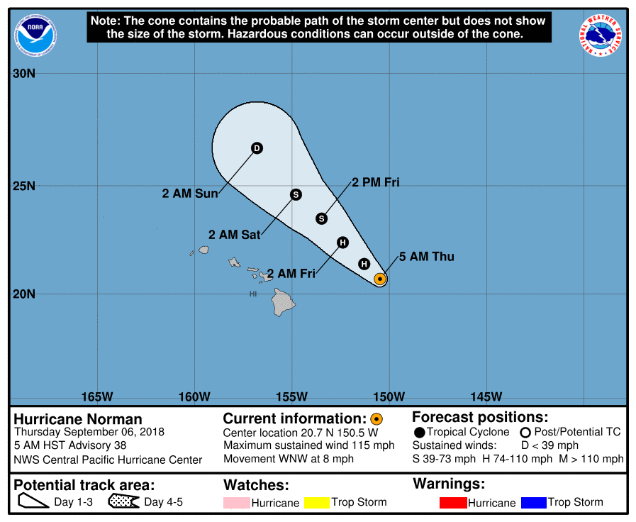
Hurricane Norman is weakening east of the Hawaiian Islands and tracking toward the WNW, the National Weather Service Central Pacific Hurricane Center in Honolulu reported on Thursday, Sept. 6, 2018.
At 5 a.m., the center of Hurricane Norman was located near latitude 20.7 north, longitude 150.5 west, about 305 miles ENE of Hilo.
Norman is moving toward the WNW near 8 mph, and a turn toward the NW is expected today.
Norman is forecast to continue to move toward the NW on Friday and Saturday, and along the
forecast track, the center of Norman is expected to pass 200 to 300 miles to the northeast of the main Hawaiian Islands.
Norman is a Category 3 hurricane with maximum sustained winds near 115 mph, with higher gusts.
Steady weakening is expected during the next few days.
Hurricane-force winds extend outward up to 30 miles from the center and tropical-storm-force winds extend outward up to 105 miles.
SURF: Large swells generated by Norman will continue to build across the Hawaiian Islands today. Large and potentially dangerous surf is expected along east-facing shores through at least tonight.
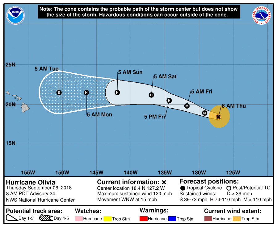
Hurricane Olivia remains a major hurricane about 1,160 miles WSW of Baja, the NWS NHC in Miami, Florida reported at 5 a.m..
The eye of Hurricane Olivia is located near latitude 18.4 north, longitude 127.2 west, moving
WNW near 15 mph. This motion, with some increase in forward speed, is expected during the next
couple of days.
A gradual turn toward the west is expected over the weekend.
Maximum sustained winds are near 120 mph with higher gusts. Olivia is a Category 3 hurricane on the Saffir-Simpson Hurricane Wind Scale.
Some strengthening is possible today. After that, a gradual weakening trend is forecast to begin tonight or Friday.
Hurricane-force winds extend outward up to 25 miles from the center and tropical-storm-force winds extend outward up to 115 miles.


Sponsored Content

