Post-Tropical Cyclone Miriam has become a post-tropical remnant low far NE of the Hawaiian Islands, according to a Sept. 2, 2018, report by the NWS Central Pacific Hurricane Center in Honolulu.
At 11 a.m. on Sept. 2, the center of Post-Tropical Cyclone Miriam was located near latitude 26.4 north, longitude 144.6 west, 810 miles NE of Hilo. The post-tropical cyclone is moving toward the NW near 12 mph. The post-tropical remnant low of Miriam was forecast to dissipate on Monday.
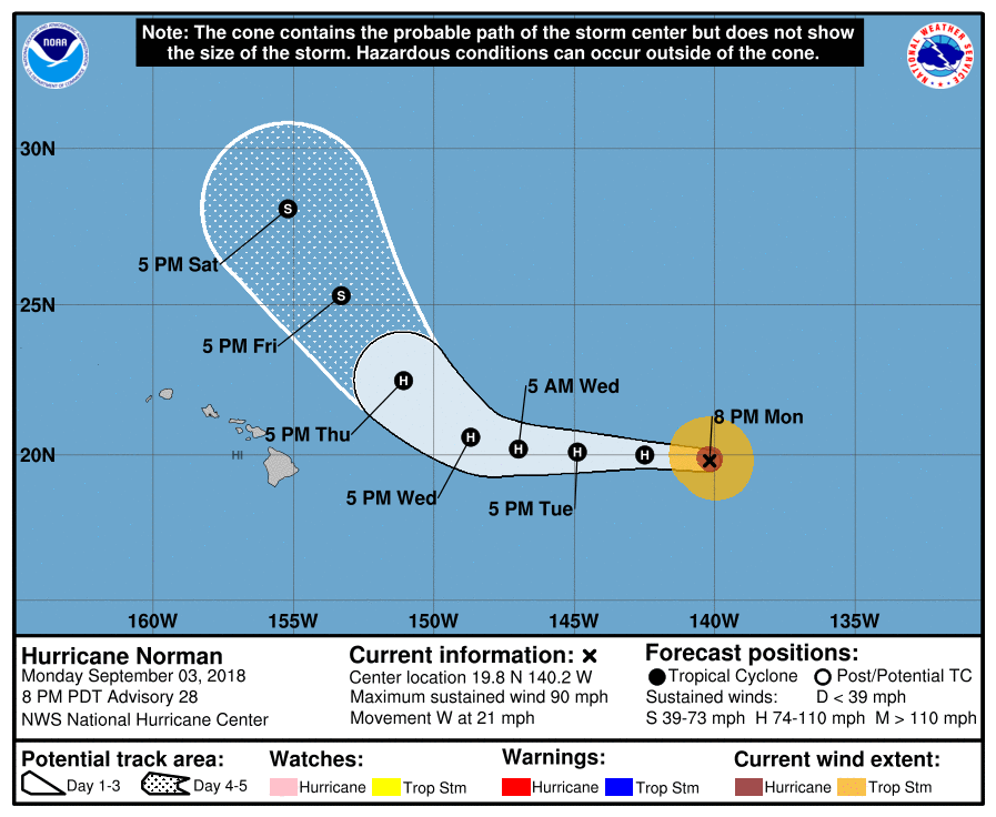
NWS National Hurricane Center in Honolulu reported on Sept. 4 at 5 a.m. that Hurricane Norman has moved into the Central Pacific Basin.
ARTICLE CONTINUES BELOW AD
ARTICLE CONTINUES BELOW AD
Norman is located at 19.9 north, 143.4 west, 760 miles east of Hilo, moving west near 17 mph with little change in strength.
A westward motion with a decrease in forward speed is expected over the next day or two. A turn toward the WNW is anticipated by late Wednesday.
Maximum sustained winds have decreased to near 85 mph, with higher gusts, making it a Category 1 hurricane. Some additional weakening is forecast during the next few days, but Norman is expected to remain a hurricane through
midweek.
ARTICLE CONTINUES BELOW AD
Hurricane-force winds extend outward up to 25 miles from the center and tropical-storm-force winds extend outward up to 105 miles.
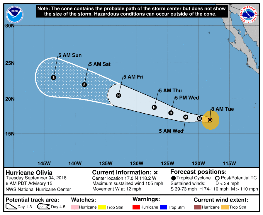
Hurricane Olivia has intensified to a Category 2 hurricane, with maximum sustained winds of 105 mph.
ARTICLE CONTINUES BELOW AD
At 5 a.m., the center of Hurricane Olivia was located near latitude 17.0 north, longitude 118.2 west.
Olivia is moving toward the west near 12 mph, and this general motion is expected to continue through tonight. A turn toward the WNW and an increase in forward speed are expected on Wednesday.
Additional strengthening is expected today, and Olivia could become a major hurricane. A gradual weakening is expected beginning late Wednesday or Wednesday night.
Hurricane-force winds extend outward up to 25 miles from the center and tropical-storm-force winds extend outward up to 105 miles.
This comments section is a public community forum for the purpose of free expression. Although Big Island Now encourages respectful communication only, some content may be considered offensive. Please view at your own discretion. View Comments