Just as Hurricane Lane finally leaves the Hawaiian Islands, Tropical Storm Miriam has formed about 2,000 miles east of the island chain, with maximum wind speeds of around 60 miles per hour.
ARTICLE CONTINUES BELOW AD
ARTICLE CONTINUES BELOW AD
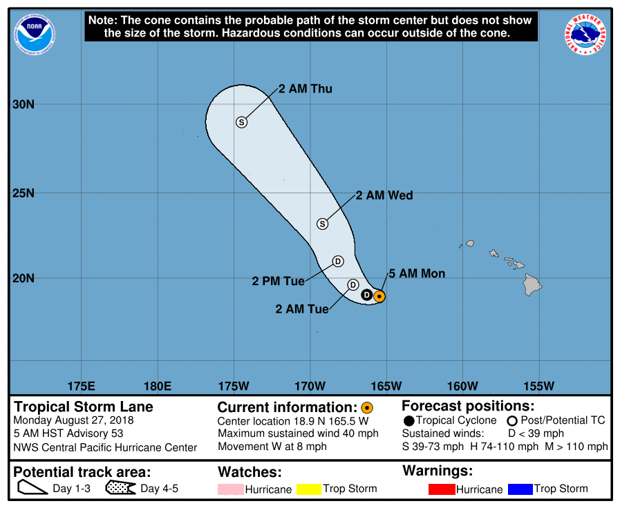
5 AM: Tropical Storm Lane Update from NWS Central Pacific Hurricane Center Honolulu
At 5 a.m., the center of Tropical Storm Lane, which had been downgraded to a tropical depression, was located near latitude 18.9 north, longitude 165.5 west, about 430 miles WSW of Barking Sands, Kaua‘i.
Lane is moving toward the west near 8 mph, and this motion is expected to continue today. A decrease in forward speed is expected tonight as Lane makes a turn toward the northwest. Lane is then expected to accelerate toward the northwest on Tuesday and Wednesday.
Maximum sustained winds are near 40 mph with higher gusts.
Some short-term weakening is forecast, and Lane is expected to become a post-tropical remnant low by Tuesday. Lane may strengthen as an extratropical low as it passes over portions of the Northwestern Hawaiian Islands from Tuesday night through Thursday.
ARTICLE CONTINUES BELOW AD
Tropical-storm-force winds extend outward up to 105 miles from the center.
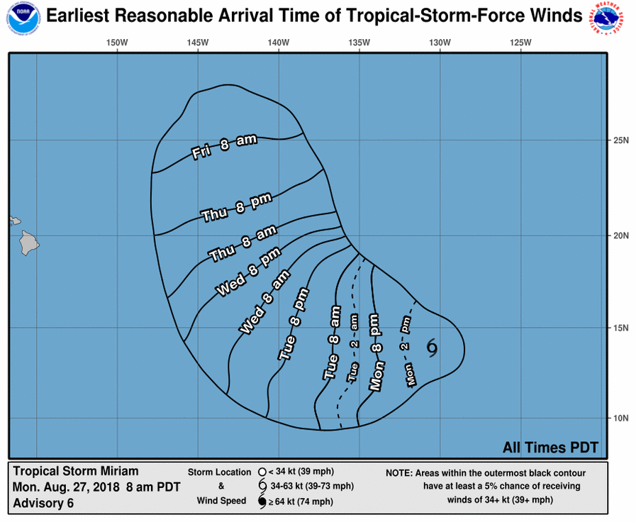
8 AM: Tropical Storm Miriam Continues to Strengthen
ARTICLE CONTINUES BELOW AD
The National Oceanic and Atmospheric Administration said Tropical Storm Miriam has formed about 2,000 miles east of the Hawaiian islands.
At 8 a.m., the center of Tropical Storm Miriam was located near latitude 13.9 north, longitude 130.5 west in the East Pacific. Miriam is moving toward the west near 14 mph, and this general motion is expected to continue for the next couple of days.
A turn toward the WNW is expected on Thursday.
On the forecast track, Miriam will approach the Central Pacific Basin late Wednesday or Wednesday night.
Maximum sustained winds have increased to near 65 mph, with higher gusts.
Additional strengthening is forecast during the next 2 to 3 days, and Miriam is expected to become a hurricane tonight or early Tuesday.
Tropical-storm-force winds extend outward up to 60 miles from the center.
This comments section is a public community forum for the purpose of free expression. Although Big Island Now encourages respectful communication only, some content may be considered offensive. Please view at your own discretion. View Comments