The Central Pacific Hurricane Center has downgraded Hawai‘i Island to a Tropical Storm Warning. The windward side of Hawai‘i Island is currently under a flash flood warning and experiencing conditions of heavy rains and flooding.
Pi‘ihonua Road is currently flooded and HPD has stopped all traffic from passing. PC: Crystal Richard
The Central Pacific Hurricane Center reports as of 5 p.m., that Hurricane Lane is a Category 3 hurricane located approximately 180 miles SW of Kailua-Kona with sustained winds of 120 mph, moving NNW at approximately 6 mph. Due to the slowing of the hurricane, dangerous heavy rains and flooding may persist for a period of time for the island of Hawai‘i.
Due to Hurricane Lane, the following policies are in effect:
Mail delivery has been cancelled and all post offices will be closed on Friday.
All non-emergency County operations are suspended, including transfer stations.
All County Parks are closed through Friday and will be re-assessed for weekend use. All pavilion and camping permits for these parks have been cancelled.
All State facilities and services are closed.
All DLNR outdoor recreation areas and reserves are closed.
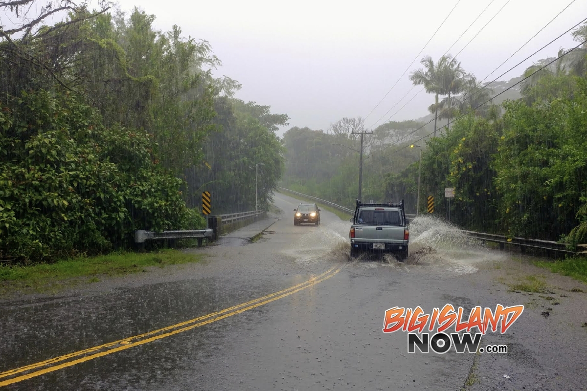
Numerous major and secondary roads are closed. Due to the extreme hazards created from the heavy rain, stay off the roads unless absolutely necessary. The latest road closures can be found here: http://www.hawaiicounty.gov/active-alerts.
ARTICLE CONTINUES BELOW AD
ARTICLE CONTINUES BELOW AD
The Hawai‘i State Department of Health is advising the public to stay out of streams, coastal, and standing waters that are contaminated by storm water. Storm water may contain harmful micro-organisms from overflowing cesspools or septic tanks as well as animal waste washed into streams and storm drains.
Conditions are being monitored and you will be kept informed of major closures as best as possible. All motorists and residents of effected areas are urged to use extreme caution and be aware of flooding conditions. This is a very dangerous situation and heavy rains are expected to continue on the windward side of the Big Island.
A slow general northward motion is expected to continue through Friday. A turn toward the west is expected Saturday and Sunday, with an increase in forward speed. On the forecast track, the center of Lane will move over, or dangerously close to portions of the main Hawaiian islands tonight and Friday. Regardless of the exact track, life threatening impacts are likely over many areas as this strong hurricane makes its closest approach. Do not focus on the exact forecast track or intensity of Lane. Be prepared for changes in future forecasts. Although the official forecast does not explicitly indicate Lane’s center making landfall over any of the islands, this could still occur.
ARTICLE CONTINUES BELOW AD
The onset of damaging tropical storm-force winds is expected across portions of the Big Island tonight. In Maui County, damaging tropical storm-force winds are expected later tonight, with dangerous hurricane force winds expected in some areas Friday. On O‘ahu, damaging tropical storm force winds are expected to develop late tonight, with dangerous hurricane force winds expected Friday into Friday night. Tropical storm or hurricane conditions are possible on Kaua‘i on Saturday.
Outer rain bands associated with Hurricane Lane are already affecting all the main Hawaiian Islands. Widespread heavy rainfall and flash flooding is ongoing over portions of the Big Island. The rain bands will continue to spread northwest through Friday night. Excessive rainfall is likely which could result in life threatening flash flooding, as well as landslides and mudslides. Flooding will be possible in areas that are typically not prone to flooding. Storm total rainfall amounts of 10 to 20 inches are expected to be common across the island chain, with localized amounts in excess of
30 inches.
Swells generated by Lane will produce very large life-threatening surf and dangerous rip currents along southeast, south and southwest facing shores of all of the Hawaiian islands. Large surf is likely occurring along southeast facing shores on the Big Island. Surf is expected to increase tonight along southwest facing shores of the Big Island as well as along south and southeast facing shores from Maui County to Kaua‘i County, with the surf becoming extremely large later tonight through Saturday. Surf heights as large as 10 to 15 feet are expected in the Puna and Ka‘ū districts as well as along the Kona coast of the Big Island. Surf heights of 10 to 20 feet are expected along south and southeast facing coasts from Kauai County to Maui County.
ARTICLE CONTINUES BELOW AD
The combination of storm surge and large breaking waves is expected to raise water levels well above normal tide levels as Hurricane Lane makes its closest approach. Water levels could reach 2 to 4 feet above normal along southeast, south and southwest facing shores from Kaua‘i to Maui, as well as southeast, south, southwest and west facing shores of the Big Island, should Lane makes landfall. This is expected to result in significant beach erosion and overwash onto vulnerable coastal roadways tonight through Saturday as Lane makes its closest approach, particularly for vulnerable low-lying coastal areas during and around the time of the normal high tide cycles.
Tornadoes and large waterspouts will be possible with Lane, mainly along and to the right of the track of the hurricane.
This comments section is a public community forum for the purpose of free expression. Although Big Island Now encourages respectful communication only, some content may be considered offensive. Please view at your own discretion. View Comments