The National Weather Service in Honolulu has extended the Flood Advisory for the island of Hawai‘i until 11 p.m.
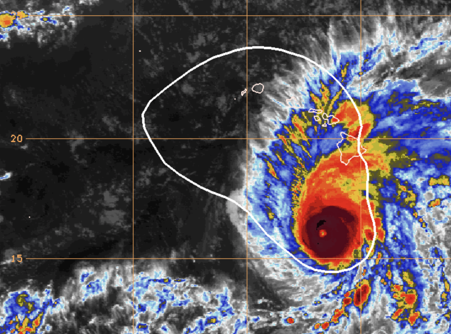
At 7:41 p.m., radar showed persistent moderate to locally heavy rain from the outer bands of Hurricane Lane continuing to affect the windward slopes of the Big Island. The most intense rainfall rates are one to two inches per hour along the Hāmākua Coast southward through parts of the Hilo and Puna districts.
Hawai‘i County Civil Defense recently reported one foot of water over the Troop Street bridge on Old Mamalahoa Highway in Honomu. Water levels in Honoli‘i Stream, Kawainui Stream and Wailuku River also remain high.
Additional rain bands from Hurricane Lane will be moving onshore from the east for the next several hours.Locations in the advisory include but are not limited to Hilo, Na‘alehu, Paauilo, Waipio Valley, Orchidlands Estates, Kukuihaele, Hawi, Pepeekeo, Keaau, Honokaa, Ookala and Hawaiian Paradise Park.
ARTICLE CONTINUES BELOW AD
ARTICLE CONTINUES BELOW AD
PRECAUTIONARY/PREPAREDNESS ACTIONS
Stay away from streams, drainage ditches and low lying areas prone to flooding.
Rainfall and runoff will also cause hazardous driving conditions due to ponding, reduced visibility and poor braking action.
Do not cross fast flowing or rising water in your vehicle, or on foot. Turn around, don’t drown.
This comments section is a public community forum for the purpose of free expression. Although Big Island Now encourages respectful communication only, some content may be considered offensive. Please view at your own discretion. View Comments