The U.S. Geological Survey released these photos of the East Rift Zone on Sunday, July 29, 2018.
Kīlauea lower East Rift Zone
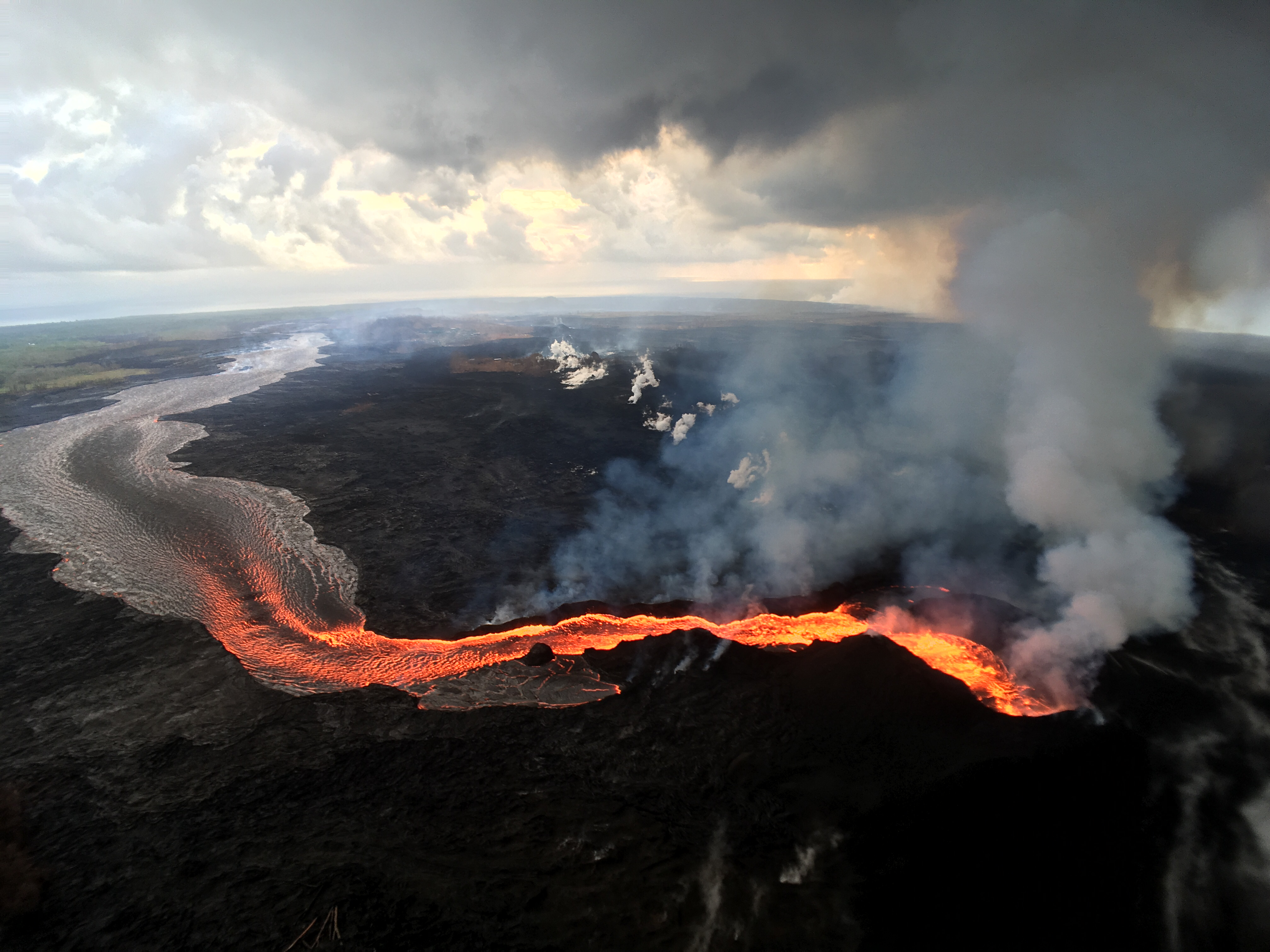
Fissure 8 continues to erupt, feeding lava to a perched channel that extends to the coast.
Fissure 8 continues to erupt. Click to enlarge. PC: USGS
The white laze plume at the distant ocean entry is visible just to the left of the gases rising from the Fissure 8 cone (lower right).
ARTICLE CONTINUES BELOW AD
ARTICLE CONTINUES BELOW AD
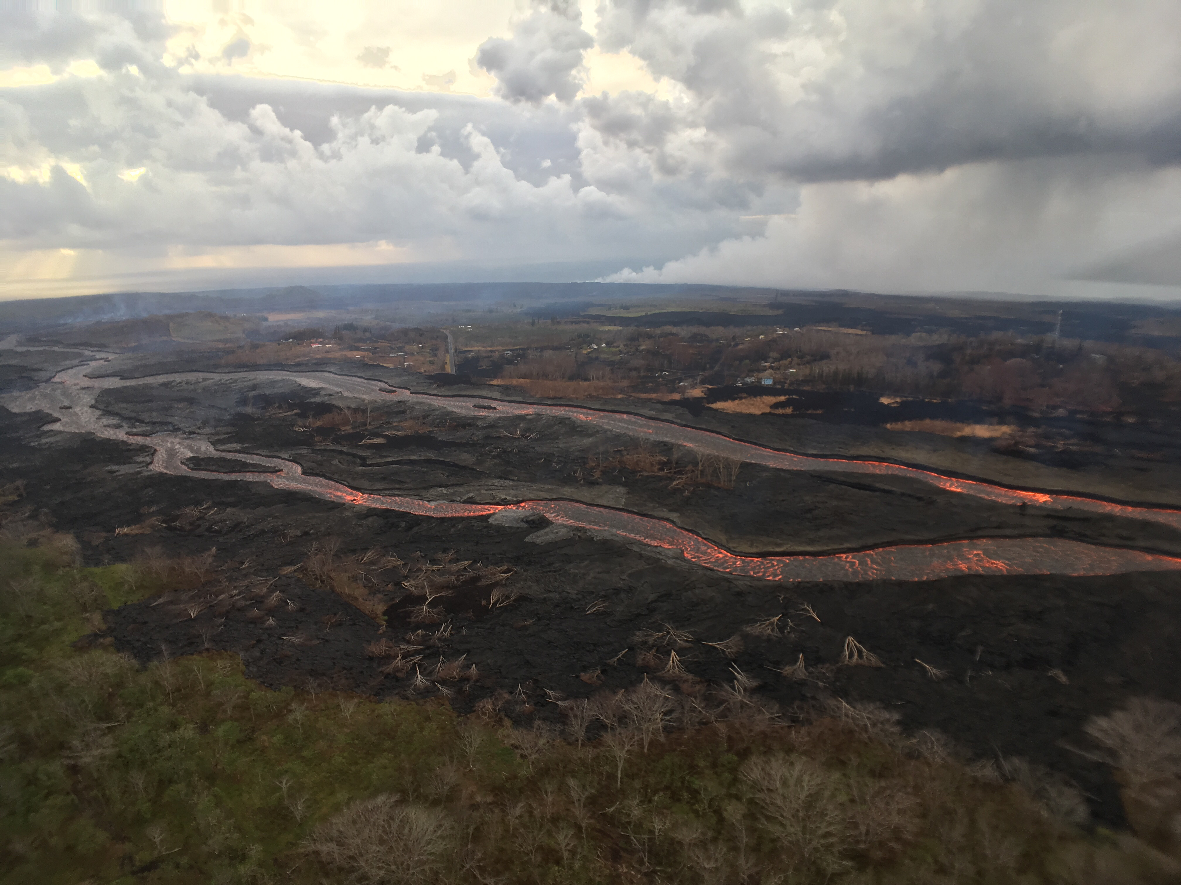
An aerial view of the braided section of the Fissure 8 lava channel captured during HVO’s overflight of Kīlauea’s lower East Rift Zone eruption this morning.
Aerial View of Fissure 8. Click to enlarge. PC: USGS
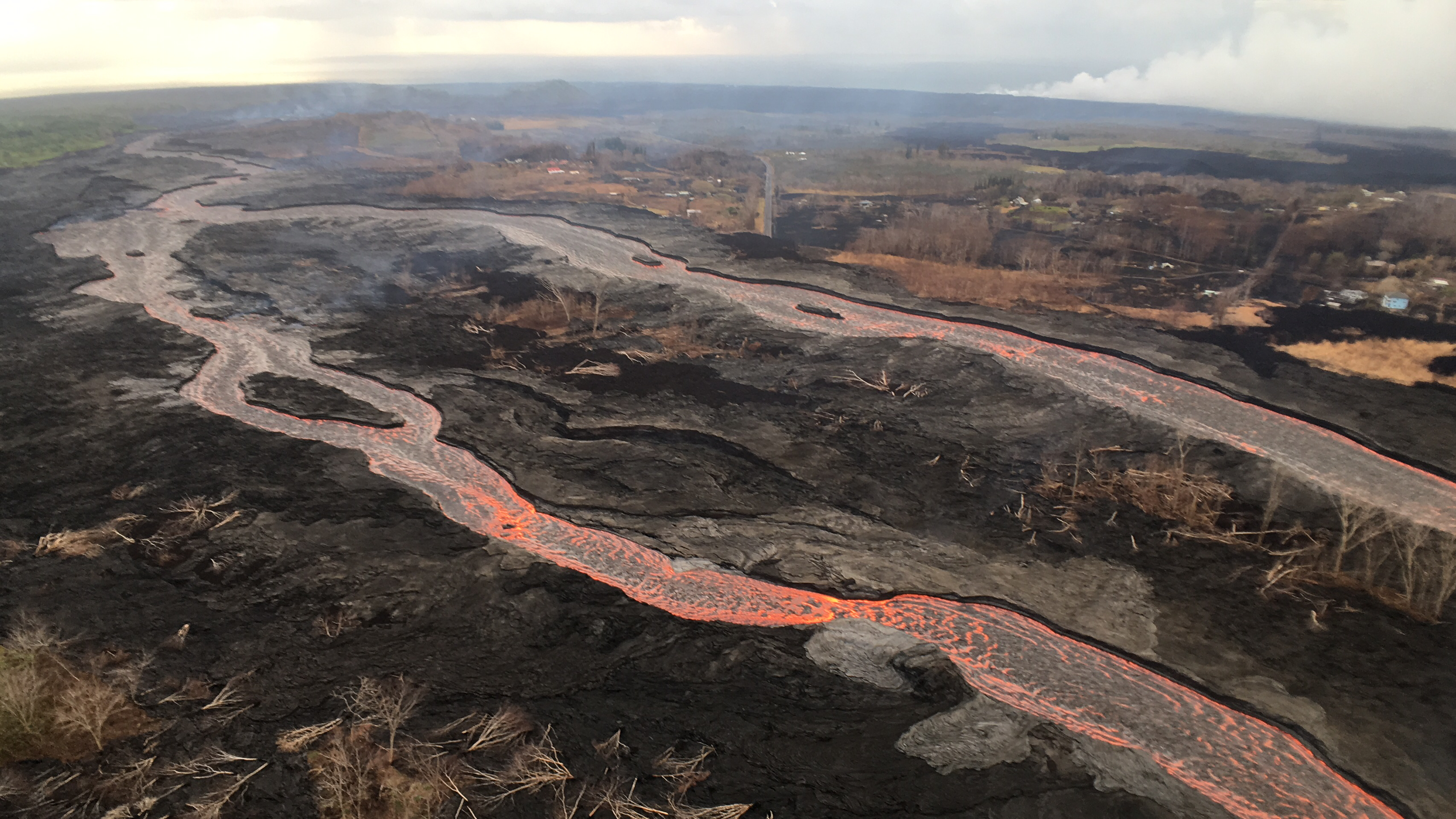
A slightly closer view of the braided section of the Fissure 8 lava channel before it turns southward and heads toward the ocean.
Close up of the braided channels. Click to enlarge. PC: USGS
The ocean entry laze plume is visible at upper right.
ARTICLE CONTINUES BELOW AD
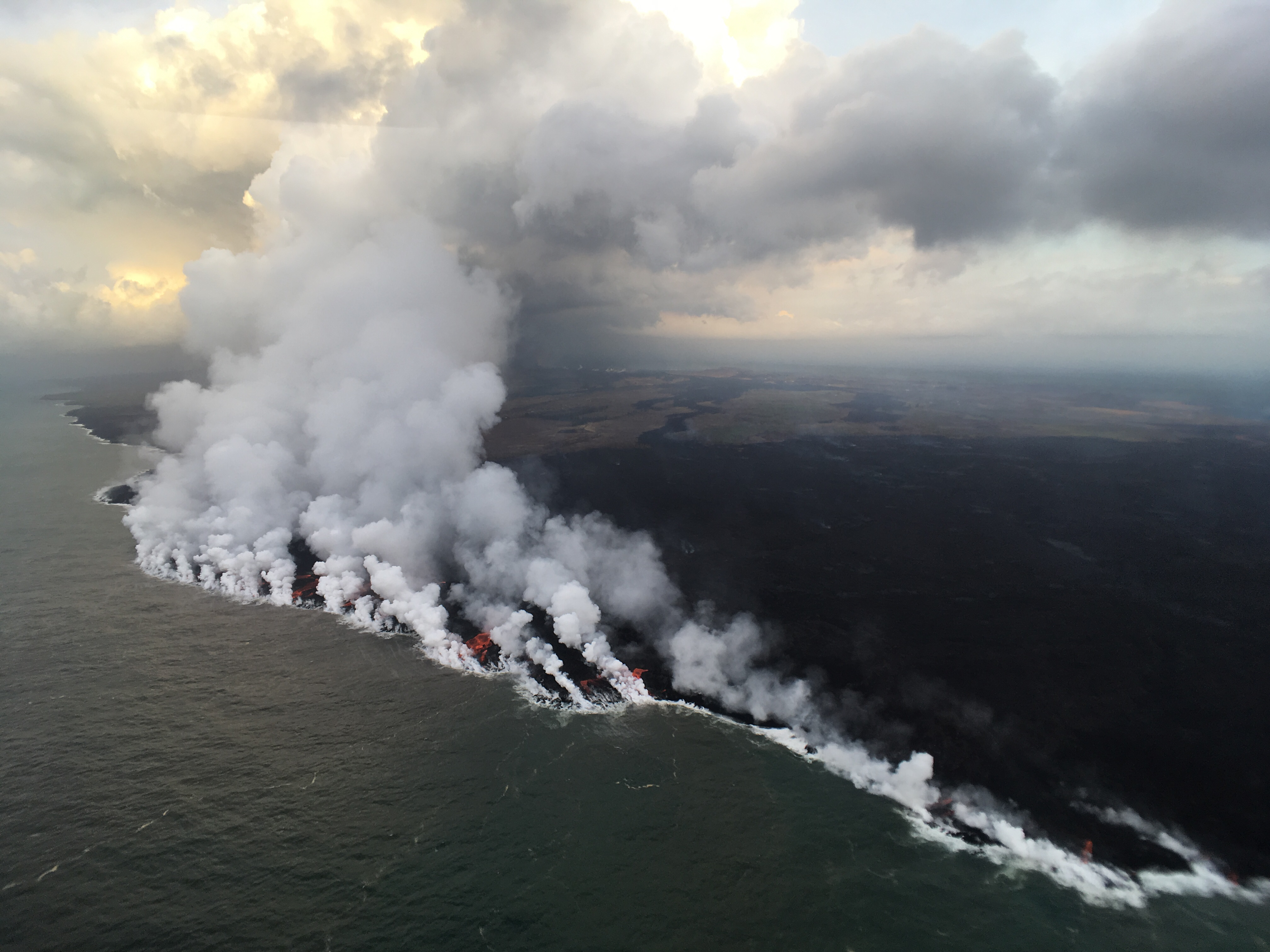
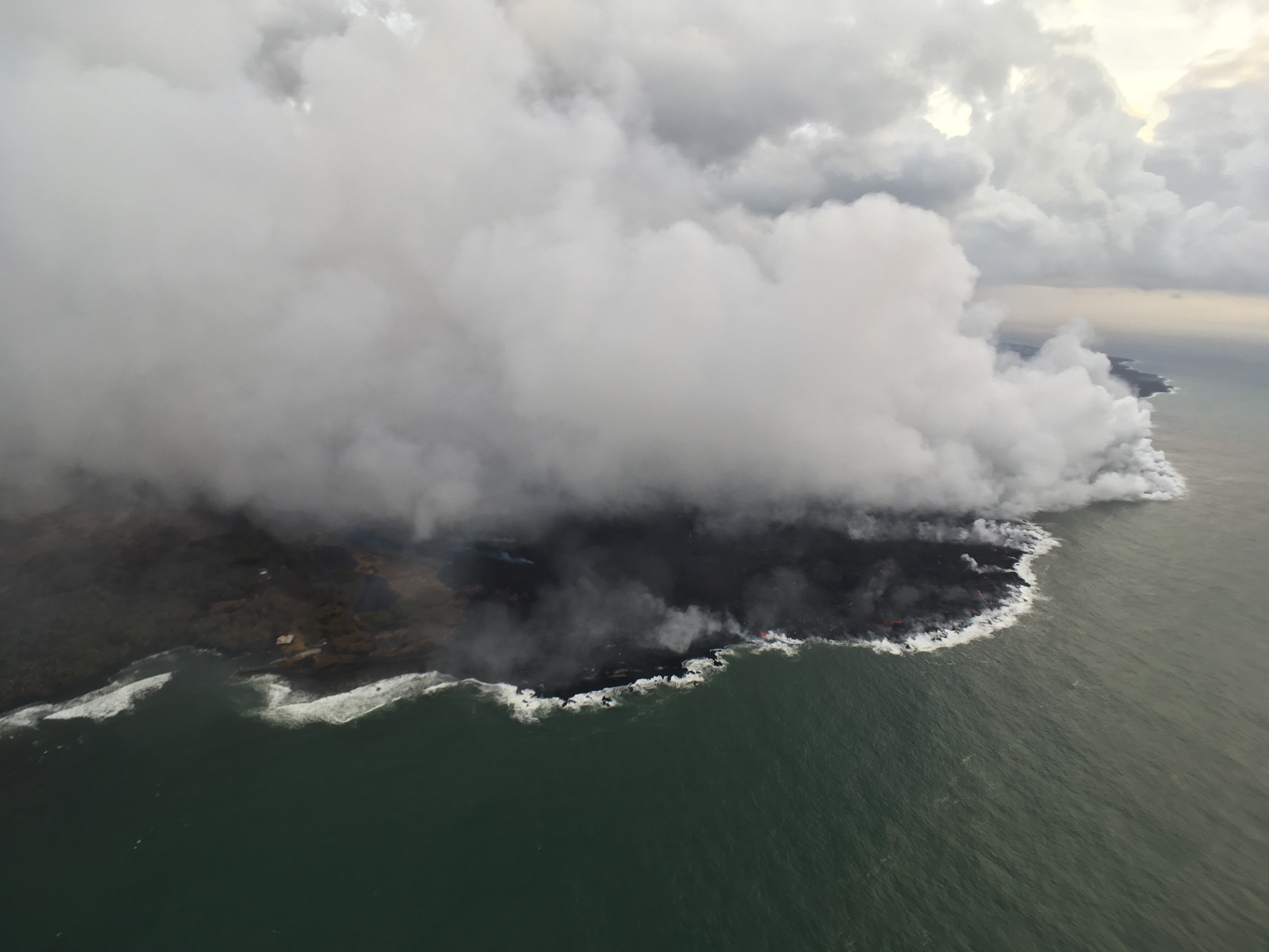
The main ocean entry remains in the Ahalanui area, where numerous small streams of lava were entering the ocean across a broad swath of coastline this morning.
The ocean entry on July 29, 2018. Click to enlarge. PC: USGS
The western flow margin did not advance overnight, and remained approximately 0.1 mile from the Pohoiki Boat Ramp at Isaac Hale Park this morning.
Lava flow is about .1 miles from Pohoiki on July 29, 2018. Click to enlarge. PC: USGS
Kīlauea summit
ARTICLE CONTINUES BELOW AD
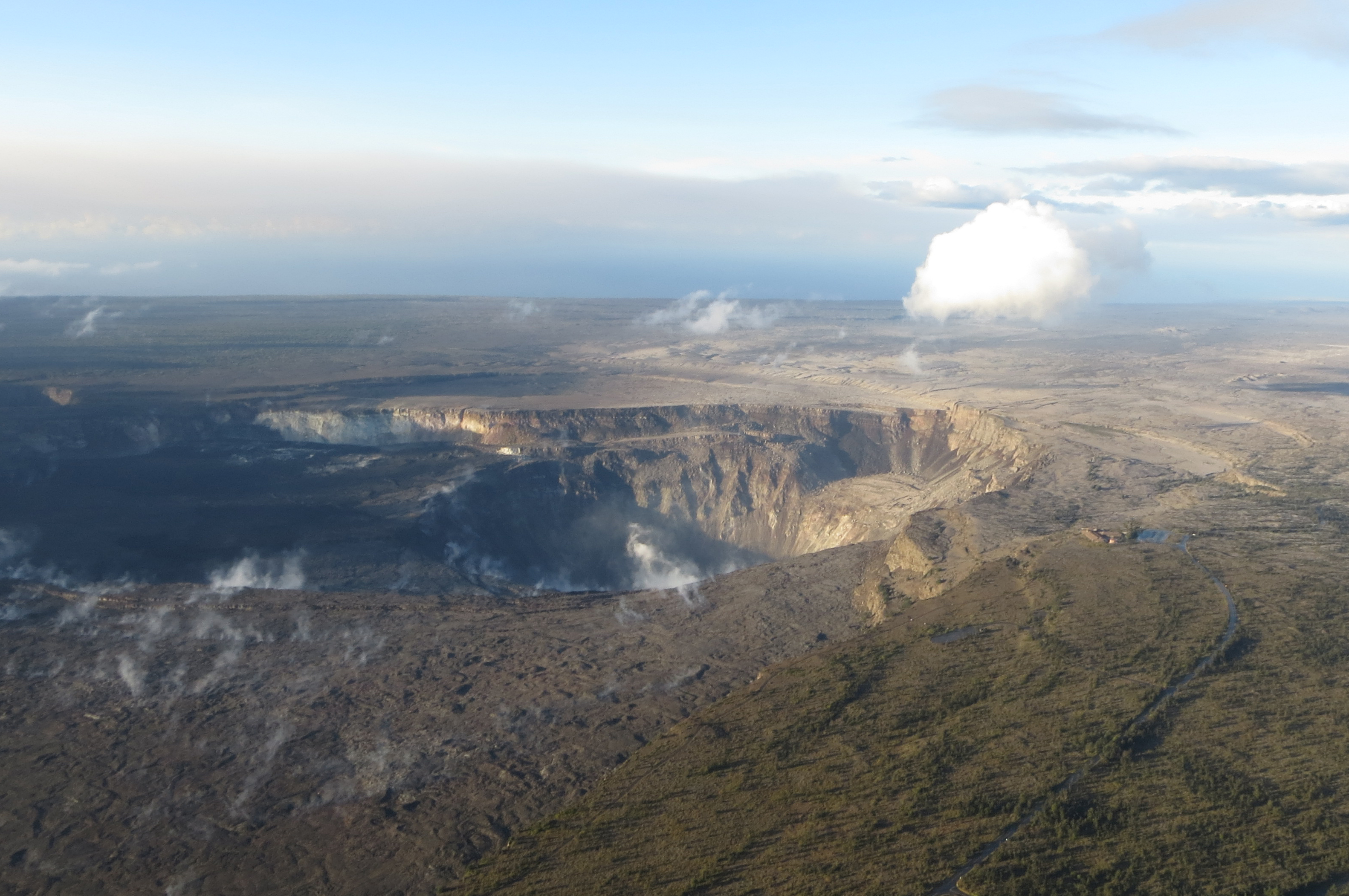
This aerial view of Kīlauea’s summit (taken early yesterday morning, looking south) shows some well-known features and some that are now more obvious as a result of ongoing collapse of Halema‘uma‘u and parts of the summit caldera floor.
Kīlauea summit on July 29, 2018. Click to enlarge. PC: USGS
Crater Rim Drive (lower right) leads to the USGS Hawaiian Volcano Observatory and NPS Jaggar Museum (right, middle), perched on the caldera rim and overlooking the growing Halema‘uma‘u. Ground cracks, parallel to the crater rim, are visible on the north side of Halema‘uma‘u (left side of image). South Sulphur Bank stands out as the light-colored area on the opposite crater wall.
This comments section is a public community forum for the purpose of free expression. Although Big Island Now encourages respectful communication only, some content may be considered offensive. Please view at your own discretion. View Comments