The U.S. Geological Survey released the following photos of the East Rift Zone on Sunday, July 22, 2018.
Kīlauea summit
A collapse of Kīlauea’s caldera floor has exposed a South Sulphur Bank that was prominent in the mid-19th century but covered as lava flows filled the caldera.
Kīlauea summit on July 22, 2018. Click to enlarge. PC: USGS
The flat top of the white deposit shows how high the caldera fill reached. As the caldera floor dropped in mid-June 2018, South Sulphur Bank was again exposed. The height of the bank, now more than 213 feet, increases about nine feet with each collapse event at Kīlauea’s summit. On the caldera floor, white patches lie along spatter ramparts formed in 1971 and 1974.
ARTICLE CONTINUES BELOW AD
ARTICLE CONTINUES BELOW AD
Kīlauea Volcano’s lower East Rift Zone
The Unmanned Aircraft Systems (UAS) team frequently works into the night, flying aircraft (also referred to as drones) that hover over the active lava channel to collect data and look for changes, such as significant channel overflows.
Kīlauea Volcano’s lower East Rift Zone on July 22, 2018.The Unmanned Aircraft Systems (UAS) team frequently works into the night, flying aircraft (also referred to as drones) that hover over the active lava channel to collect data and look for changes, such as significant channel overflows. Click to enlarge. PC: USGS
The moon (bright white area above the UAS team scientist) is partially obscured by clouds.
ARTICLE CONTINUES BELOW AD
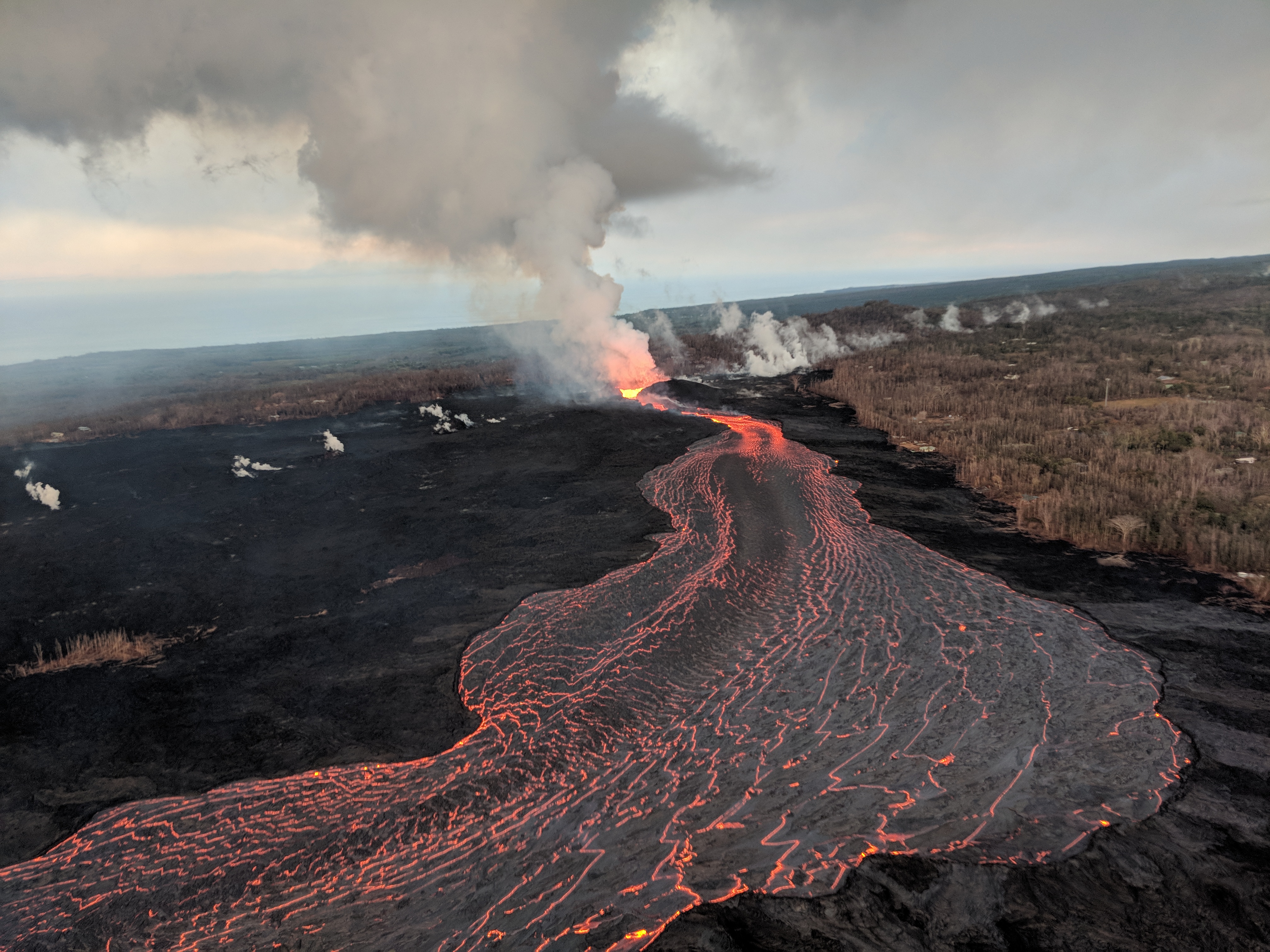
Fissure 8 on Kīlauea’s lower East Rift Zone continues to erupt, feeding a channel that carries lava to the coast. This aerial image captured during HVO’s early morning overflight, shows the erupting vent (center) and near-vent part of the channel.
Aerial view of Fissure 8 on July 22, 2018. Click to enlarge. PC: USGS
The main ocean entry, as observed early this morning, was located a few hundred yards northeast of the southern flow margin, which remains about 3 miles from the boat ramp at the Isaac Hale Park.
Ocean entry on July 22, 2018. Click to enlarge. PC: USGS
This comments section is a public community forum for the purpose of free expression. Although Big Island Now encourages respectful communication only, some content may be considered offensive. Please view at your own discretion. View Comments