The U.S. Geological Survey released these photos and videos of the East Rift Zone on Tuesday, July, 17, 2018.
Kīlauea lower East Rift Zone
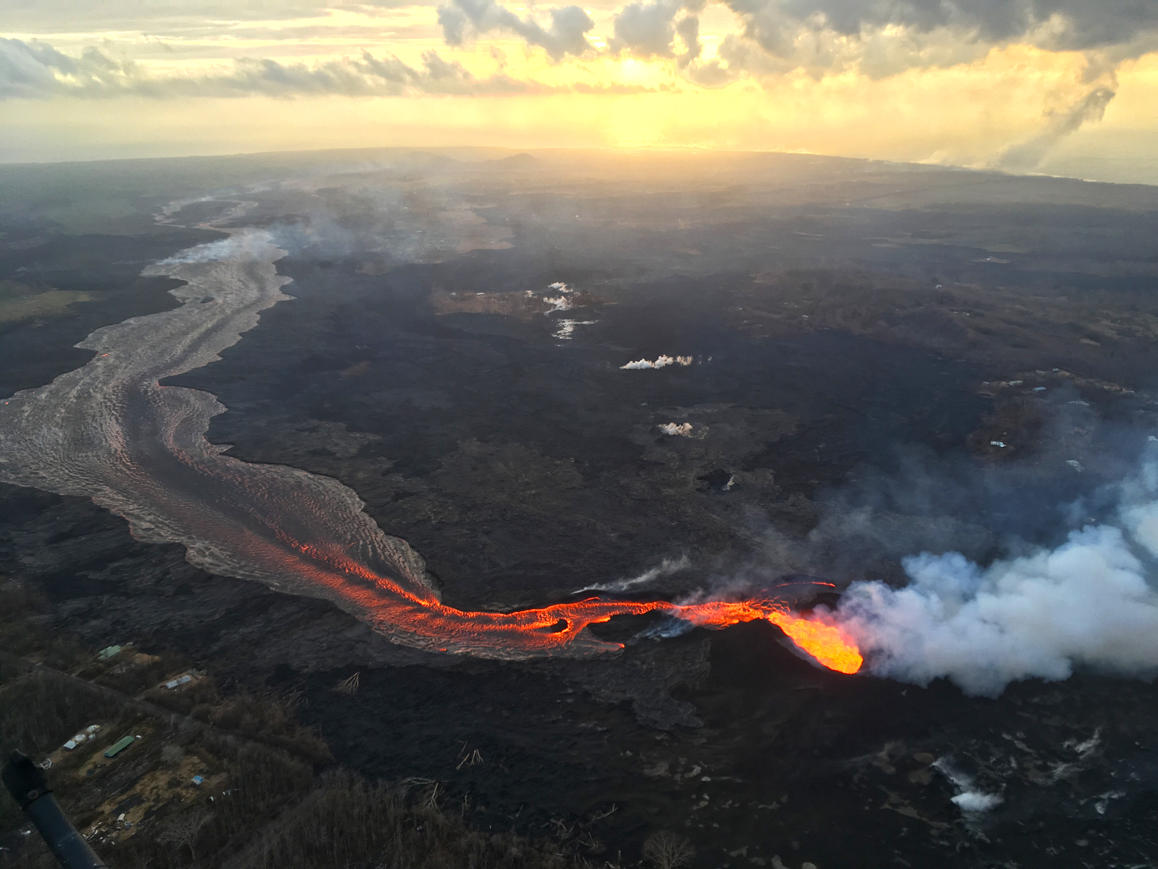
During the Tuesday, July 17, 2018, overflight, USGS scientists captured this image of sunrise above Kīlauea’s lower East Rift Zone. Click to enlarge. PC: USGS
Fissure 8 continues to feed a channelized lava flow that reaches the ocean, forming a large plume at the coast (upper right).
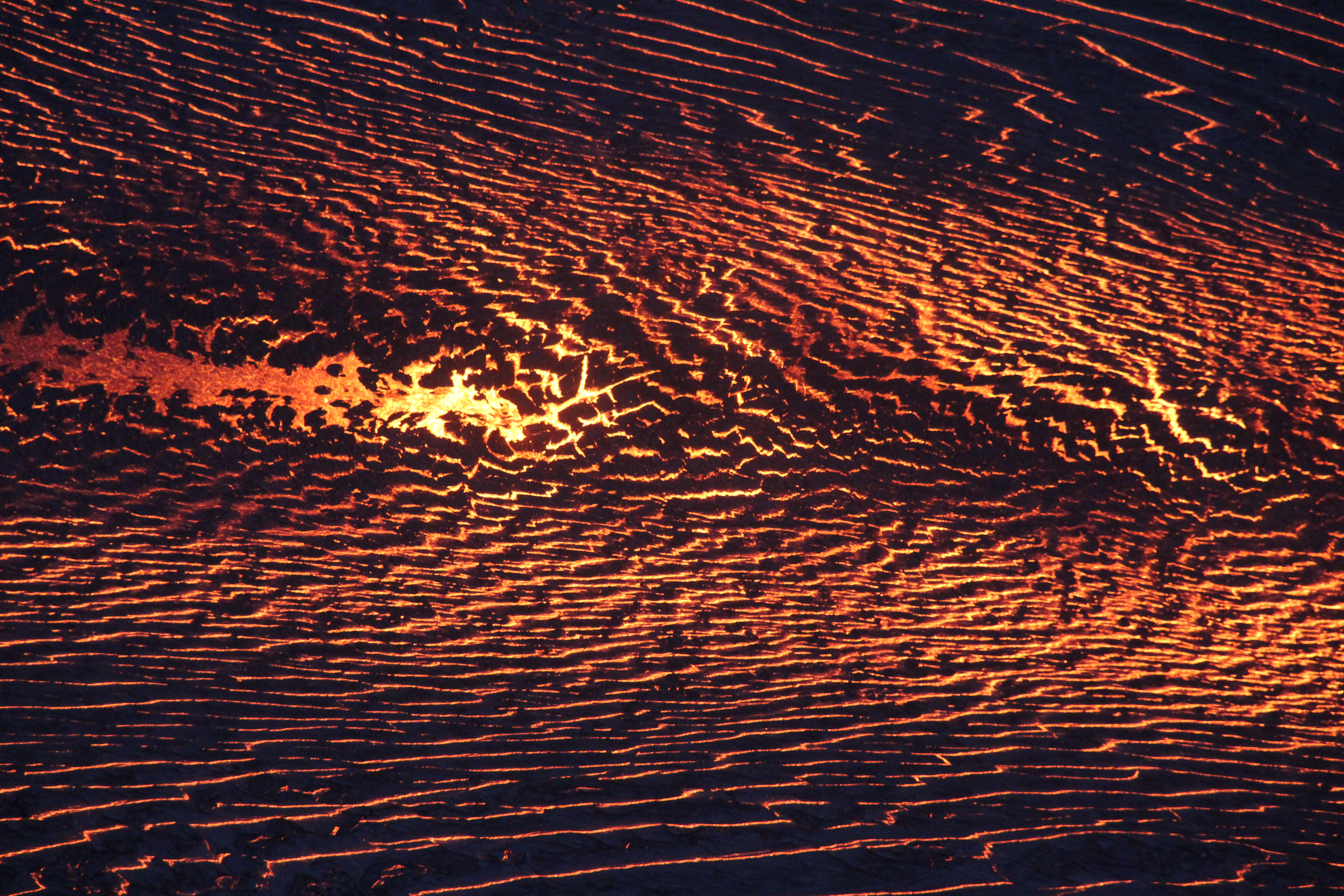
During their overflight, scientists used a telephoto lens to photograph the surface of the Fissure 8 lava channel.
Incandescent lava is visible through pieces of darker crust that forms as the flow surface cools. Click to enlarge. PC: USGS
ARTICLE CONTINUES BELOW AD
ARTICLE CONTINUES BELOW AD
Note the apparent symmetry on either side of the channel center, where lava flows more quickly than it does along the channel margins—a visual representation of flow velocity across the channel width.
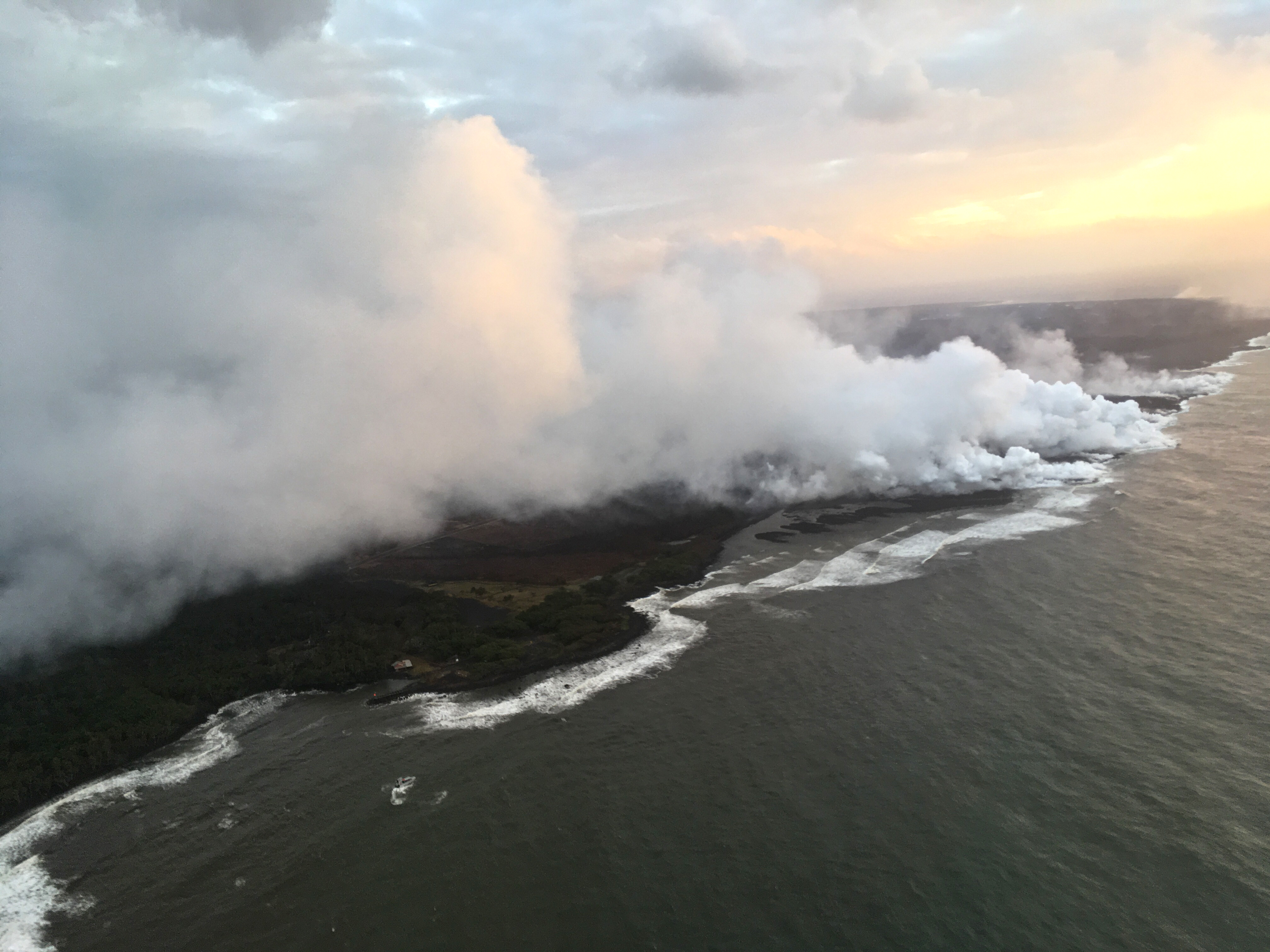
South margin of the Fissure 8 lava flow ocean entry.
As of this morning July 17, 2018, the flow was just under 0.5 miles from the Pohoiki boat ramp. Click to enlarge. PC: USGS
As of this Tuesday morning, July 17, 2018, the flow was just under 0.5 miles from the Pohoiki boat ramp.
ARTICLE CONTINUES BELOW AD
Kīlauea Volcano’s summit
Since early May 2018, the floor of Halema‘uma‘u Crater has dropped about 1480 feet. Extensive cracking and faulting around the crater, along with inward slumping of the crater rim, has more than doubled its diameter. Like a balloon slowly losing air, subsidence occurs because magma in Kīlauea’s shallow summit reservoir is moving into the East Rift Zone more rapidly than magma is being supplied from depth. Images collected during a helicopter overflight of the summit area on July 13, 2018, were used to produce this digital elevation model showing current conditions at Kīlauea.
Listen to the sounds of rockfalls at Kīlauea Volcano’s summit in this short video taken from the northeast rim of the caldera. At 2:42 p.m. on July 12, 2018, a collapse/explosion event at Kīlauea’s summit released energy equivalent to a magnitude-5.3 earthquake.
ARTICLE CONTINUES BELOW AD
Rockfalls that occurred in Halema‘uma‘u and along the steep summit caldera walls during the event can be heard in this video.
This comments section is a public community forum for the purpose of free expression. Although Big Island Now encourages respectful communication only, some content may be considered offensive. Please view at your own discretion. View Comments