The U.S. Geological Survey released these photos and video of the East Rift Zone on Monday, July 2, 2018.
Collapse/explosion event at Halema‘uma‘u
On June 30, 2018, at 2:51 p.m., a collapse/explosion event occurred at Kīlauea’s summit. An ash-poor plume rose about 500 feet above the ground and drifted to the southwest. The energy released by the event was equivalent to a 5.3M earthquake. This video, taken by a USGS observer at Volcano House, captures rockfall (brown dust visible in the center right) along the bluff and a small plume rising from the Halema‘uma‘u crater. Since May 16, these collapse/explosion events have occurred on average, about every 28 hours. As magma from the shallow reservoir beneath the summit drains into the East Rift Zone, it slowly pulls away support of the rock above it. The crater floor responds by incrementally collapsing, which produces these events.
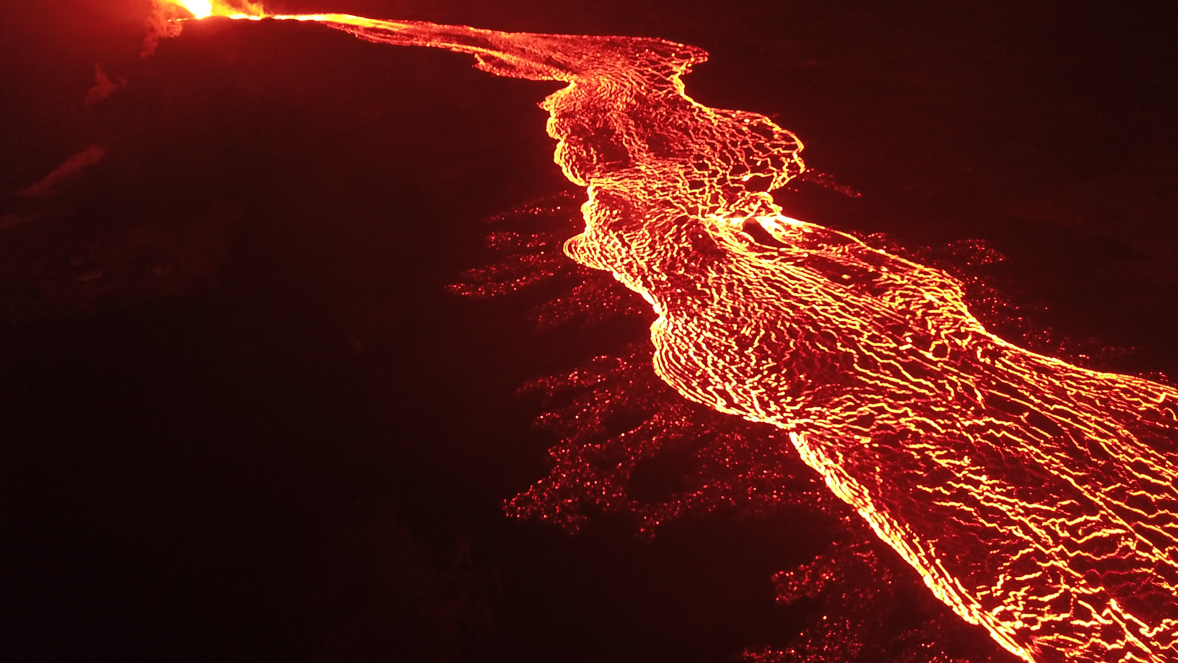
Whirlwind above the fissure 8 lava channel, in Kīlauea Volcano’s lower East Rift Zone
In the Leilani Estates subdivision, Hawaiian Volcano Observatory field crews monitoring Fissure 8 captured this video of a whirlwind above the lava channel. The vortex of rapidly swirling air entrained hot lava, flinging it meters away. The scientists maintained a safe distance, using a telephoto lens to take this video. The whirlwind lasted about 10 minutes, starting and stopping without warning.
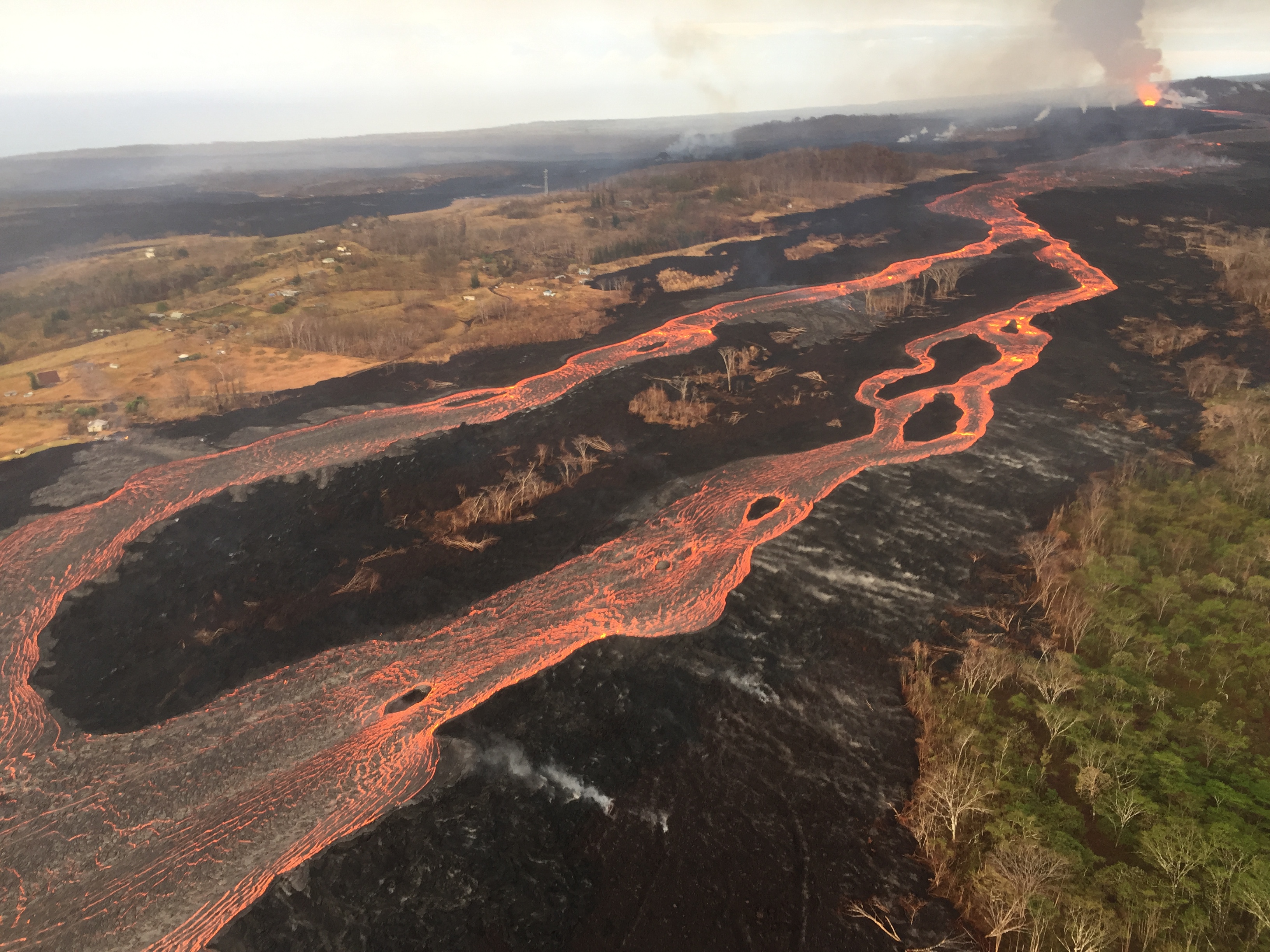
Fissure 8 feeding a full to overflowing channel
ARTICLE CONTINUES BELOW AD
ARTICLE CONTINUES BELOW AD
USGS Mavic Pro drone image of the fissure 8 lava channel looking toward the vent. Overflows can be seen as incandescent spots beyond the channel margins.
Incandescence (glowing) lava is easier to identify in the dark versus during daylight hours on July 2. Click to enlarge. PC: USGS
Drone flights and resultant imagery help scientists better identify areas of channel overflows and active flow advancement. Incandescence (glowing) lava is easier to identify in the dark versus during daylight hours.
Annotated drone image of Kīlauea Volcano’s lower East Rift Zone Fissure 8 lava channel.
Drone image of Kapoho taken on July 2, 2018. PC: USGS
Image captured near Kapoho Crater looking east toward the ocean entry. Incandescent flow margin is more easily identified in the dark – specifically here in the area of Kapoho Beach Lots.
ARTICLE CONTINUES BELOW AD
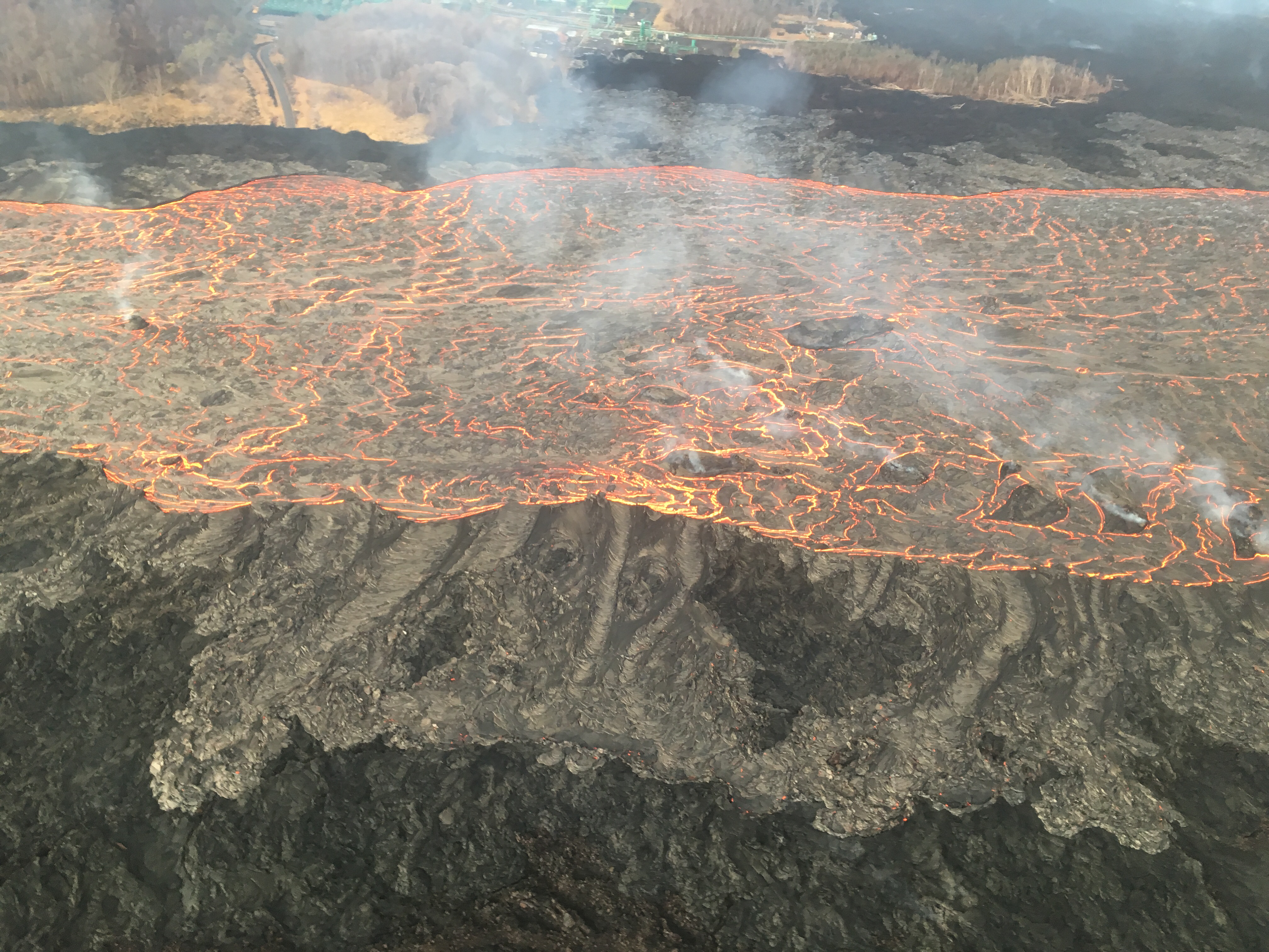
Fountains from Fissure 8 spatter cone continue to supply lava to the open channel with intermittent small, short-lived overflows.
A larger of active overflow can be seen in the upper right of this photograph taken July 2, 2018. PC: USGS
Overflows appear as lighter gray to silver areas on the margins of the channel.
Close-up image of overflows from the Fissure 8 lava channel. Photograph taken during the morning overflight.
Close-up image of the lava channel taken on July 2, 2018. PC: USGS
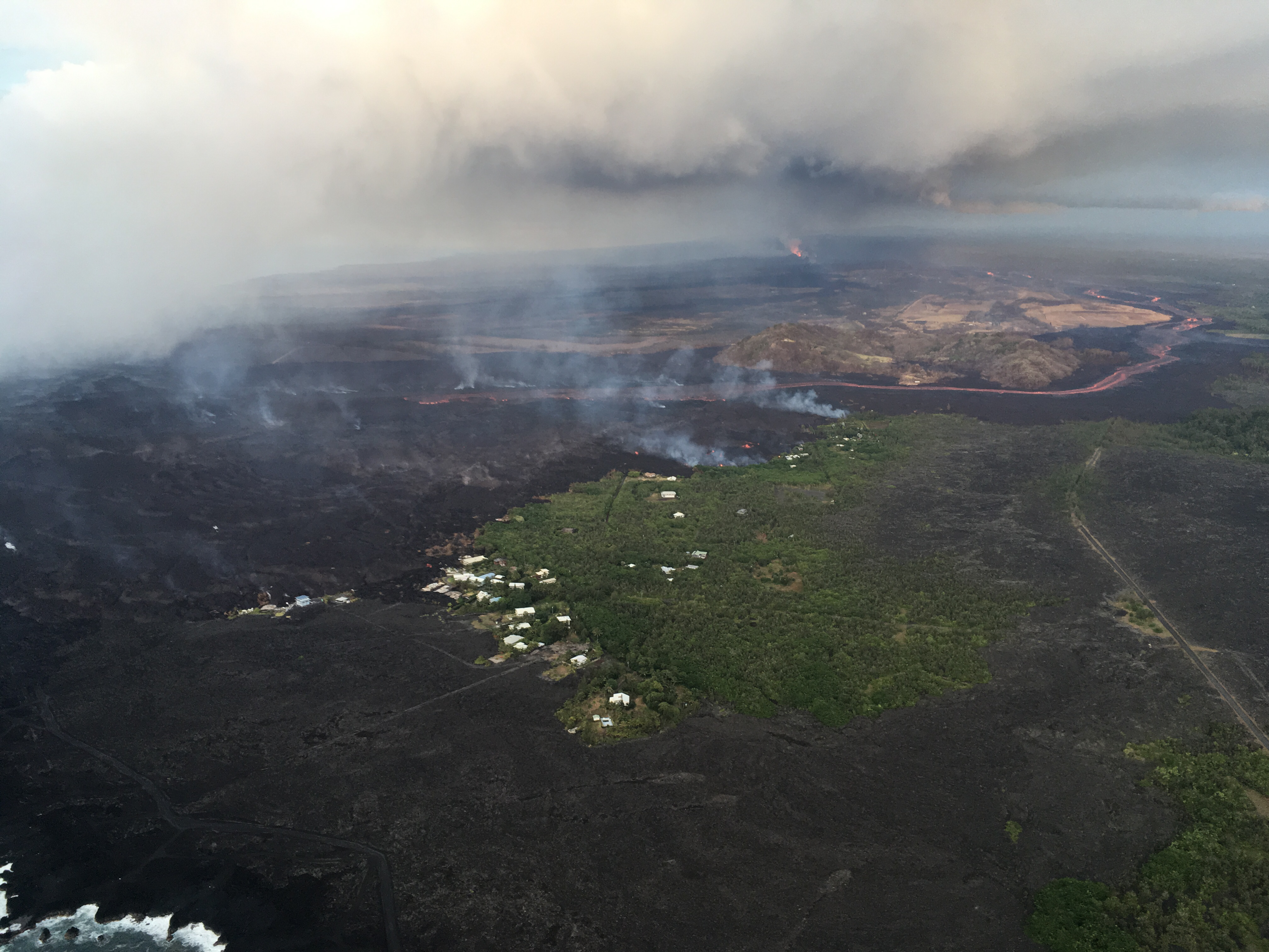
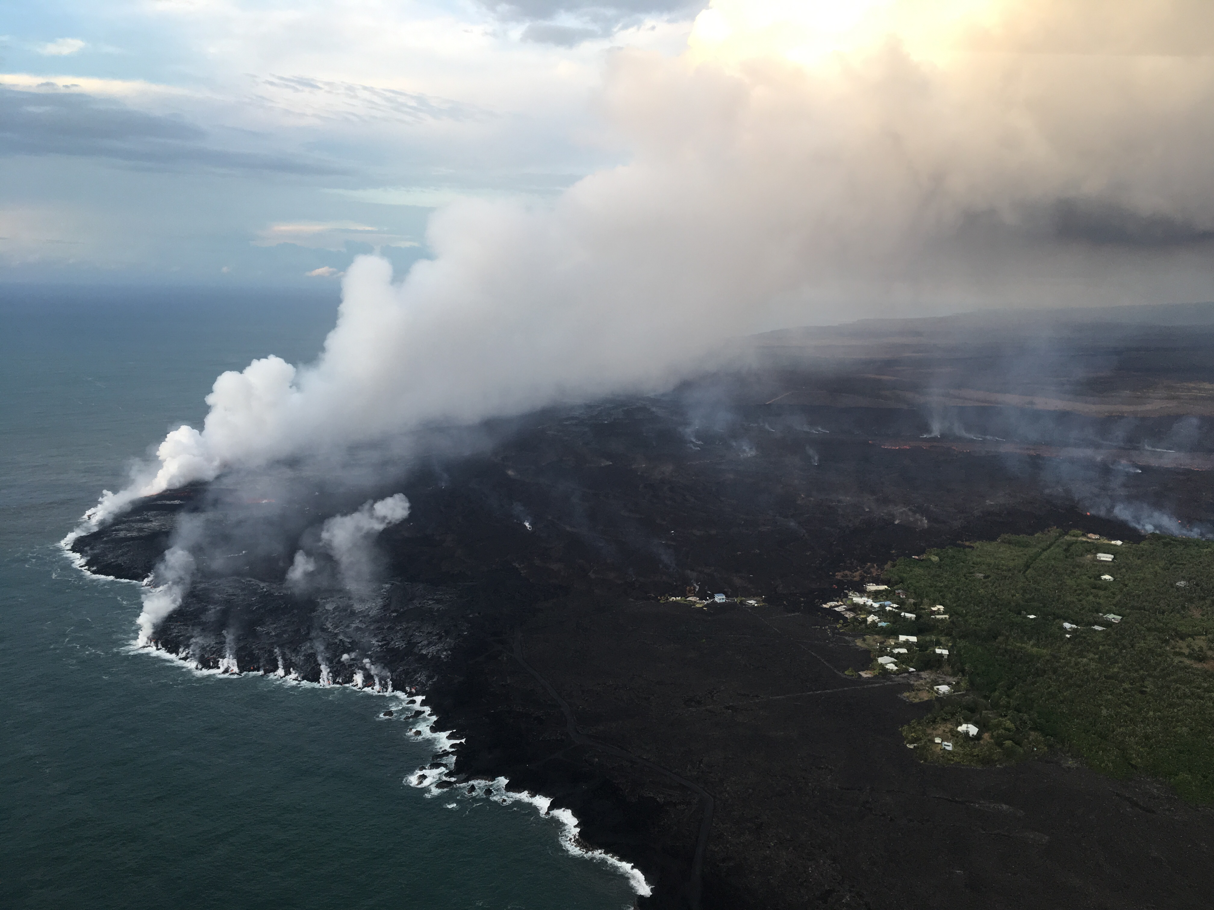
Lava continues to enter the ocean and flow into Kapoho Beach Lots
ARTICLE CONTINUES BELOW AD
At the coast, the northern margin of the flow field is still oozing pasty lava at several points in the area of Kapoho Beach Lots.
Lava river in Kapoho on July 2, 2018. PC: USGS
The ocean entry being fed by a crusted over channel has fewer tiny ooze-out channels than yesterday spilling into the water.
The ocean entry on July 2, 2018. PC: USGS
One larger ooze-out channel making dominant entry plume at the northern end of the broad ocean entry.
This comments section is a public community forum for the purpose of free expression. Although Big Island Now encourages respectful communication only, some content may be considered offensive. Please view at your own discretion. View Comments