Sunday, July 1, 2018, 6 p.m.: Alert Warning Sirens Scheduled
Hawaiian Volcano Observatory reports that Fissure 8 continues to be very active and is feeding a lava channel to the ocean at Kapoho.
Hawai‘i County Civil Defense photo taken June 30, 2018.
The flow is producing a broad ocean entry along the shoreline, and is also oozing fresh lava at Kapoho Beach Lots. Fissure 22 is also active and producing a short flow. Gas emissions from the fissure eruption and laze at the ocean entry continue to be very high. The National Weather Service reports trade winds will push vog to the south and west side of the island.
Due to volcanic activity, the following polices are in effect:
Due to active lava near houses in Kapoho, access by residents is not allowed.
Due to frequent earthquakes, residents in the Volcano area are advised to monitor utility connections of gas, electricity, and water after earthquakes.
The Disaster Recovery Center is open daily from 8 a.m. to 8 p.m., and is located at the Kea‘au High School Gym. If you need a ride, buses will resume running between the two shelters and the Disaster Recovery Center between 7:30 a.m. and 9 p.m..
Sunday, July 1, 2018, 3 p.m.: Updates on East Rift Zone
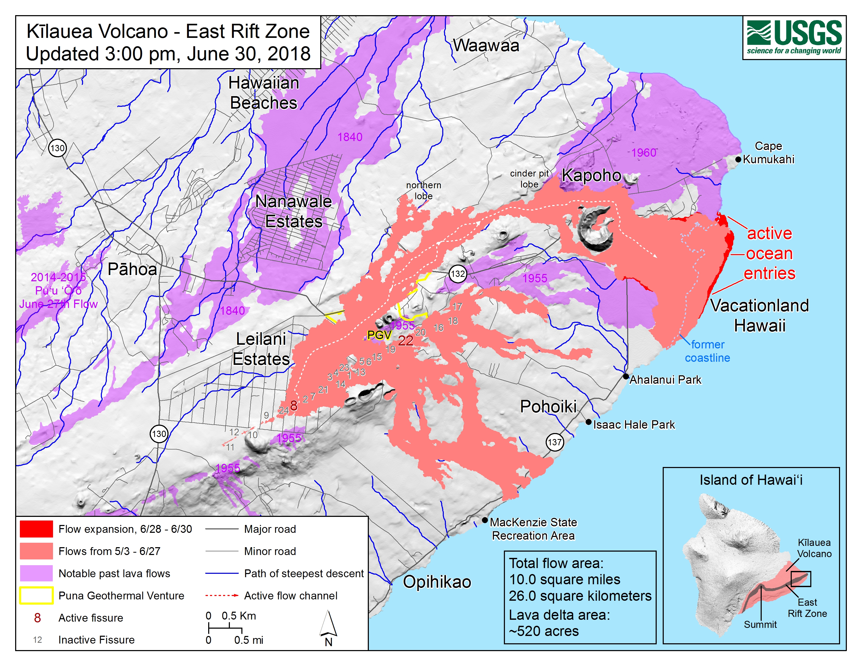
The U.S. Geological Survey released this map, GIF animation and these photos of the East Rift Zone.
USGS map as of 3 p.m., June 30, 2018. Click to enlarge
ARTICLE CONTINUES BELOW AD
ARTICLE CONTINUES BELOW AD
Given the dynamic nature of Kīlauea’s lower East Rift Zone eruption, with changing vent locations, fissures starting and stopping, and varying rates of lava effusion, map details shown here are accurate as of the date/time noted. Shaded purple areas indicate lava flows erupted in 1840, 1955, 1960 and 2014-2015.
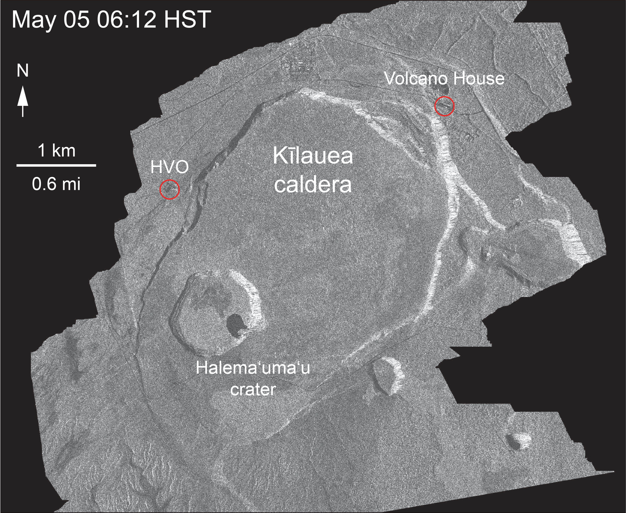
This animated GIF shows a sequence of radar amplitude images that were acquired by the Agenzia Spaziale Italiana CosmoSkyMed satellite system. The images illustrate changes to the caldera area of Kīlauea Volcano that occurred between May 5 and June 30 at about 6 a.m.
The satellite transmits a radar signal at the surface and measures the strength of the return, with bright areas indicating a strong return and dark areas a weak return. Strong returns indicate rough surfaces or slopes that point back at the radar, while weak returns come from smooth surfaces or slopes angled away from the radar. Over time, expansion of the summit eruptive vent within Halema‘uma‘u crater and the widening of Halema‘uma‘u itself are clear.
Starting in late May, the development of several cracks outside Halema‘uma‘u is clear, and inward slumping of a large portion of the western, southwestern, and northern crater rim begins. Much of this motion appears to be coincident with the small explosions from the summit that have taken place on a near daily basis since early June. The most recent radar scene, from June 30, shows the formation of cracks over a broader area of the caldera floor, extending east of Halema‘uma‘u (these cracks are the scarps seen in recent photographs from the Keanakākoʻi overlook area). We expect this slumping to continue as long as the collapse events and overall subsidence persist.
ARTICLE CONTINUES BELOW AD
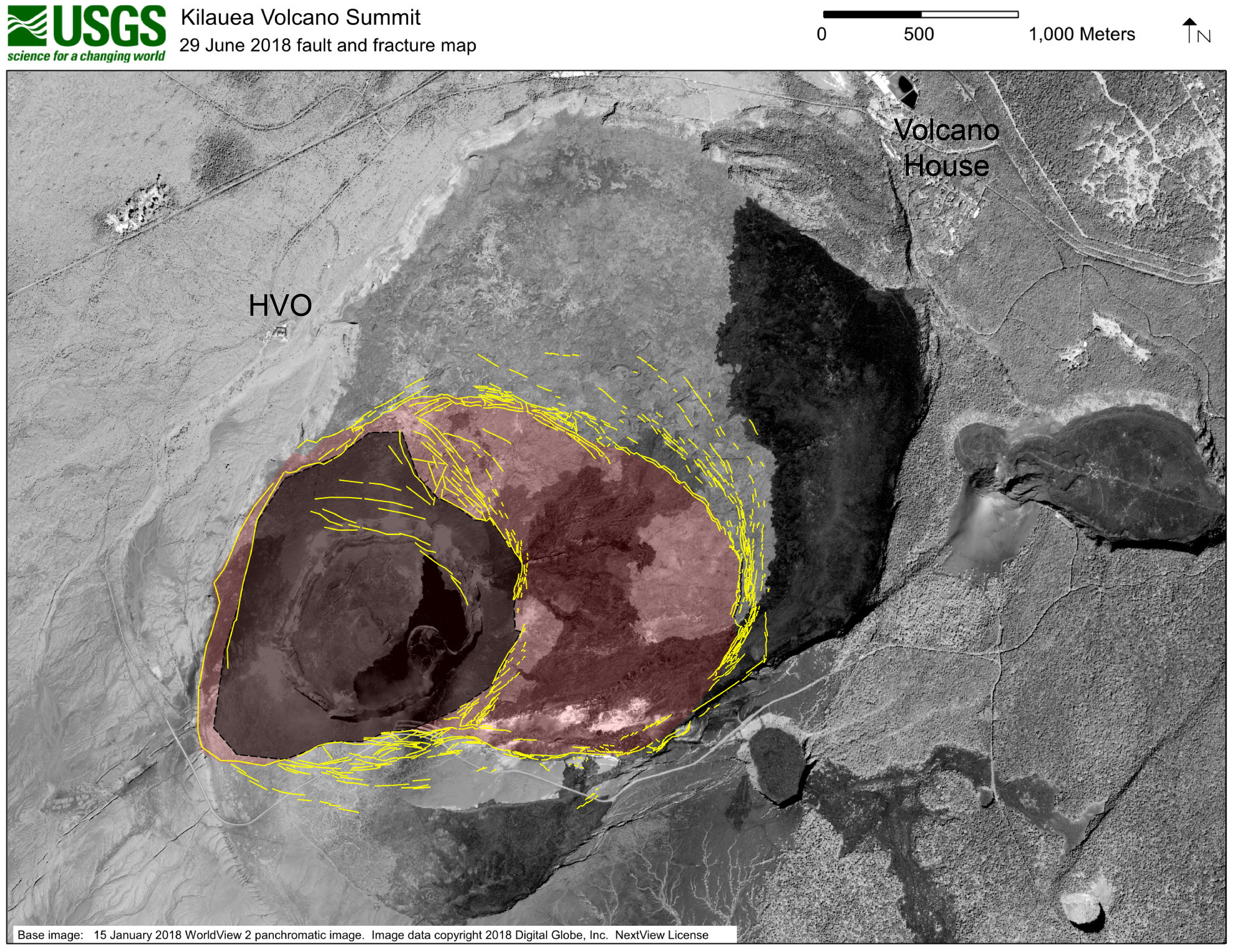
High-resolution satellite data are useful for mapping cracks and deformation in the summit caldera at Kīlauea Volcano.
This map shows major fractures in yellow (as of June 29) on a base image acquired by the WorldView-2 satellite before the current sequence of events began at Kīlauea.
The area of major subsidence has expanded east and south, and slightly west, of the main Halema‘uma‘u crater area. The large, red-shaded area east of Halema‘uma‘u is moving down within a scarp-bounded area, as seen in recent photographs of the summit. Some fractures have also formed to the east-northeast of the red-shaded area of accelerated motion, and also on the south caldera rim where parts of the caldera wall have slumped into the rapidly moving caldera floor below. The dark gray-shaded area within the red shaded area shows the region of most significant down dropping and is currently the deepest part of Kīlauea caldera.
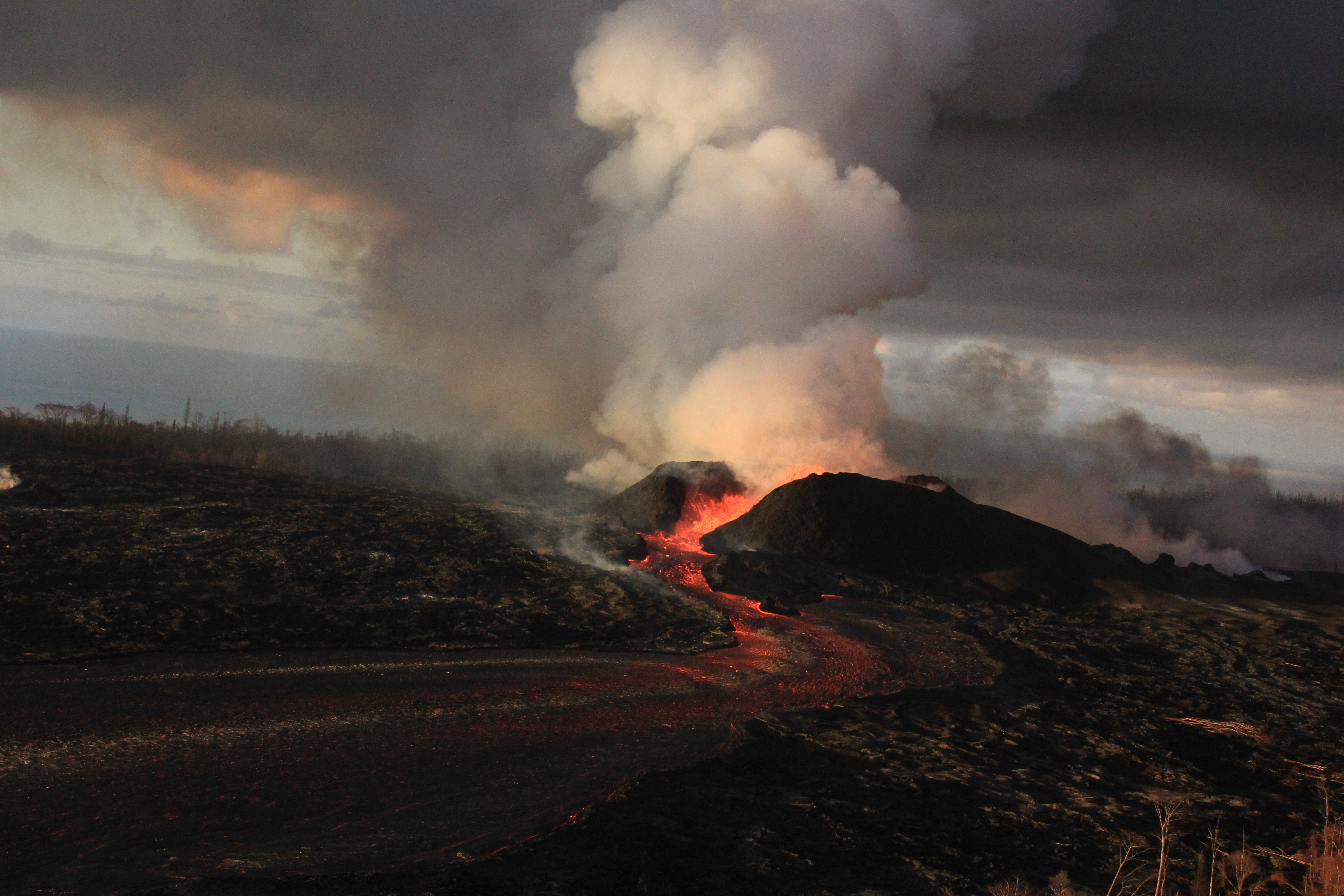
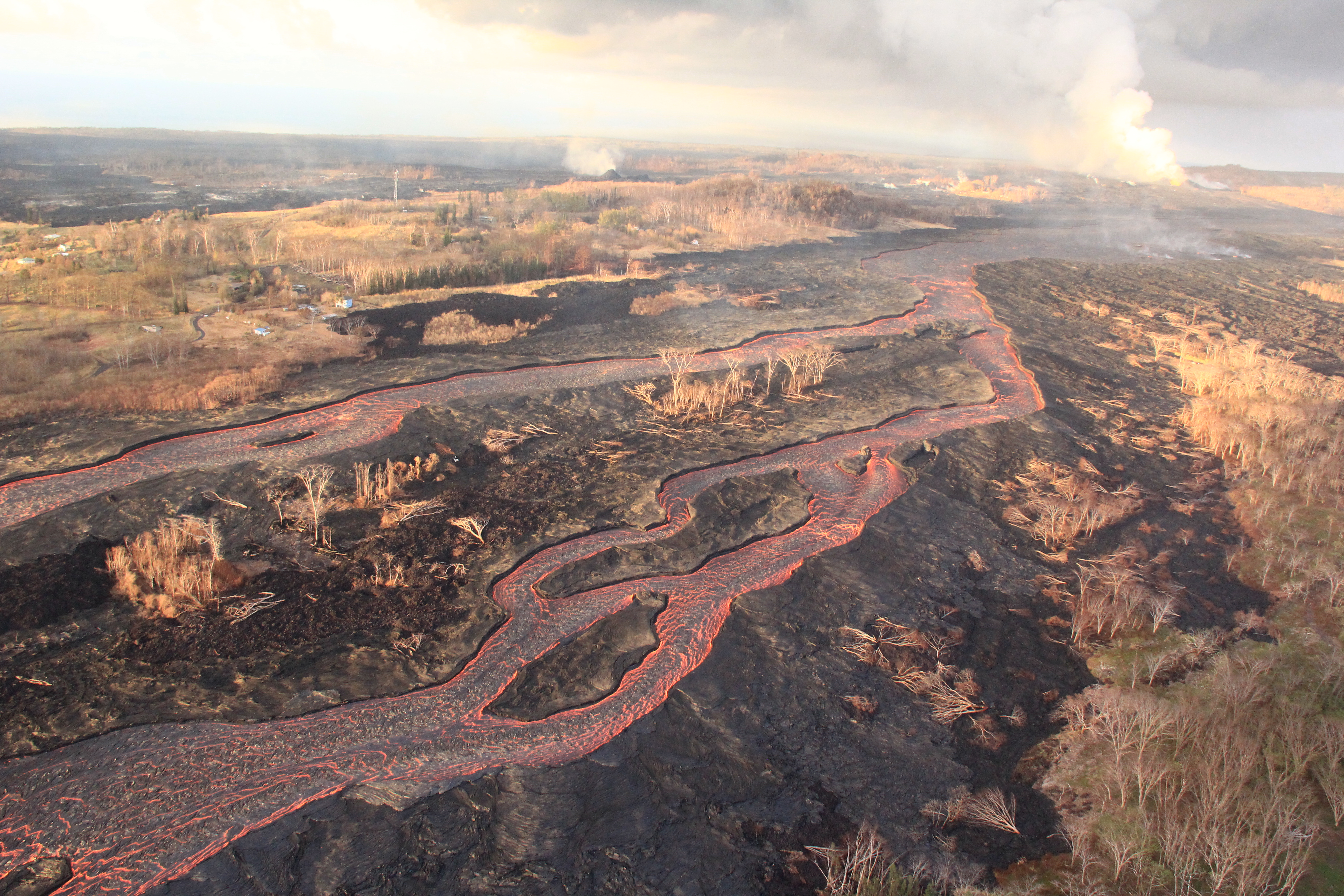
Activity continues in Kīlauea Volcano’s lower East Rift Zone
Fountains from the Fissure 8 spatter cone continue to supply lava to an open channel.
As observed during yesterday’s helicopter overflight, the fountains rarely rise above the rim of the spatter cone.
The spatter cone is now about 55 m (180 ft) tall at its highest point.
ARTICLE CONTINUES BELOW AD
Lava from Fissure 8 is fed into a channel that travels about 13 km (8 mi) to the sea. A plume marks the location of Fissure 8, visible in the upper right; a small plume in the upper center marks the location of Fissure 22.
Intermittent small, short-lived overflows have occurred, but these overflows rarely extend beyond the existing flow field.
Each morning, HVO field crews conduct an overflight of the lava channel to determine if there have been any overflows.
Lava flows around islands in the lava channel. The direction of flow is from the upper right to lower left.
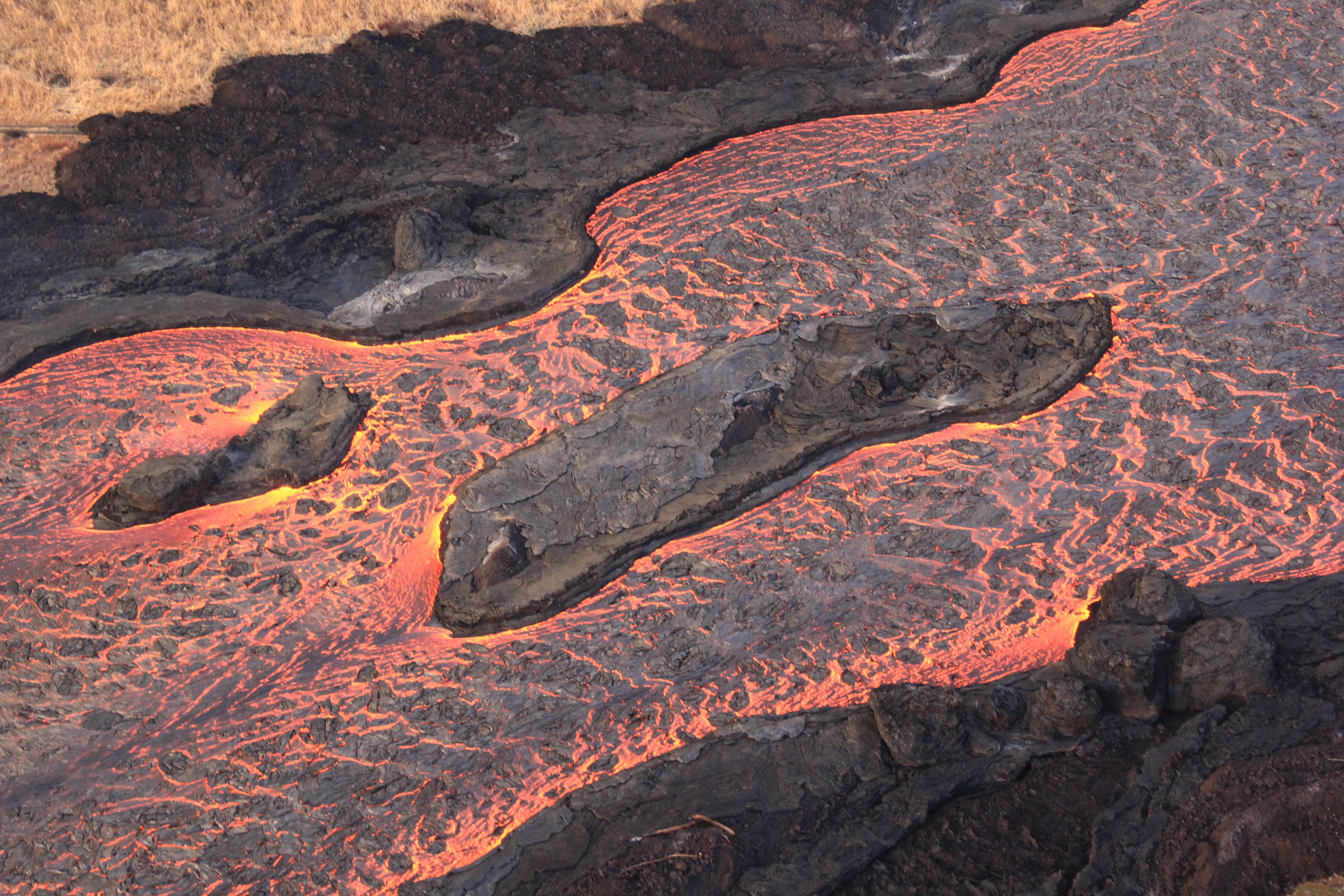
Field crews can make a rough calculation of velocity by timing large blocks as they pass between two landmarks that are a known distance apart.
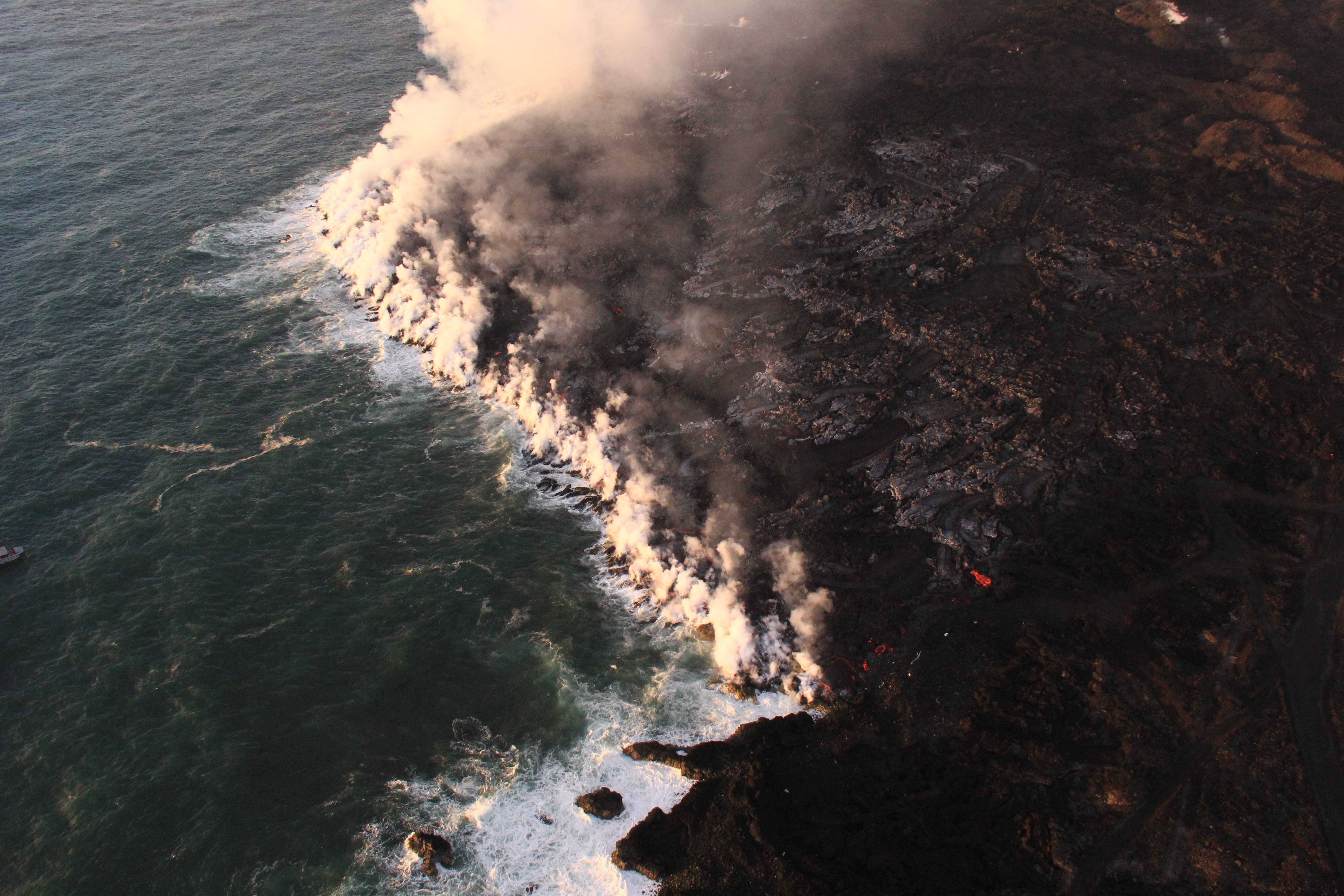
At the Kapoho coast, lava enters the ocean along the northern margin of the flow field.
USGS Photo
Lava was entering the ocean over a broad area this morning.
View to the south.
This image shows an active entry area along the northern flow front at Kapoho. View to the south.
Hawaiian Volcano Observatory geologist Matt Patrick acquires video of fissure 8 and the lava channel from Pohoiki Road/Highway 132.
The video is used to document fountain behavior and lava flow characteristics, and how they change with time.
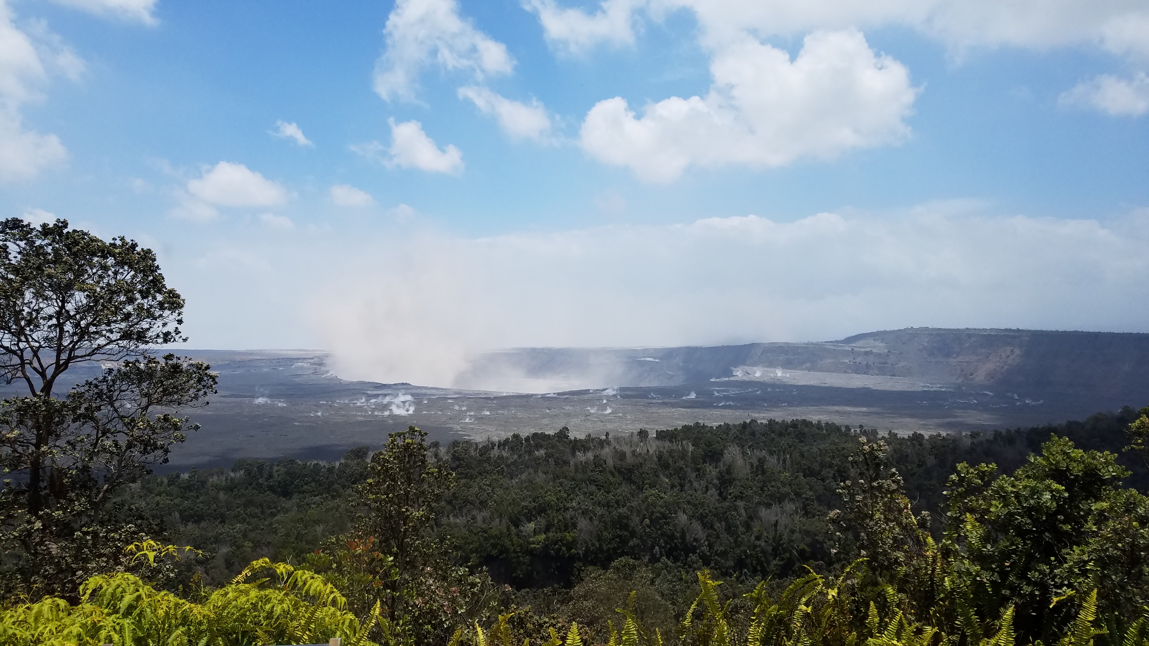
View of Kīlauea Volcano’s summit. The brown visible dust coming from Halema‘uma‘u is from rockfalls.
This comments section is a public community forum for the purpose of free expression. Although Big Island Now encourages respectful communication only, some content may be considered offensive. Please view at your own discretion. View Comments