The U.S. Geological Survey released these photos of the East Rift Zone on Wednesday, June 20, 2018.
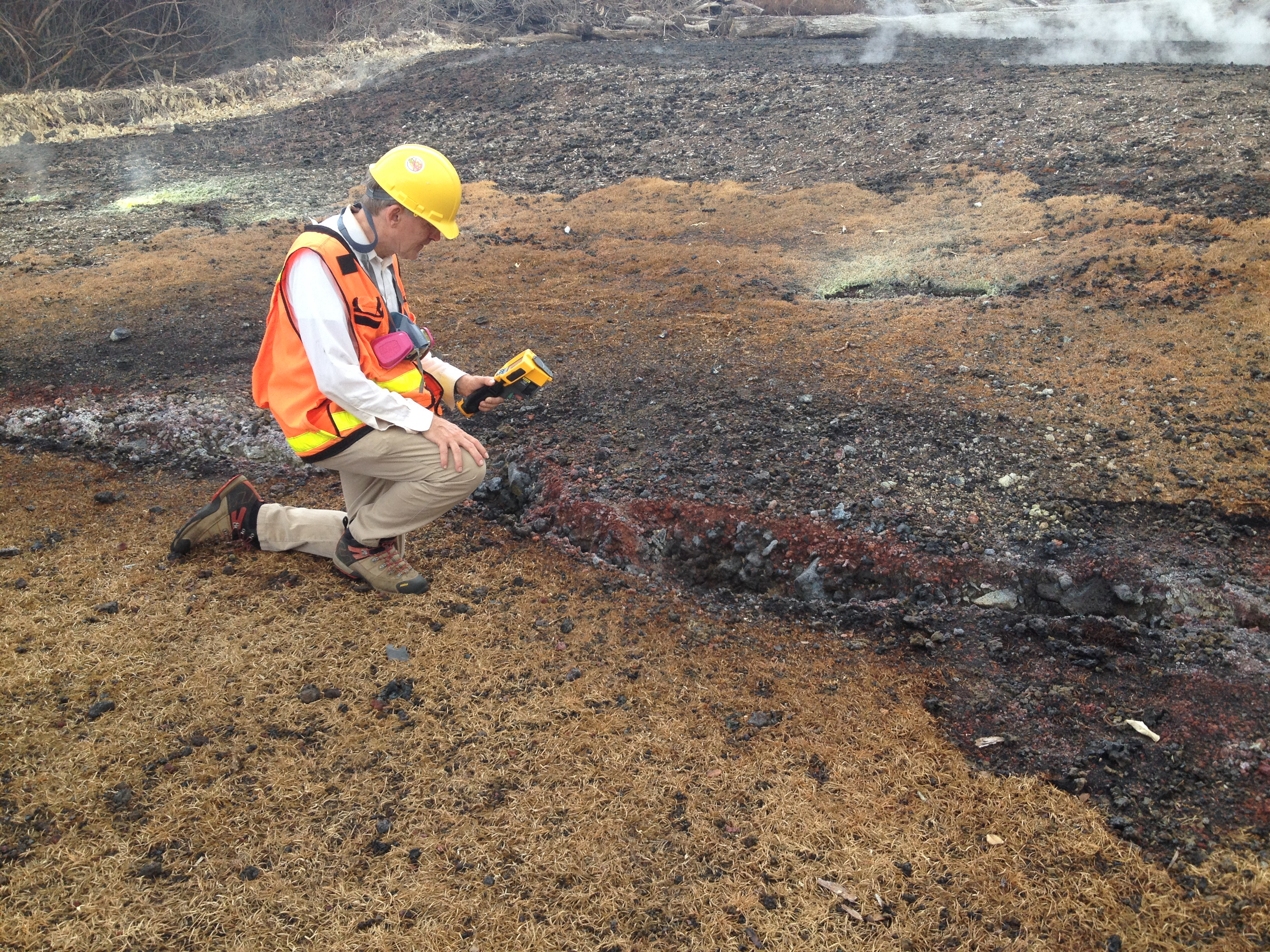
HVO geologist measures 500 degrees Farenheit along ground cracks near fissure 10 in Leilani Estates.
Geologists routinely make temperature measurements to track changes throughout the fissure complex in the lower East Rift Zone.
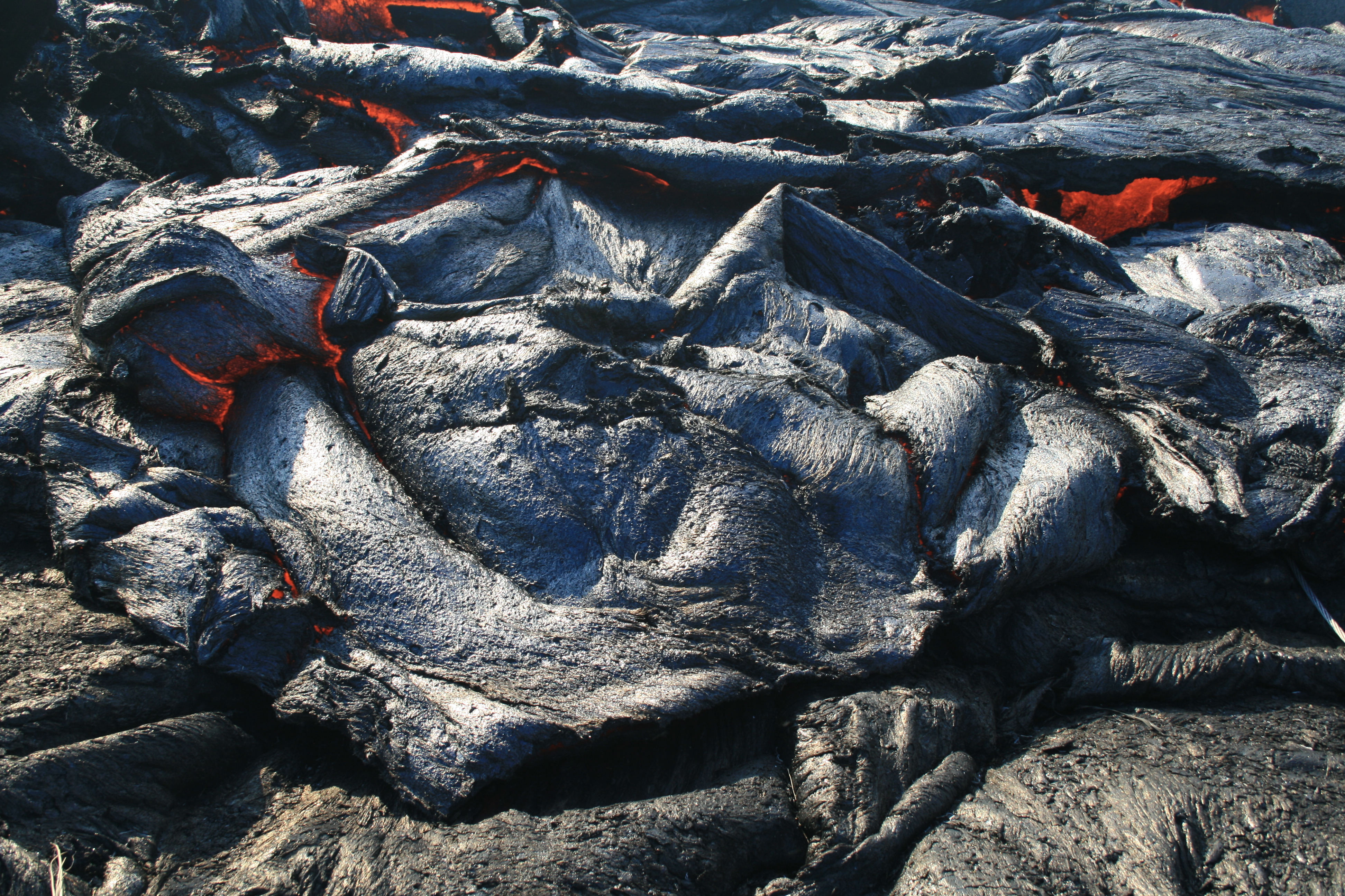
Sluggish pāhoehoe briefly spills over a section the levee along the well-established lava channel. Such overflows generally travel short distances measured in yards.
Geologists track the extent of oveflows and look for potential areas of weakness and seepages along the sides of the perched channel in order to assess potential breakouts from the channel.
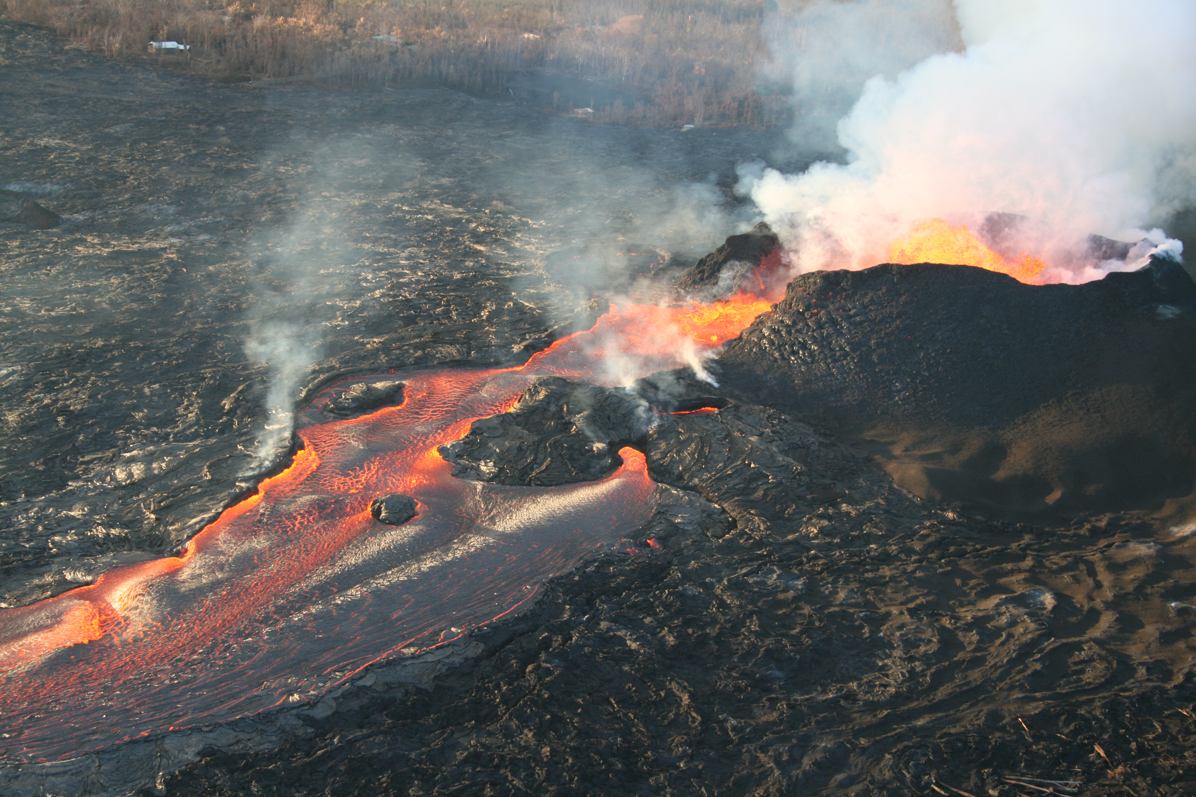
Fissure 8 lava fountains reached as high as about 164 feet during the past day. The fountain height varies, often sending a shower of lava fragments over the rim of the cone, building it slightly higher and broader.
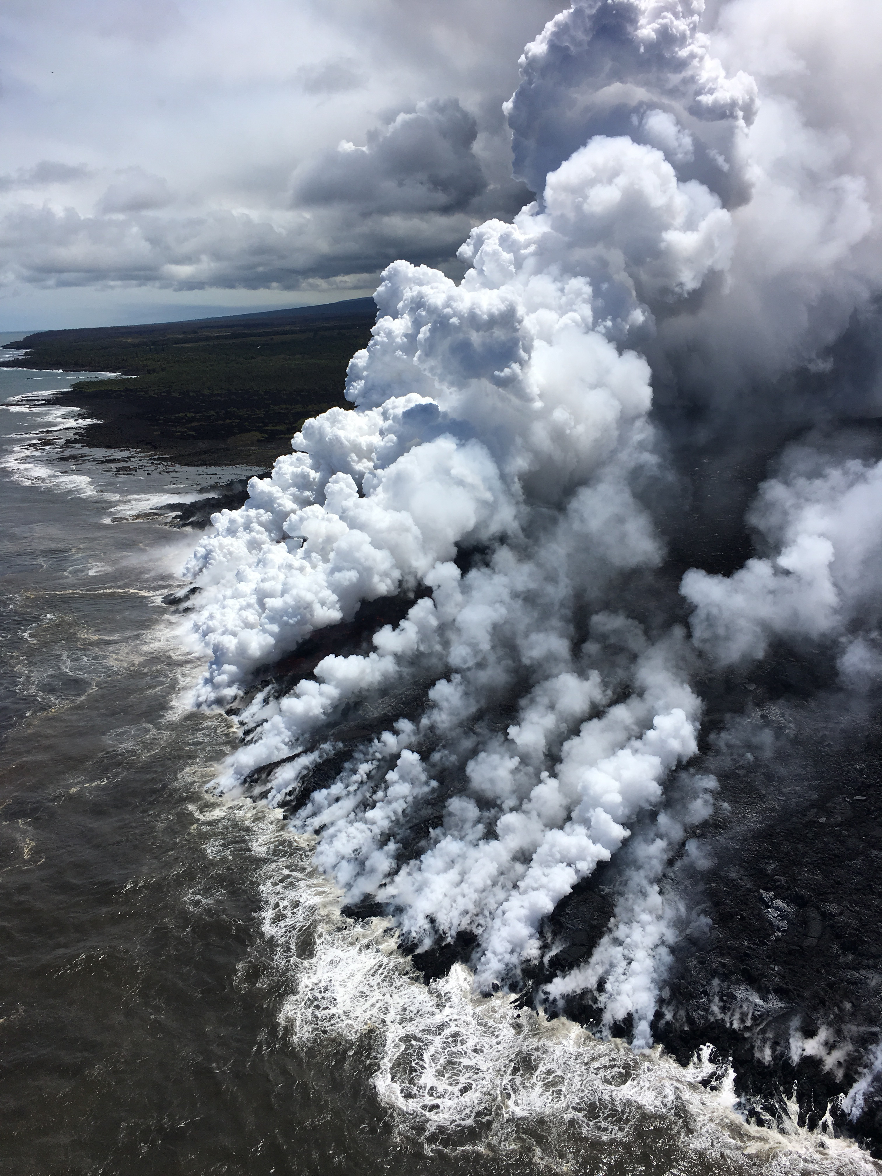
Lava from fissure 8 flows through a well-established channel to the ocean south of Kapoho.
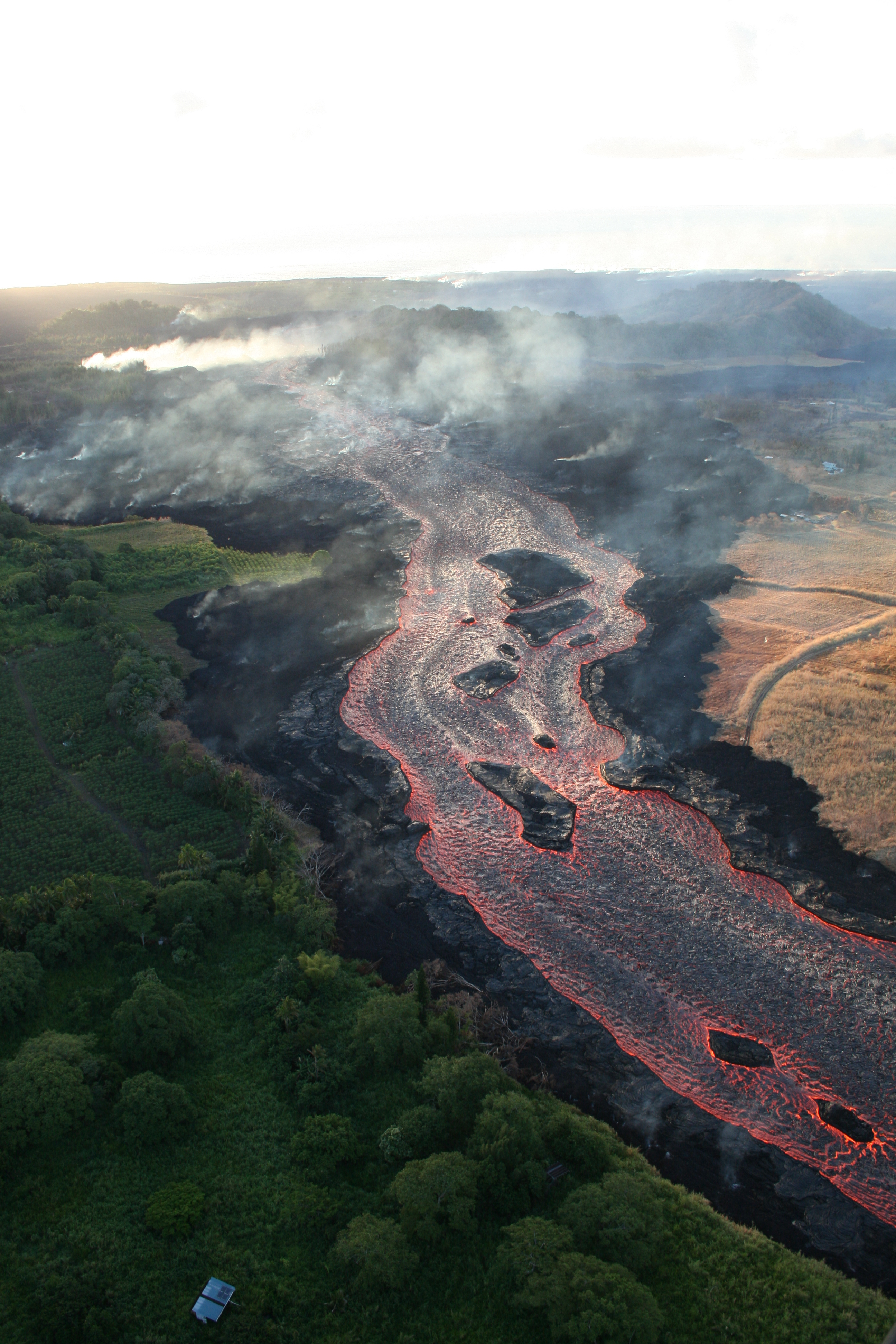
Lava from fissure 8 travels about eight miles to the ocean in an open channel. Lava remains incandescent (glowing orange) throughout its journey.
The ocean entry is at upper right.
ARTICLE CONTINUES BELOW AD
ARTICLE CONTINUES BELOW AD
Small streams of lava enter the ocean across a broad area, shown by the multiple white steam and laze plumes.
Lava has added about 380 acres of new land into the sea.
Big changes at Halema‘uma‘u
ADVERTISEMENT
ARTICLE CONTINUES BELOW AD
ARTICLE CONTINUES BELOW AD
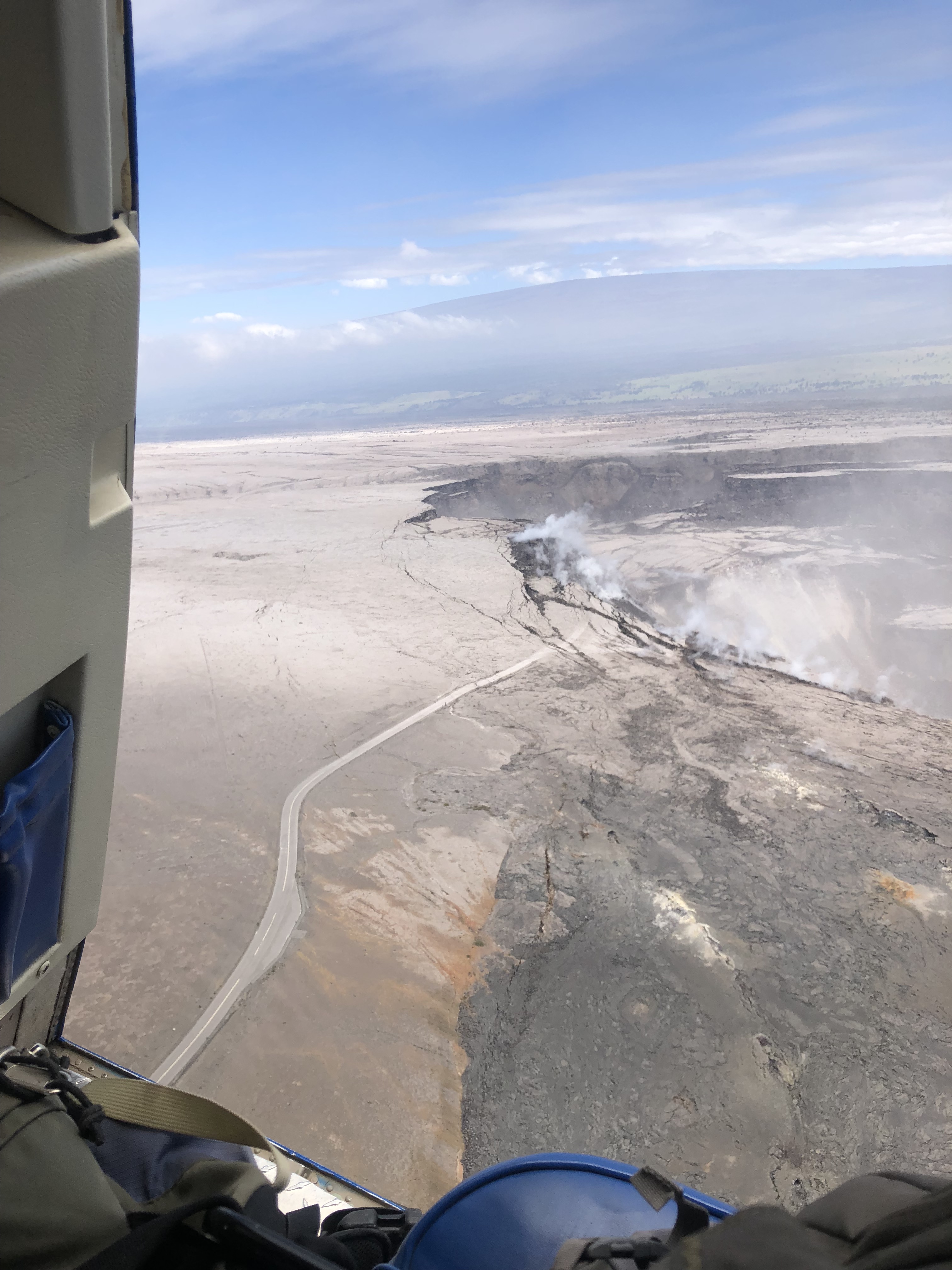
View of the southern edge of the growing Halema‘uma‘u crater (middle right) during yesterday’s helicopter-assisted work at Kīlauea’s summit.
The Crater Rim Drive road (middle) now ends at Halema‘uma‘u instead of the parking lot. The view is toward the west-northwest.
The once-popular parking lot (closed since 2008) that provided access to Halema‘uma‘u is no longer–the parking lot fell into the crater this past week as more and more of the Kīlauea Crater floor slides into Halema‘uma‘u.
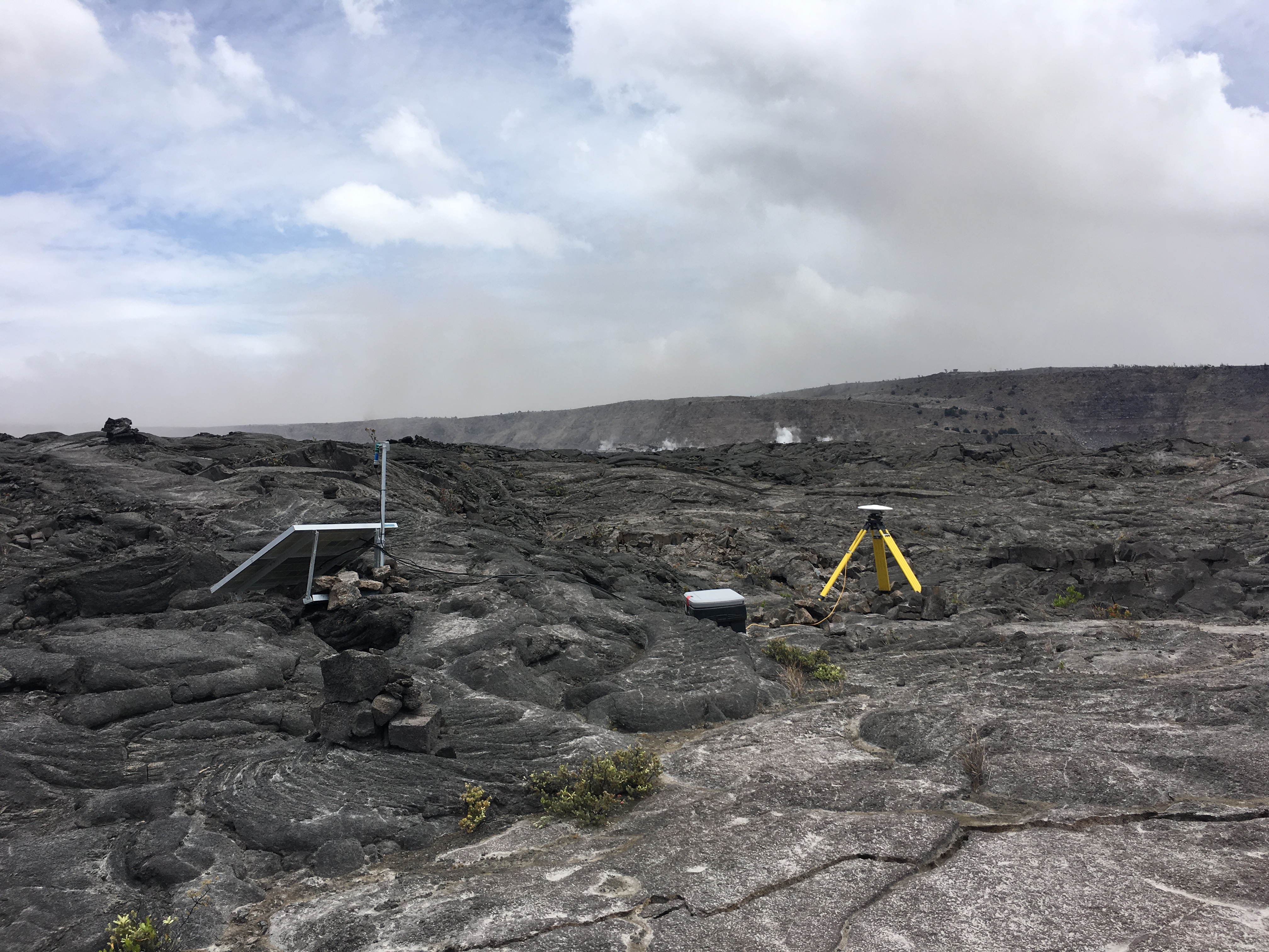
A temporary GPS station (with radio telemetry for continuous measurement) was installed this week on the Kīlauea caldera floor to track the ongoing subsidence of the summit area.
HVO work at the summit is conducted with the cooperation and support of Hawai‘i Volcanoes National Park.
The data will help to characterize the extent and rate of the subsidence.
This comments section is a public community forum for the purpose of free expression. Although Big Island Now encourages respectful communication only, some content may be considered offensive. Please view at your own discretion. View Comments