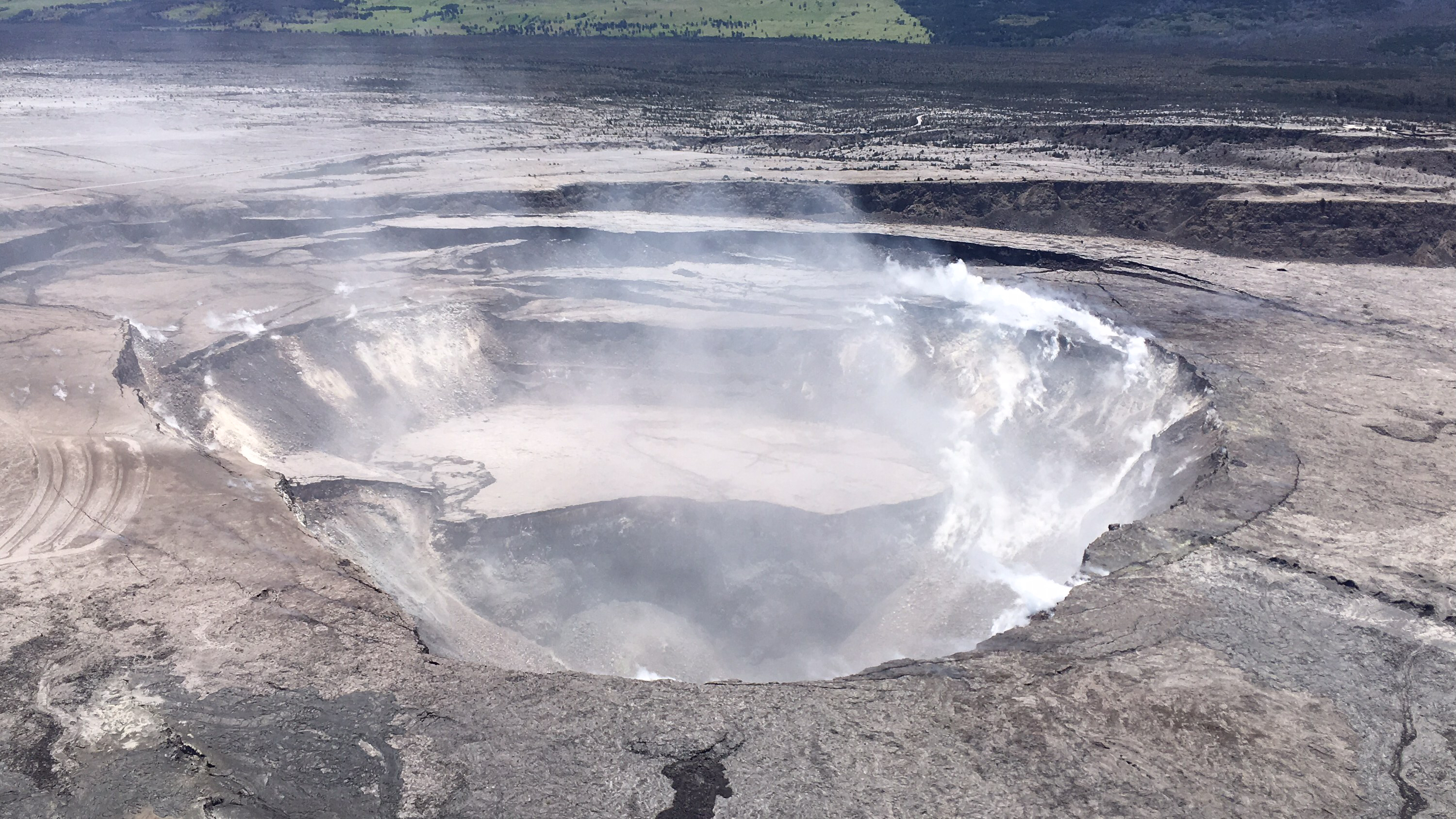
The U.S. Geological Survey released these pictures that HVO scientists captured this aerial view of a much-changed Halema‘uma‘u during their overflight of the summit this afternoon.
Earthquake activity dropped after this morning’s small explosion and is now slowly rising following the pattern of previous events of this type. Monitoring data show that subsidence at the summit crater continues. The mid-day observation flight showed continued Inward slumping of the rim and walls of Halema`uma`u in response to subsidence at the summit. Locally felt earthquakes are expected to continue and further ash explosions are likely. Over the last week, sulfur dioxide passively degassing from the volcano’s summit has decreased, but emission rates remain high enough to impact air quality in downwind regions. Click to enlarge
Explosions and collapse within Halema‘uma‘u have enlarged the crater (foreground) that previously hosted the summit lava lake, and the far rim of Halema‘uma‘u has dropped with continued summit deflation. The parking area for the former Halema‘uma‘u Overlook (closed since early 2008 due to volcanic hazards) can be seen to the left of the crater.
Tuesday, June 5, 2018, view of Halema‘uma‘u and the adjacent caldera floor from the Kīlauea overlook.
Additional bursts of gas released with intermittent explosive activity are also transported downwind and may temporarily affect air quality as well. Click to enlarge
Heavy steam dominates the view, and strong winds are blowing the plume to the southwest.
ARTICLE CONTINUES BELOW AD
ARTICLE CONTINUES BELOW AD
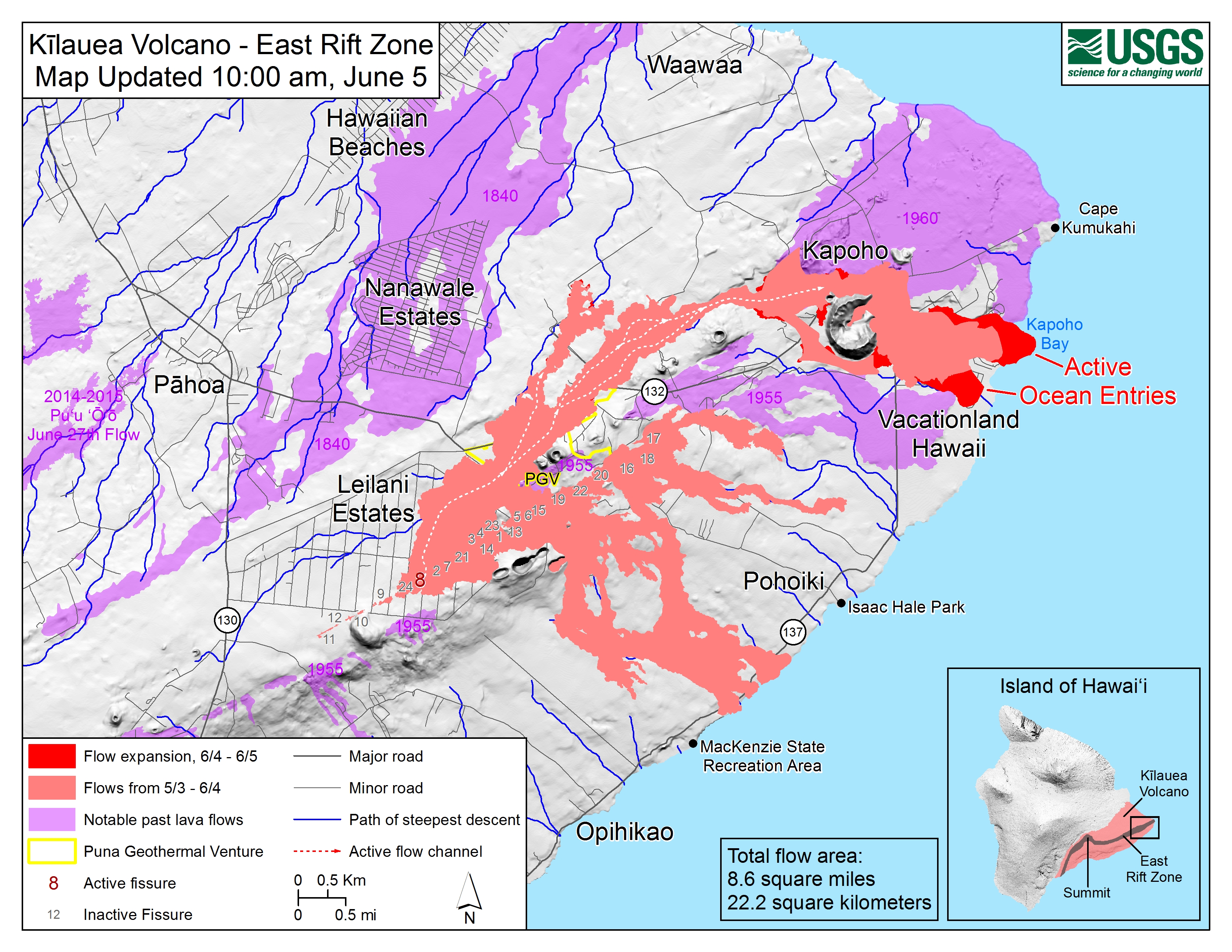
Map as of 10 a.m., June 5, 2018. Given the dynamic nature of Kīlauea’s lower East Rift Zone eruption, with changing vent locations, fissures starting and stopping, and varying rates of lava effusion, map details shown here are accurate as of the date/time noted.
Click to enlarge
Shaded purple areas indicate lava flows erupted in 1840, 1955, 1960 and 2014-2015.
This comments section is a public community forum for the purpose of free expression. Although Big Island Now encourages respectful communication only, some content may be considered offensive. Please view at your own discretion. View Comments