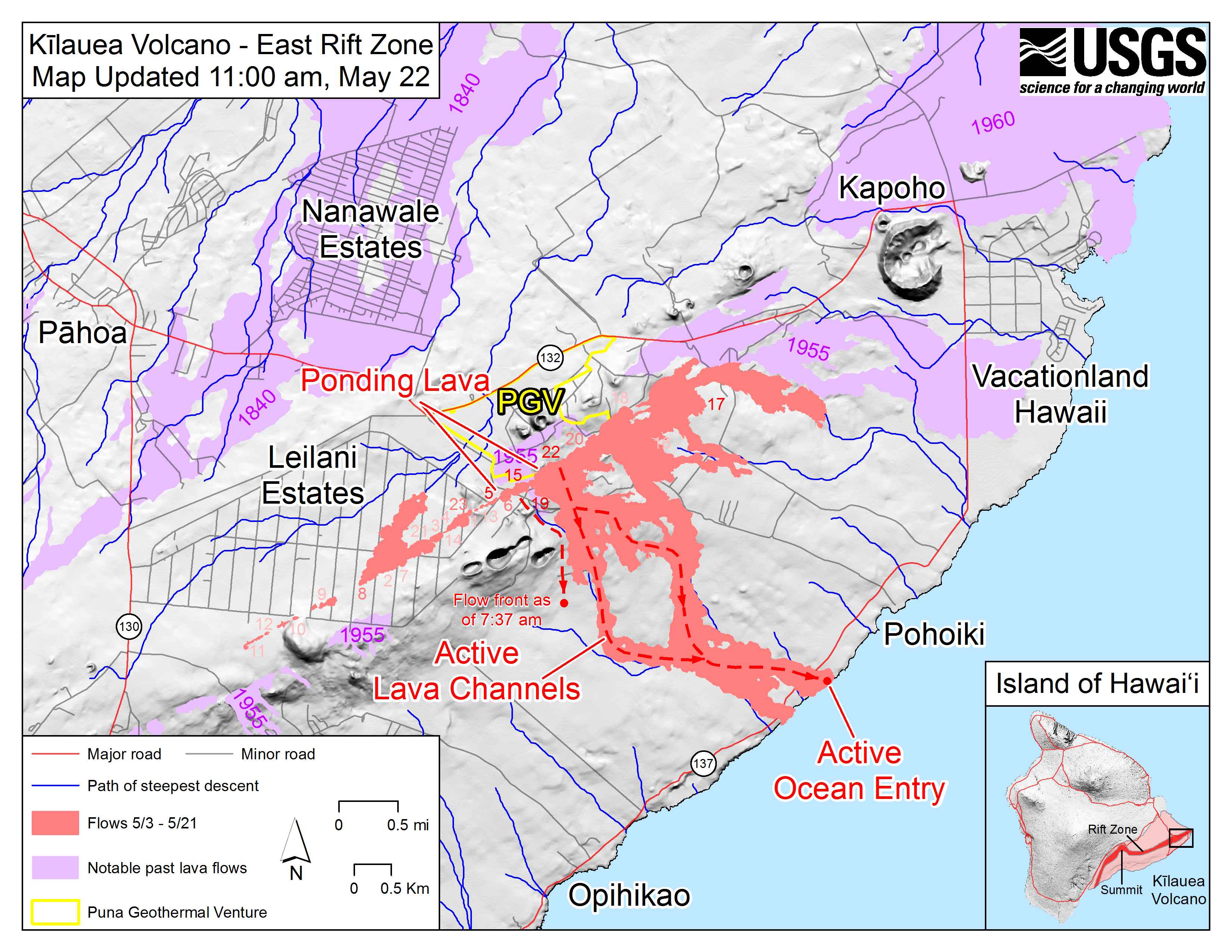
The U.S. Geological Survey released this map as of 11 a.m. Tuesday, May 22, 2018, showing “ponding lava” near the Puna Geothermal Ventures (PGV) site.
Click to enlarge
The flow field has not expanded significantly during the past day because most of erupted lava moved southward through the active lava channels and into the ocean. Note a new lava flow that was observed during this morning’s overflight west of the active channels.
There was a single ocean entry this morning. Shaded purple areas indicate lava flows erupted in 1840, 1955, 1960 and 2014-2015.
This comments section is a public community forum for the purpose of free expression. Although Big Island Now encourages respectful communication only, some content may be considered offensive. Please view at your own discretion. View Comments