

Aerial Views of Fissures and Flows
The U.S. Geological Survey released this video and photos of a helicopter overflight of a fast-moving lava flow emerging from fissure 20 on May 19, at 7:52 a.m.
The flow is advancing to the southeast. Photograph courtesy of the Hawai‘i County Fire Department.
Lava fountaining is visible in the background. The audio is the sound of the helicopter.
Lava fountains from Fissure 20 in Kīlauea Volcano’s lower East Rift Zone.
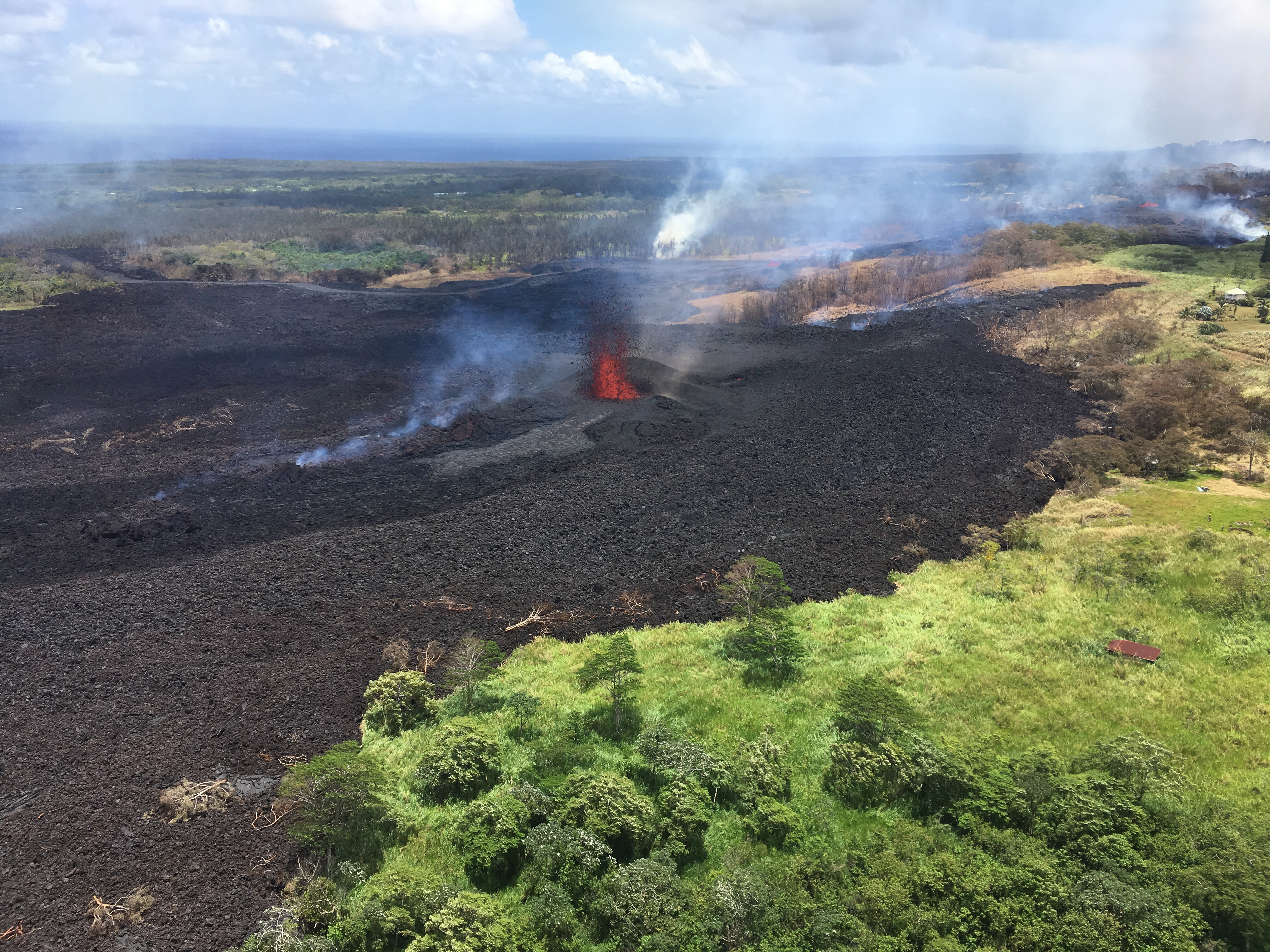
Photo taken May 19, 2018, at 7:37 a.m. Click to enlarge. (USGS Photo)
Channelized lava flows originate from a merged elongated fountaining source between fissures 16 and 20 in Kīlauea Volcano’s lower East Rift Zone.
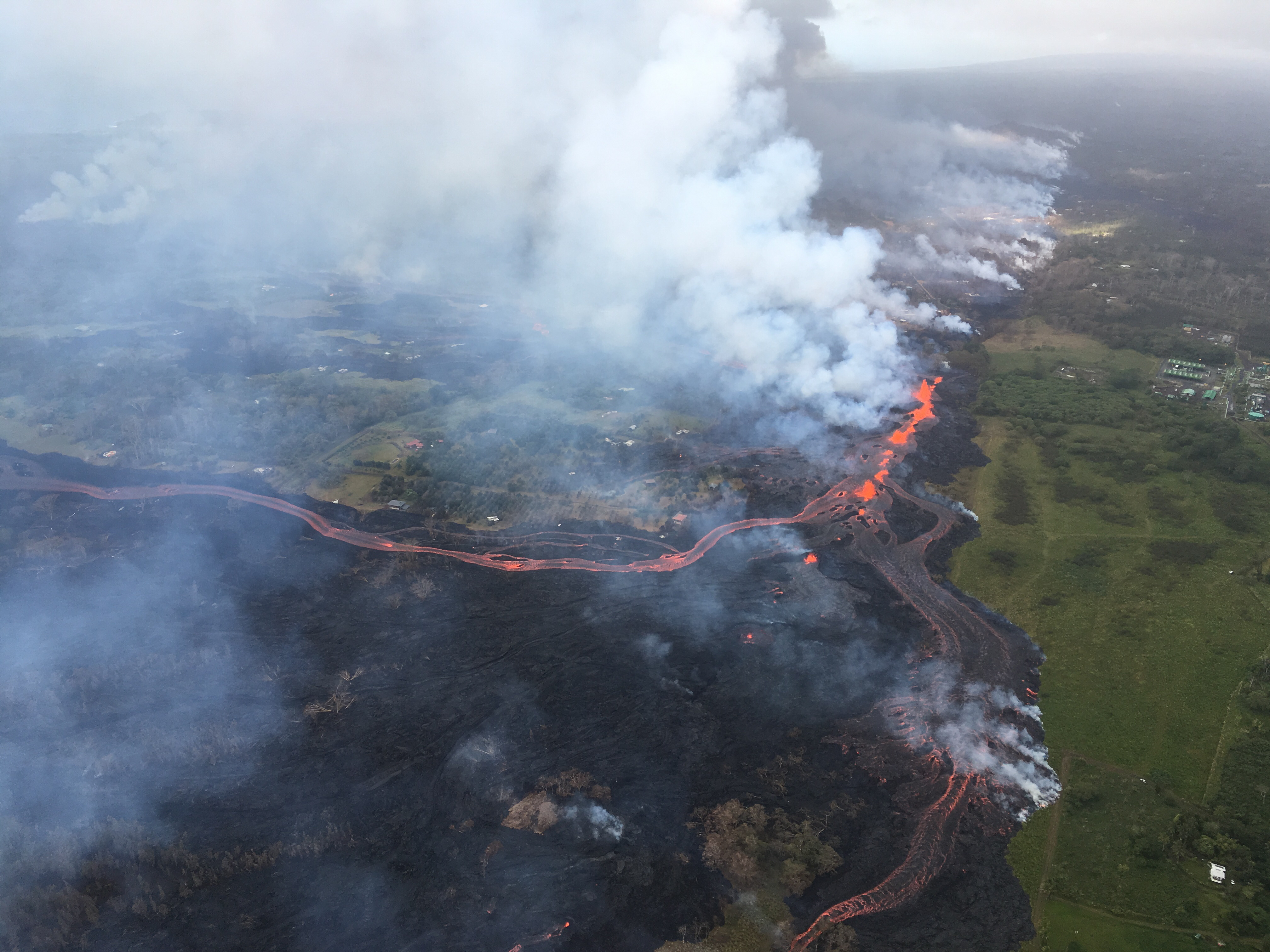
Click to enlarge. (USGS Photo)
Channelized lava emerges from the elongated fissure 16-20 (in the upper right).

Photo taken May 19, 2018, at 8:18 a.m. Click to enlarge. (USGS Photo)
Helicopter overflight of Kīlauea Volcano’s lower East Rift zone on May 19, 2018, around 8:18 a.m.
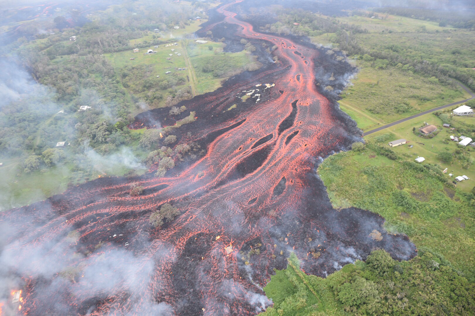
The flow direction in this picture is from upper center to the lower left. Click to enlarge. (USGS Photo)
‘A‘ā lava flows emerging from the elongated fissure 16-20 form channels.
Helicopter overflight of the southeast coast of the Puna district during the early morning hours of May 19, 2018.
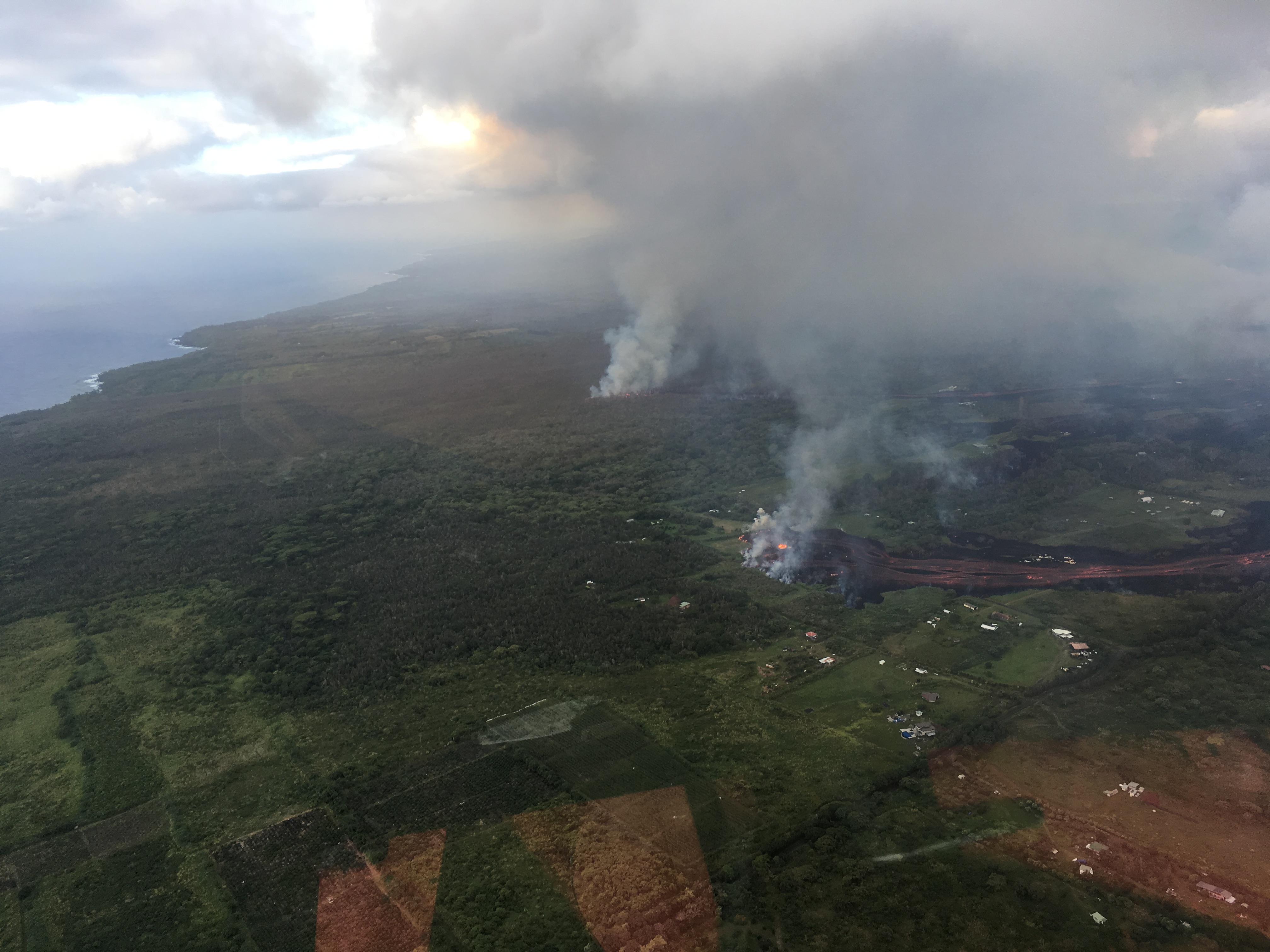
Flows are moving downslope toward the ocean. Click to enlarge. (USGS Photo)


Sponsored Content

