This news story will be updated throughout the day as new information becomes available and new articles will be added to the website’s “News” section. Previous information about ongoing events can be found in Big Island Now’s “Volcano Blog” section.
This image is from a research camera mounted in the observation tower at the Hawaiian Volcano Observatory. The camera is looking SSE towards the active vent in Halemaʻumaʻu, 1.2 miles from the webcam. For scale, the crater wall of Halemaʻumaʻu behind the eruptive vent is about 280 feet high.
Tuesday, May 15, 2018, 10 a.m.: Ash spreading across Ka‘ū District
The Hawaiian Volcano Observatory reports rock falls and gas explosions within Halema‘uma‘u Crater have caused an ash plume which is carrying ash downstream across the Ka‘ū District. Ash is being reported along Highway 11 to Pahala.
Avoid excessive exposure to ash which is an eye and respiratory irritant.
Those with respiratory sensitivities should take extra precaution to minimize exposure.
Motorists are advised to drive with caution.
ARTICLE CONTINUES BELOW AD
ARTICLE CONTINUES BELOW AD
County, state and federal partners continue to monitor the situation. You will be informed of any conditions that affect your safety.
Tuesday, May 15, 2018, 8:13 a.m.
LOWER EAST RIFT ZONE
May, 14, 2018, 7 a.m.: An early morning view of fissure 17, still erupting and supplying lava to a flow that was still advancing (out of view). View is looking toward the east. PC: USGS/HVO
Eruption of lava continues from multiple points along the northeast end of the active fissure system.
Residents in lower Puna should remain informed and heed Hawai‘i County Civil Defense closures, warnings and messages.
ARTICLE CONTINUES BELOW AD
This morning, activity remains concentrated at fissure 17. Lava flows from fissure 17 have advanced little over the past day.
An estimate of advance rate overnight was about 20 yards per hour.
The flow is moving generally east south east and as of this morning was about 1.2 miles above Highway 137.
A new fissure has opened this morning in the Lanipuna Gardens subdivision northeast of fissure 19.
Volcanic gas emissions remain elevated throughout the area downwind of the vents.
ARTICLE CONTINUES BELOW AD
HVO field crews are on site tracking the lava flow as conditions allow and reporting information to Hawai‘i County Civil Defense.
This eruption is still evolving and additional outbreaks of lava are possible. Ground deformation continues and seismicity remains elevated in the area.
The location of future outbreaks could include areas both uprift (southwest) and downrift (northeast) of the existing fissures, or, existing fissures can be reactivated. Communities downslope of these fissures could be at risk from lava inundation. Activity can change rapidly.
Conditions around the erupting fissures can change very quickly. Residents in lower Puna should remain informed and heed Hawai‘i County Civil Defense closures, warnings and messages.
KĪLAUEA SUMMIT
This morning, the plume from Overlook vent inside Halema‘uma‘u is steady and gray due to its ash content.
The plume is rising several thousand feet above the ground and drifting to the southwest. Ashfall is occurring in the upper Ka‘ū Desert and downwind.
Depending on wind conditions, dustings of ash may occur in the Kīlauea summit area and downwind. More energetic ash emissions are possible if explosive activity commences.
The National Weather Service issued the following special weather statement at 8 a.m. for communities downwind:
VERY LIGHT ASHFALL AND HAZARDOUS AIR QUALITY THROUGH EARLY AFTERNOON
The web camera at Kīlauea Volcano Summit at showed a burst in volcanic ash emissions from Halema‘uma‘u Crater beginning around 7 a.m. this morning.
Northeast winds will carry ash downstream across the Big Island Ka‘ū District affecting
the Punalu‘u, Wood Valley, Na‘alehu communities this morning and into early afternoon.
Avoid excessive exposure to ash which is an eye and respiratory irritant. Those with respiratory sensitivities should take extra precaution to minimize exposure.
USGS/HVO has provide newly organized information about ash hazards, gas hazards and the Lower East Rift Zone eruption.
Hawai‘i County Civil Defense messages regarding conditions, warning, and evacuations may be found online.
Tuesday, May 15, 2018, 6 a.m.
Hawaiian Volcano Observatory reports a new fissure—No. 20—has opened in the Lanipuna Gardens Subdivision northeast of fissure 19.
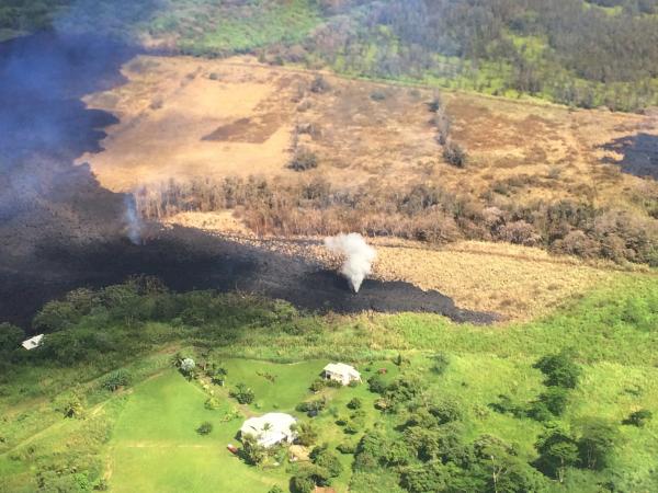
The narrow lava flow from fissure 17 is still moving slowly toward the ocean at approximately 20 yards per hour.
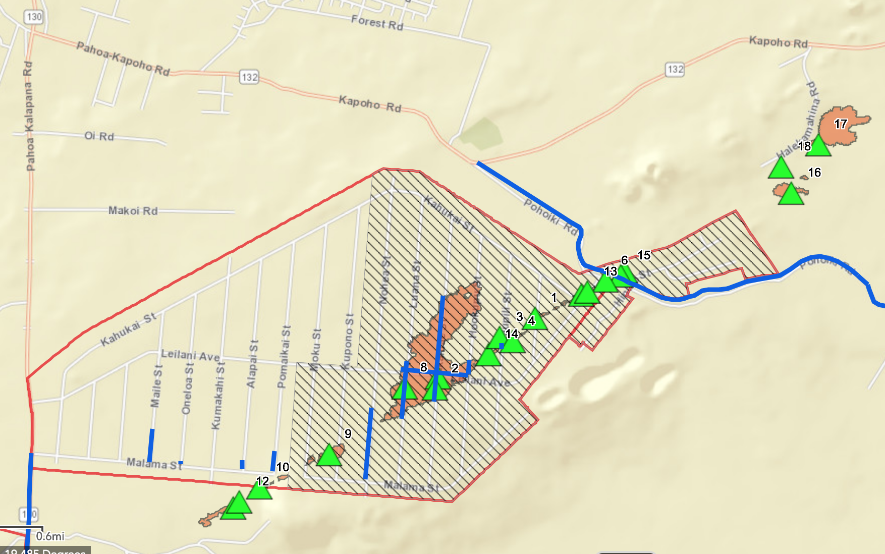
Fissures 1–18. MC: Hawai‘i County
There are no homes or roads threatened at this time.
The Hawai‘i Department of Transportation is working to reopen the Keaau-Pahoa Road (Highway 130) from Malama Street to Kamaili Road this morning for local traffic only. Motorists are advised to drive with caution as metal plates will be placed over the cracks on the roadway. HDOT and county personnel will be stationed along the route to ensure the roadway is safe for local traffic.
Around 2:30 p.m. on May 14, 2018,, a steam jet appears on fissure 17, above the area with active fountaining. Steam jets at this location were repeating about once a minute. PC: USGS/HVO
The Hawai‘i Department of Health reports hazardous emissions of sulfur dioxide (SO2) gas from fissures are especially dangerous for elderly, children/babies and people with respiratory problems. SO2 can be carried with wind, or, cover an area with no wind.
Residents of Lower Puna are advised to be on the alert to gas emissions.
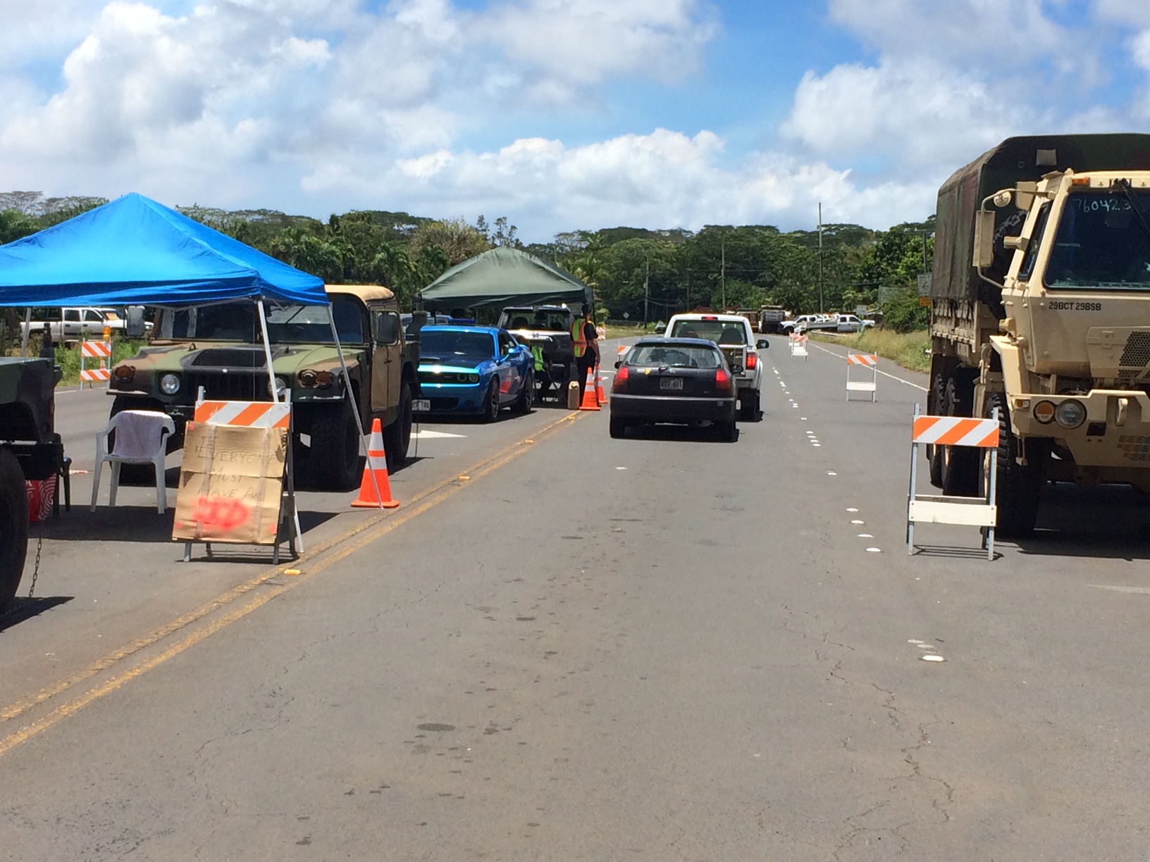
Highway 132 is closed at Pohoiki Road intersection and a checkpoint is located on Highway 130 by Pāhoa High School. Only local traffic allowed beyond all roadblocks.
Highway 132 is closed at Pohoiki Road intersection and a checkpoint is located on Highway 130 by Pāhoa High School. PC: BIN
LOWER EAST RIFT ZONE REVIEW
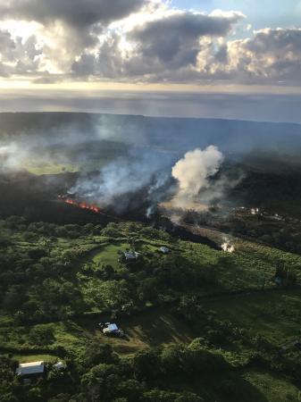
On thee morning, of Monday, May 14, activity was dominated by lava fountaining, explosion of spatter more than 100 feet into the air, and an advancing lava flow from fissure 17 at the northeast end of the fissure system.
As of 6:30 a.m., the fissure 17 flow had traveled just under a mile roughly east-southeast parallel to the rift zone. It is turning slightly south and at this time is about one half mile south of Highway 132.
Fissure 18 that became active late May 13 was weakly active.
A fissure 19 has been spotted very near fissure 15 as of about 8 a.m. on May 14, just northeast of Pohoiki Road and north of Hinalo Street at the east end of Lanipuna Gardens. It is producing a sluggish lava flow.
This comments section is a public community forum for the purpose of free expression. Although Big Island Now encourages respectful communication only, some content may be considered offensive. Please view at your own discretion. View Comments