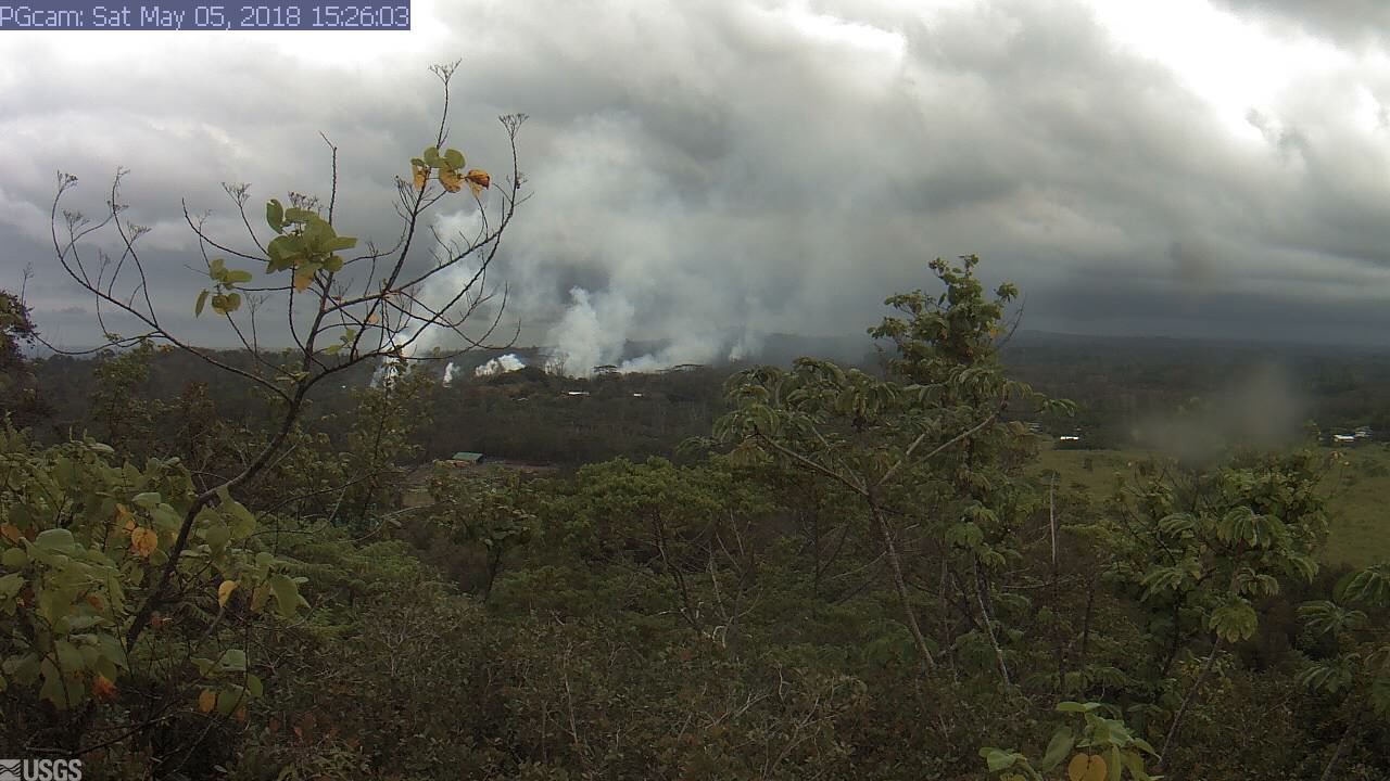
This image is from a temporary research camera positioned near Kapoho looking northwest. From left to right on the horizon, one can see Puʻu ʻŌʻō vent near the left edge of the image, the gas plume from Halemaʻumaʻu crater near the middle of the image (when clear enough), and Mauna Loa and Mauna Kea farther to the right. Click to enlarge.
U.S. Geological Survey update for Saturday, May 5, 2018, at 11:54 a.m.
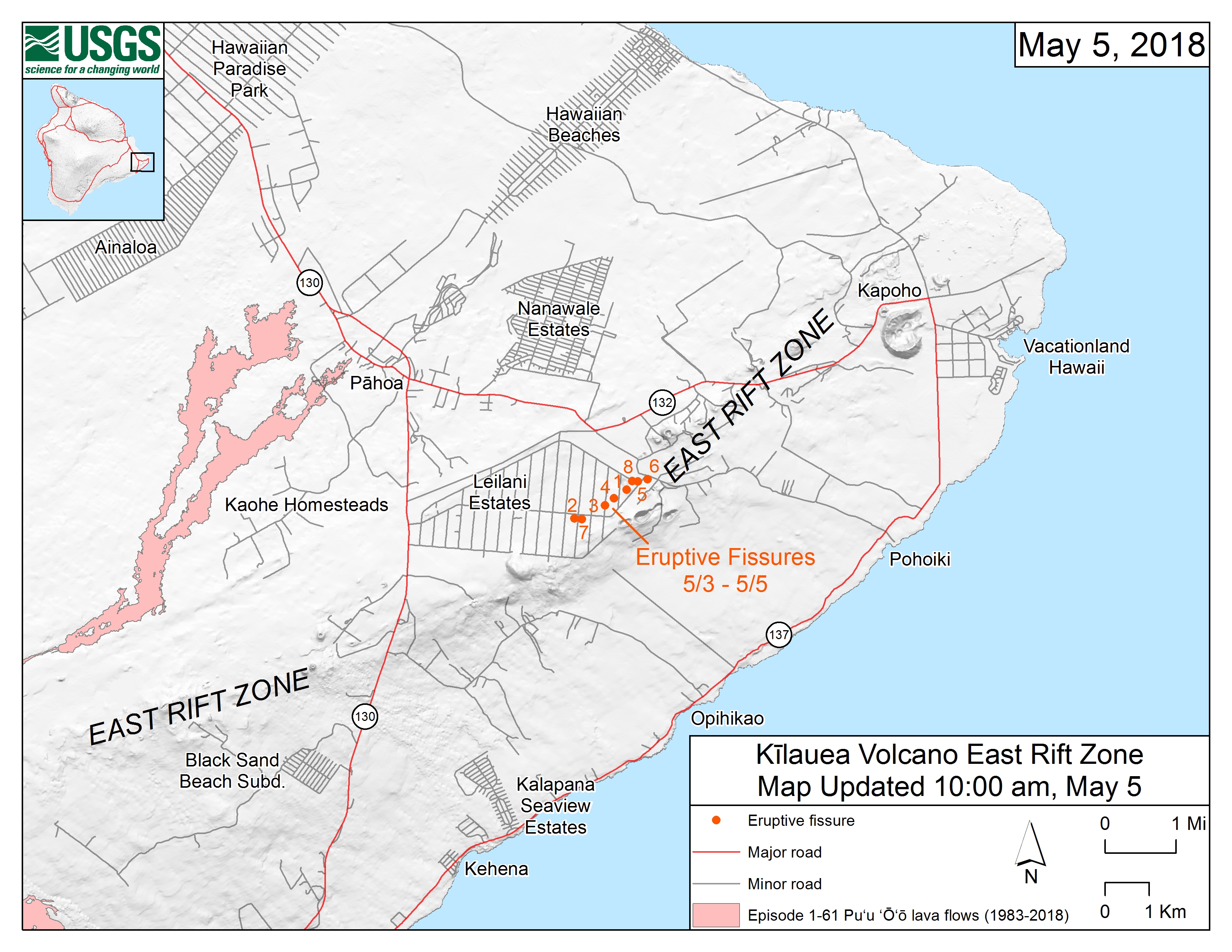
This map shows the locations, mapped by USGS-HVO scientists, of eruptive fissures in the order that they occurred in the Leilani Estates Subdivision as of 10 a.m. on Friday, May 5.
Summary: Active eruption of lava and gas continues along Kīlauea Volcano’s lower East Rift Zone within the Leilani Estates subdivision. Additional fissure vents producing spatter and small lava flows developed early this morning, and additional outbreaks in the area are likely. Deflationary tilt at the summit of the volcano continues and the lava lake level continues to drop. There is no active lava in the Puʻu ʻŌʻō area. Aftershocks from yesterday’s M6.9 earthquake continue and more should be expected, with larger aftershocks potentially producing rockfalls and associated ash clouds above Puʻu ʻŌʻō and Halemaʻumaʻu Crater.
Residents of the Puna District should remain alert, review individual, family, and business emergency plans, and watch for further information about the status of the volcano.
Summit Observations: Deflationary tilt at the summit continues. In concert, the summit lava lake is dropping. Tremor amplitude is fluctuating with lava lake spattering. No large rockfalls or ash plumes related to rockfalls into the lava lake, such as occurred yesterday during the large earthquake sequence, have occurred. Elevated summit sulfur dioxide emission rates persist. Gas emissions remain elevated. Current webcam views are here: https://volcanoes.usgs.gov/volcanoes/kilauea/multimedia_webcams.html
Puʻu ʻŌʻō Observations: Seismicity remains elevated at Puʻu ʻŌʻō but tiltmeters near the cone show no significant deformation overnight. No lava is active in the area and the 61g lava flow is no longer being fed. The summit crater of the cone will likely continue to collapse intermittently producing small plumes of ash. Yesterday, there were several vigorous episodes of ash emission in response to collapse, including immediately after the nearby M6.9 earthquake.
ARTICLE CONTINUES BELOW AD
Hazard Analysis: Additional fissure outbreaks producing spatter and lava flows are likely. Locations cannot be forecast with certainty, but new outbreaks thus far have been preceded by ground cracking, then strong steam and volcanic gas release. Areas uprift and downrift of the current fissure zone are the most likely to see further outbreaks.
Areas downslope of an erupting fissure or vent are at risk of lava inundation. Currently, lava flows from active fissures are sluggish and not moving very quickly or far. The general area of the Leilani subdivision remains at greatest risk. However, as the eruption progresses, other areas of the lower East Rift Zone may also be at risk.
High levels of volcanic gas including sulphur dioxide are being emitted from the fissure vents. In addition, smoke from burning houses and burning asphalt is a health concern and should be avoided.
ARTICLE CONTINUES BELOW AD
As the lava lake level inside Halemaʻumaʻu drops, rockfalls from the enclosing walls may increase in frequency prompting explosions of spatter from the lake onto the nearby crater rim and lofting plumes of ash. Dustings of ash from these events can occur downwind. Yesterday’s strong earthquakes were responsible for some of these plumes and associated ashfall, both from Kīlauea Volcano’s summit lava lake and the Puʻu ʻŌʻō vent.
Additional aftershocks from yesterday’s M6.9 earthquake are expected and some may be strong. Residents are advised to review earthquake preparedness by consulting available resources such as: https://www.shakeout.org/hawaii/dropcoverholdon/
This comments section is a public community forum for the purpose of free expression. Although Big Island Now encourages respectful communication only, some content may be considered offensive. Please view at your own discretion. View Comments