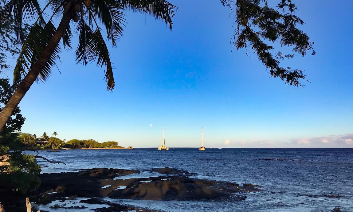
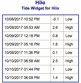
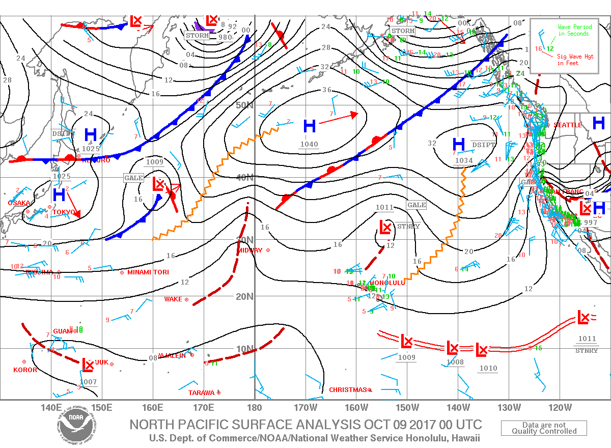
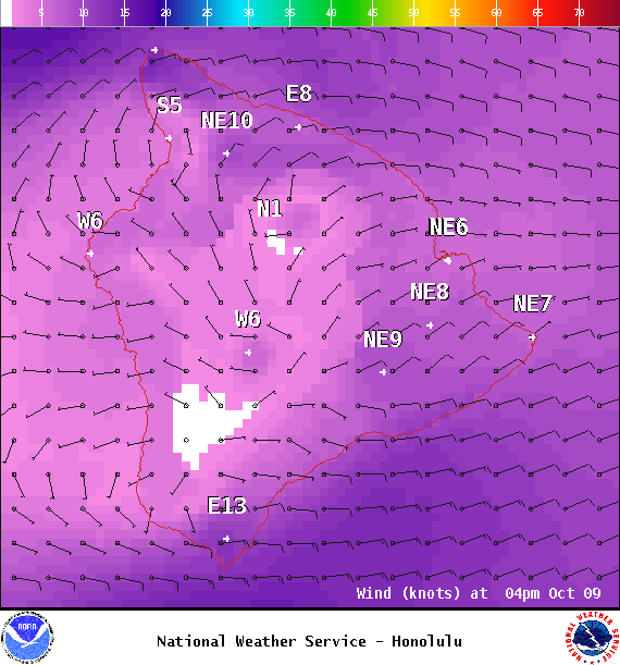
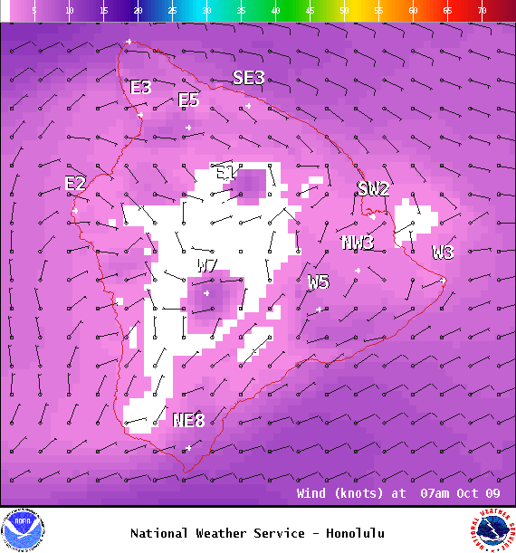
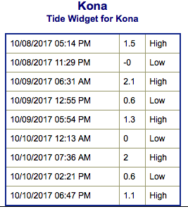
**Click directly on the images below to make them larger. Charts include: Big Island projected winds, tides, swell direction & period and expected wave heights.**
+
SWIPE LEFT OR RIGHT
ARTICLE CONTINUES BELOW AD
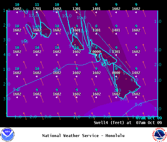
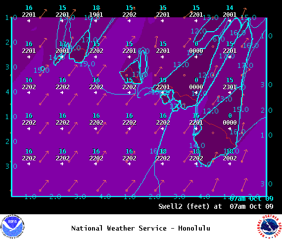
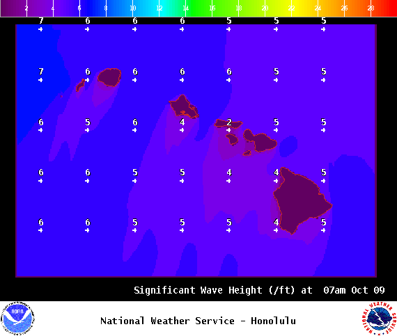
Big Island Surf Forecast
Hilo side: Surf heights are expected to be chest/head high today. The best exposures could get up to a bit overhead on the sets.
Kona side: Surf heights are expected to be waist high or less today. Exposures not open to the swell will be flat.
ARTICLE CONTINUES BELOW AD
South: Surf heights are expected to be waist high or less today.
A High Surf Advisory remains in effect for the east facing shores through early Monday morning. Northerly surf should trend down Monday.
A mix of south-southeast and southwest swells will keep surf from going flat along south- facing shores through early next week.
Keep in mind, surf heights are measured on the face of the wave from trough to crest. Heights vary from beach to beach, and at the same beach, from break to break.
**Click here for your detailed Big Island weather report.**
This comments section is a public community forum for the purpose of free expression. Although Big Island Now encourages respectful communication only, some content may be considered offensive. Please view at your own discretion. View Comments