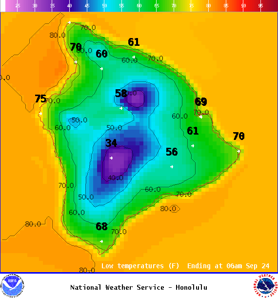
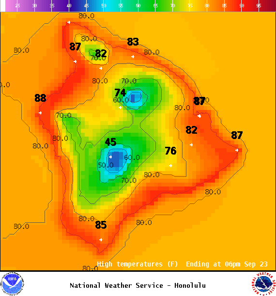
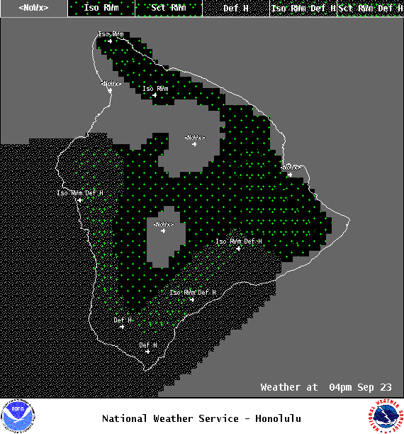
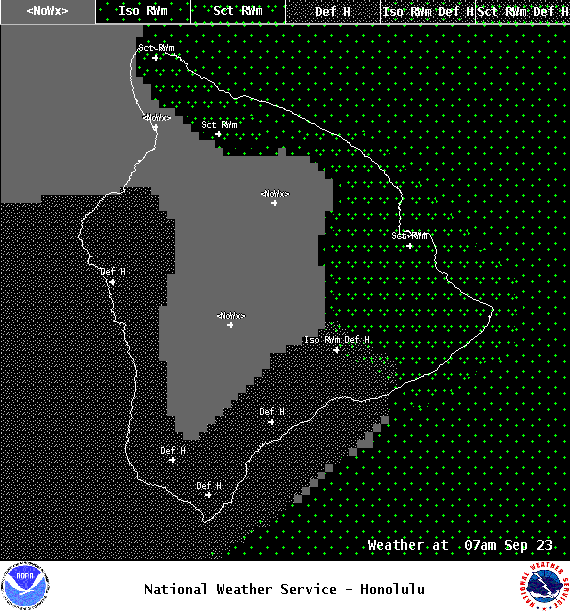
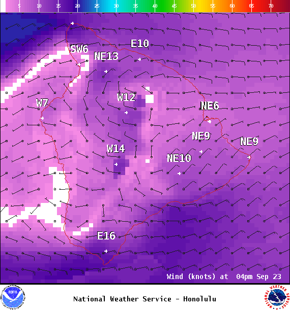
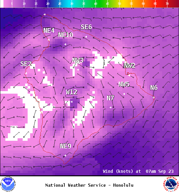
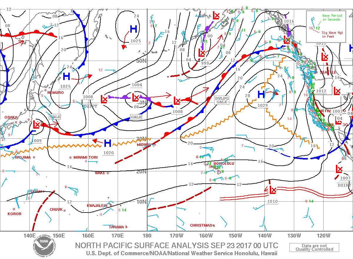
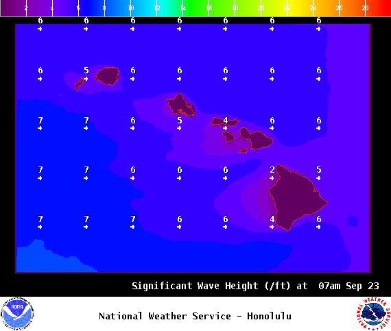
**Click directly on the images below to make them larger. Charts include: Big Island high/low forecasted temperatures, projected winds, chance of cloud cover, projected localized weather conditions, vog/SO2 forecast and expected wave heights.**
+
SWIPE LEFT OR RIGHT
ARTICLE CONTINUES BELOW AD
ARTICLE CONTINUES BELOW AD
Looking Ahead
Trade winds are forecast to gradually weaken over the weekend with mainly windward clouds and light passing showers expected into early next week. A possible boost in shower activity around the middle of next week is possible.
ARTICLE CONTINUES BELOW AD
Today & Sunday
We expect east winds around 10 to 15 mph. Partly cloudy skies in windward spots with scattered showers. Leeward spots should be mostly sunny with isolated afternoon showers. Temperatures up to 84° to 89°.
UV index at 11 (“extreme” exposure level)
ARTICLE CONTINUES BELOW AD
Tonight & Sunday Night
East winds around 10 to 15 mph. Scattered showers in windward spots with clearing skies for the Kona side. Low temperatures from 71° to 76°.
This comments section is a public community forum for the purpose of free expression. Although Big Island Now encourages respectful communication only, some content may be considered offensive. Please view at your own discretion. View Comments