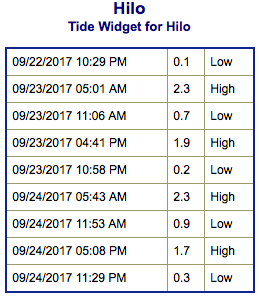
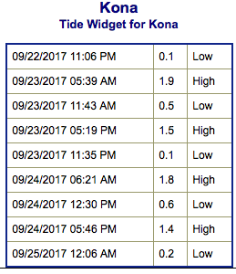
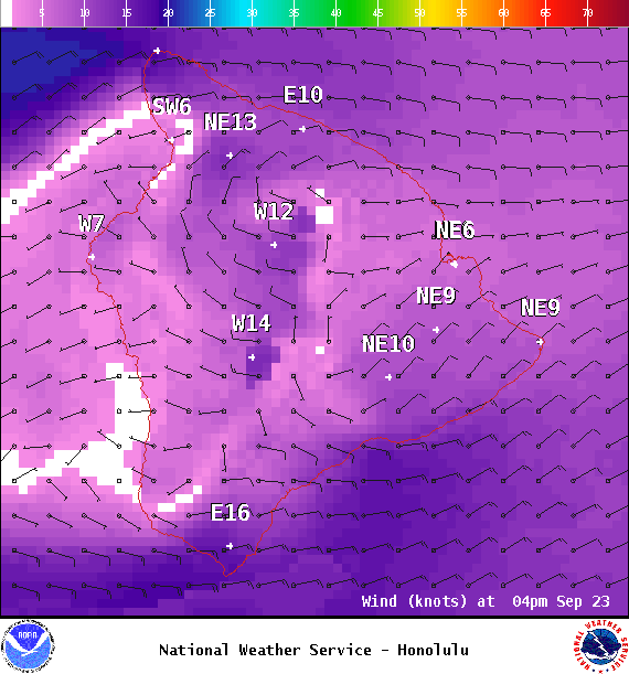
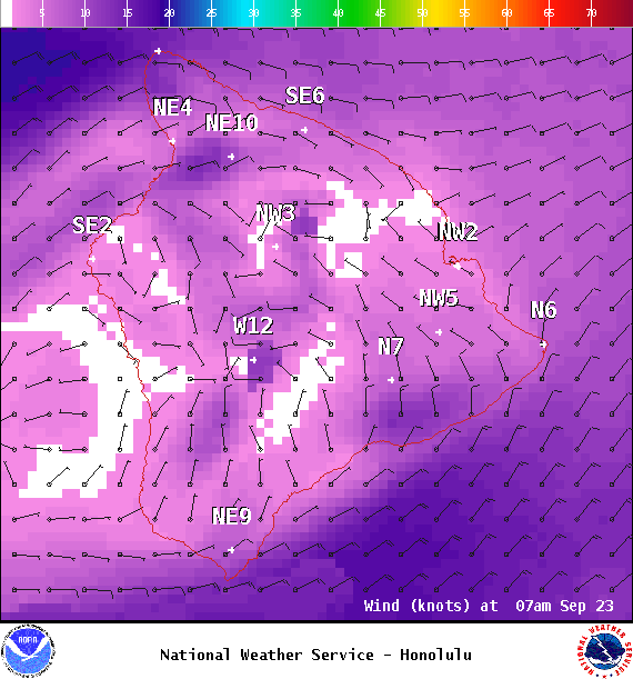
**Click directly on the images below to make them larger. Charts include: Big Island projected winds, tides, swell direction & period and expected wave heights.**
ARTICLE CONTINUES BELOW AD
ARTICLE CONTINUES BELOW AD
+
SWIPE LEFT OR RIGHT
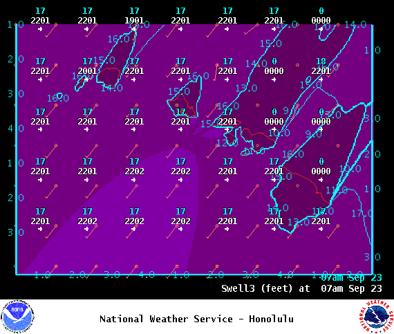
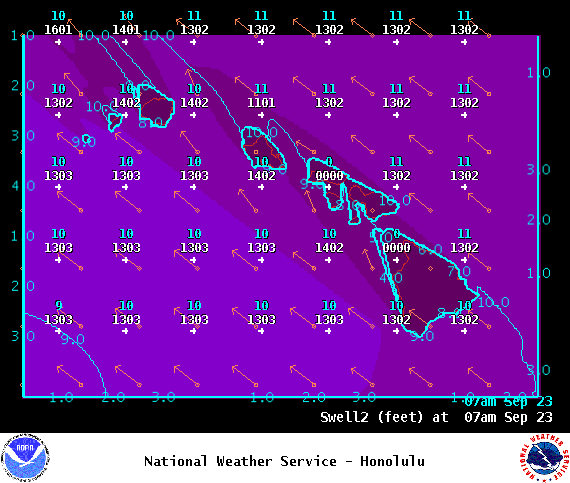
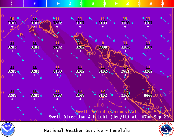
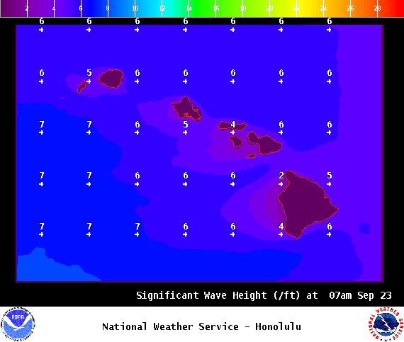
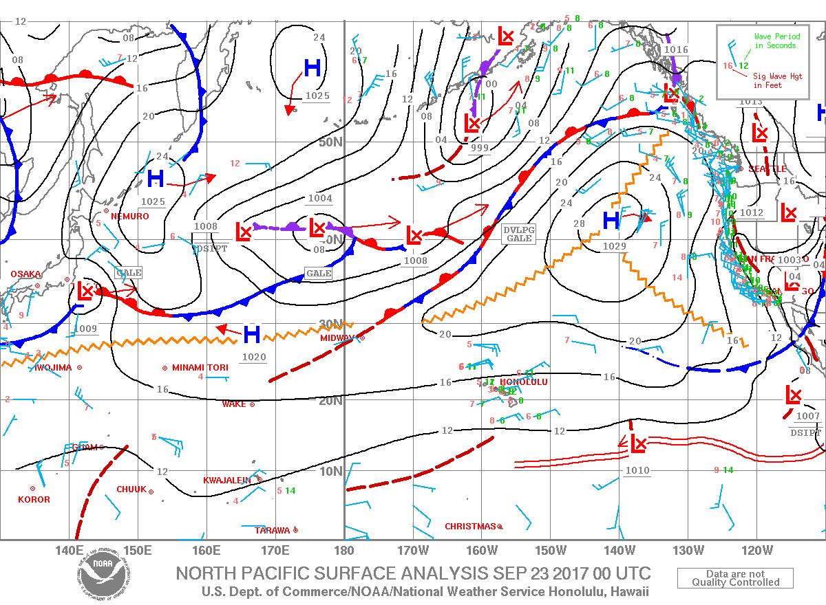
Big Island Surf Forecast
Hilo side: Surf heights are expected to be waist high today out of the northwest. The best exposures could get chest high on the sets.
ARTICLE CONTINUES BELOW AD
Kona side: Surf heights are expected to be up to be pretty flat today.
South: Surf heights are expected to be up to knee high or less today.
Nothing significant is on the radar for southerly exposures at this time.
Our current northwest swell is forecast to slowly ease into the weekend. We could see some other swells developing from some storms in the northwest Pacific. Will keep an eye on it.
ARTICLE CONTINUES BELOW AD
Over the weekend the trade swell is forecast to drop as winds weaken.
Keep in mind, surf heights are measured on the face of the wave from trough to crest. Heights vary from beach to beach, and at the same beach, from break to break.
This comments section is a public community forum for the purpose of free expression. Although Big Island Now encourages respectful communication only, some content may be considered offensive. Please view at your own discretion. View Comments