Small Craft Advisory: In place through 6 p.m. Friday.
Special Weather Statement: Coastal flooding associated with spring tides (King tides) is possible over the next couple of days. The greatest potential for flooding is midday and in the mid to late afternoon hours of Friday into early next week.
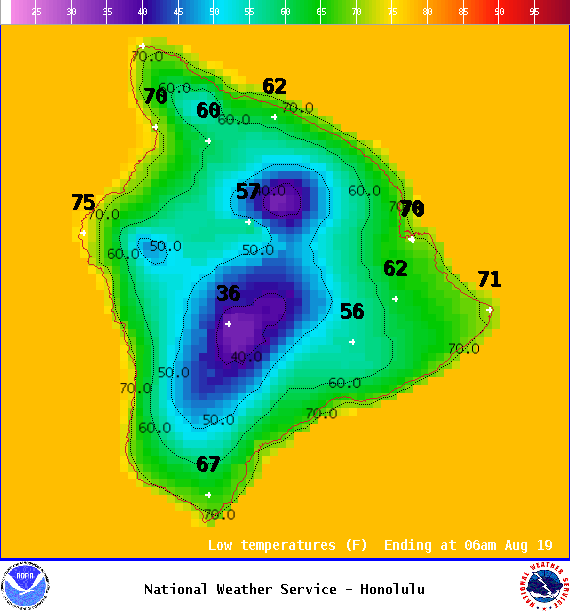
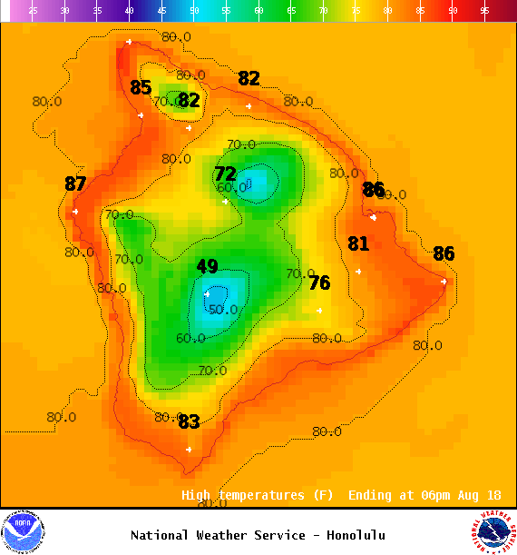
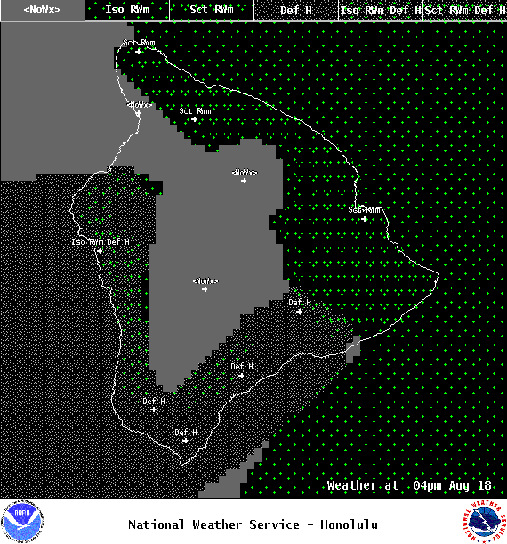
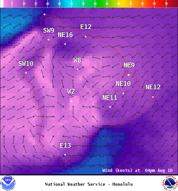
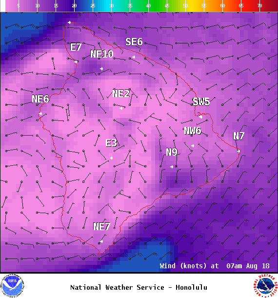
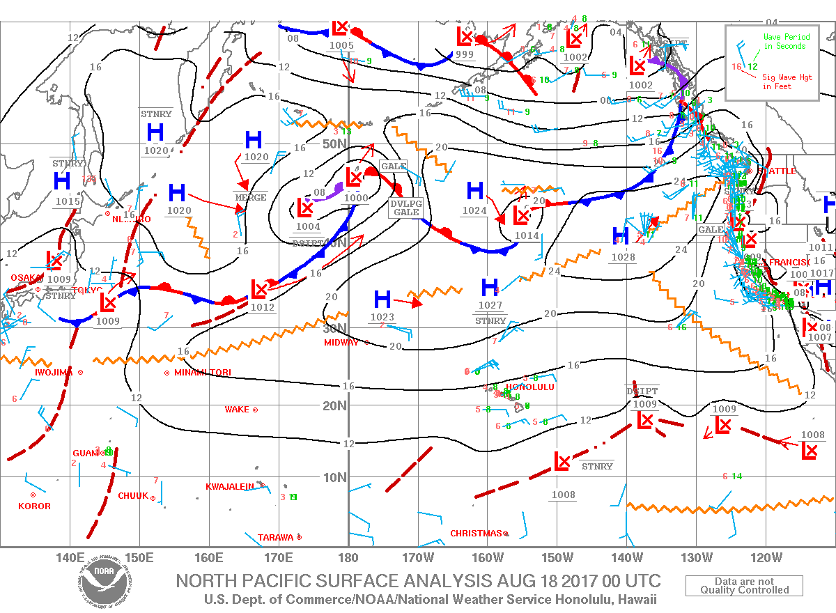
**Click directly on the images below to make them larger. Charts include: Big Island high/low forecasted temperatures, projected winds, chance of cloud cover, projected localized weather conditions, vog/SO2 forecast and expected wave heights.**
+
SWIPE LEFT OR RIGHT
Looking Ahead
Winds are forecast to gradually weaken and become light to moderate this weekend. Clouds and showers will favor our usual windward and mauka spots mainly in the morning and evening hours. An increase in trade wind showers is possible early next week, with potential for a few afternoon leeward showers as winds diminish.
ARTICLE CONTINUES BELOW AD
Today
We expect northeast winds around 10 to 20 mph. High temperatures are forecast from 84° to 89°. Partly to mostly cloudy skies with showers likely for windward spots in the morning and isolated afternoon showers forecast for the Kona side.
UV index at 12 (“extreme” exposure level)
ARTICLE CONTINUES BELOW AD
Tonight
Northeast winds are forecast up to 10 to 20 mph. Partly to mostly cloudy skies with showers likely for windward spots and isolated evening showers for leeward areas, then clearing. Low temperatures from 71° to 76°.
This comments section is a public community forum for the purpose of free expression. Although Big Island Now encourages respectful communication only, some content may be considered offensive. Please view at your own discretion. View Comments