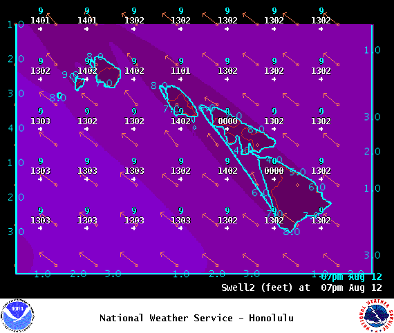
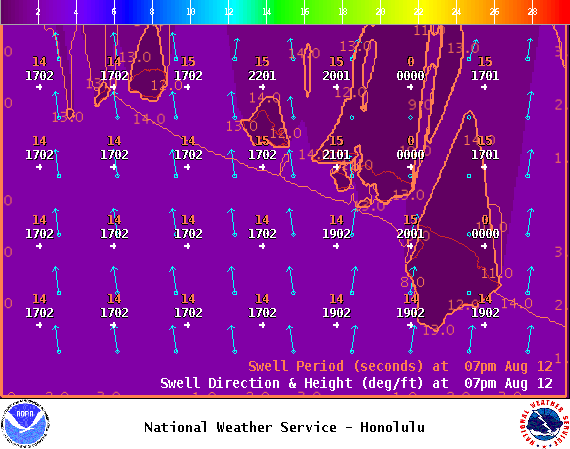
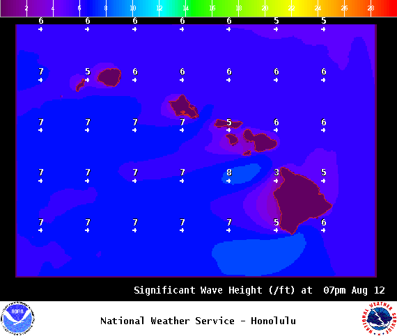
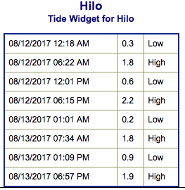
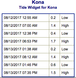
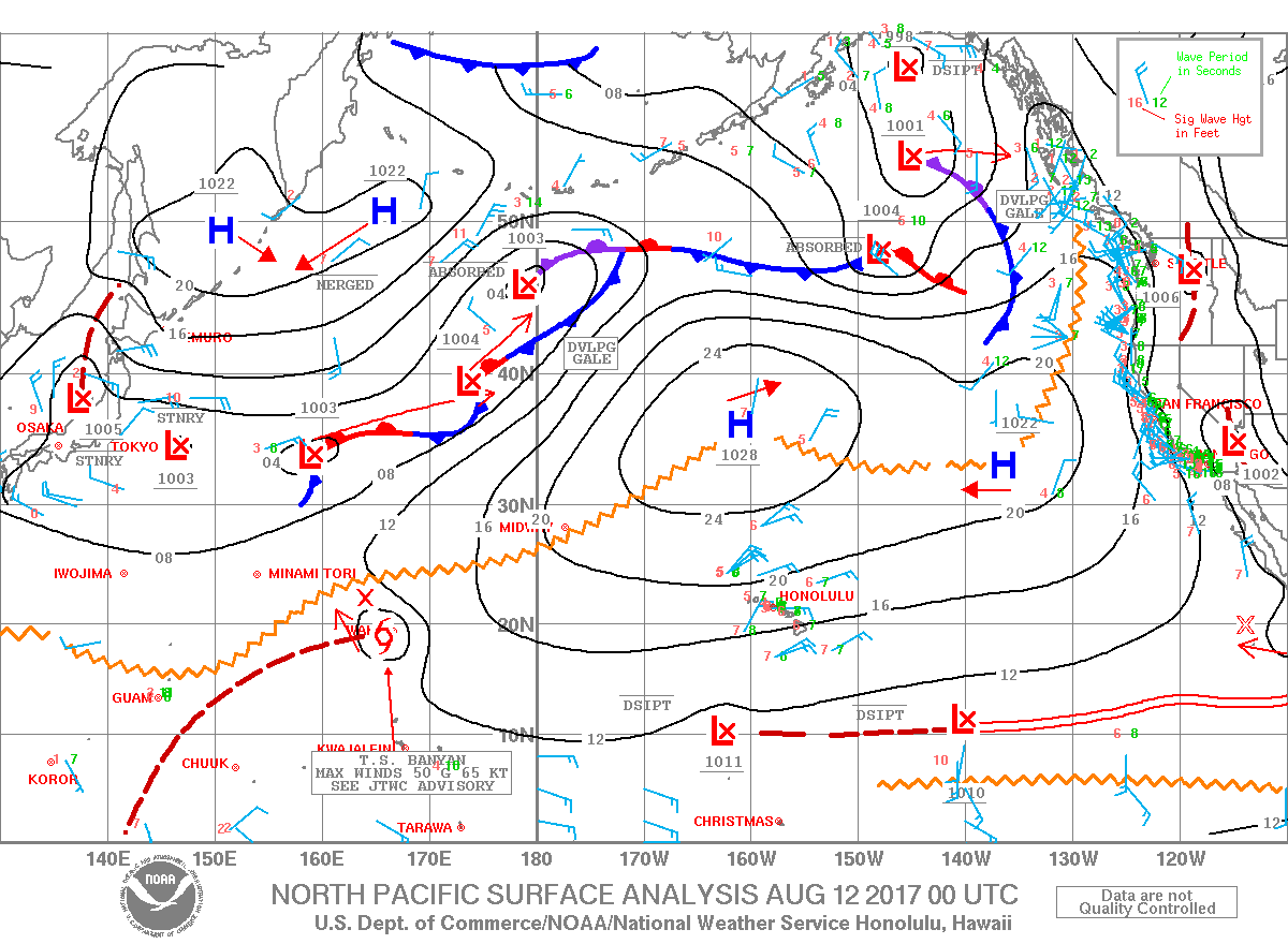
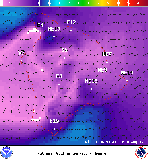
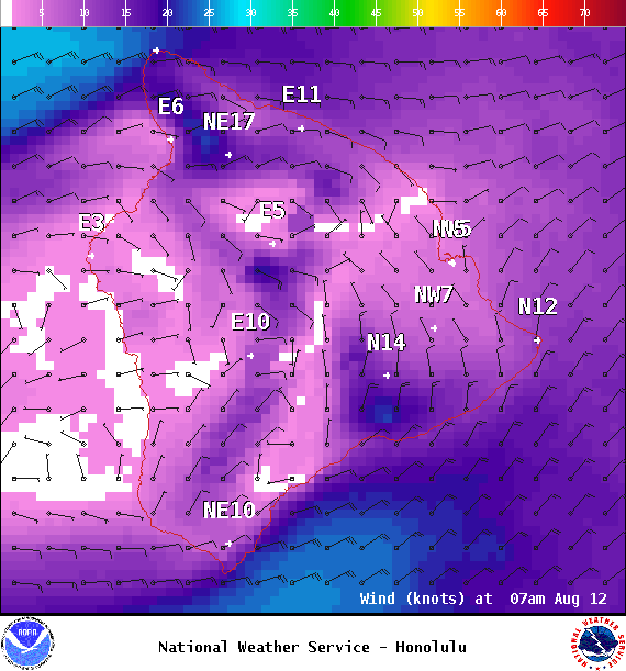
**Click directly on the images below to make them larger. Charts include: Big Island projected winds, tides, swell direction & period and expected wave heights.**
+
SWIPE LEFT OR RIGHT
ARTICLE CONTINUES BELOW AD
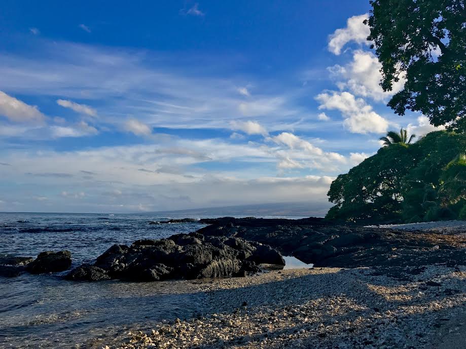
Big Island Surf Forecast
Hilo side: Surf heights are expected to be waist/chest/shoulder high today and begins easing Sunday.
Kona side: Surf heights are expected to be knee/thigh high today.
ARTICLE CONTINUES BELOW AD
South: Surf heights are expected to be chest/shoulder high today.
Trade swell is hanging around waist/shoulder high on Saturday. Sunday winds begin to ease a bit and so will the swell. Keep in mind the conditions will be pretty messy with onshore winds.
We expect to see a boost out of the south for the weekend with another boost of swell energy expected around the 15th. Another swell is expected around the 17th.
Keep in mind, surf heights are measured on the face of the wave from trough to crest. Heights vary from beach to beach, and at the same beach, from break to break.
This comments section is a public community forum for the purpose of free expression. Although Big Island Now encourages respectful communication only, some content may be considered offensive. Please view at your own discretion. View Comments