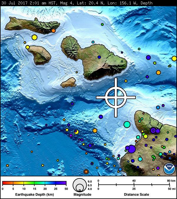
The U.S. Geological Survey’s Hawaiian Volcano Observatory (HVO) recorded a magnitude-4.2 earthquake in the ‘Alenuihāhā Channel between the Islands of Maui and Hawaiʻi on Sunday, July 30, 2017, at 2:01 a.m. HST.
The earthquake was located 16 miles southeast of Kaupō, Maui, and 21 miles northwest of Hāwī on the Big Island at a depth of 11 miles.
The USGS Did you feel it? website received almost 100 felt reports within an hour of the earthquake.
The maximum intensity of shaking reported by residents on the islands of Hawaiʻi Island, Maui, Moloka‘i, and O‘ahu and computed by the USGS ShakeMap was III on the Modified Mercalli Intensity Scale, indicating light shaking.
ARTICLE CONTINUES BELOW AD
ARTICLE CONTINUES BELOW AD
According to HVO Seismic Network Manager Brian Shiro, the earthquake was likely due to bending of the oceanic plate from the weight of the island and poses no significant hazard.
The Pacific Tsunami Warning Center reported that no tsunami was generated by the earthquake, which also had no apparent effect on Kīlauea Volcano’s ongoing eruptions.
For more information on recent earthquakes in Hawaii and eruption updates, visit the Hawaiian Volcano Observatory website.
This comments section is a public community forum for the purpose of free expression. Although Big Island Now encourages respectful communication only, some content may be considered offensive. Please view at your own discretion. View Comments


 The U.S. Geological Survey’s Hawaiian Volcano Observatory (HVO) recorded a magnitude-4.2 earthquake in the ‘Alenuihāhā Channel between the Islands of Maui and Hawaiʻi on Sunday, July 30, 2017, at 2:01 a.m. HST.


