**Click directly on the images below to make them larger. Charts include: Big Island projected winds, tides, swell direction & period and expected wave heights.**
ARTICLE CONTINUES BELOW AD
ARTICLE CONTINUES BELOW AD
+
SWIPE LEFT OR RIGHT
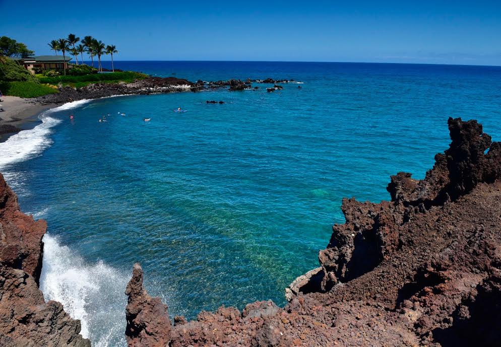
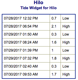
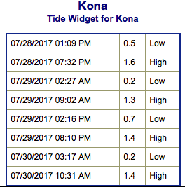
Big Island Surf Forecast
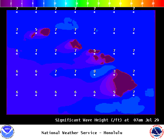
Hilo side: Surf heights are expected to be waist/head high today.
ARTICLE CONTINUES BELOW AD
Kona side: Wave heights are expected to be ankle/waist high today. Some spots will be flat.
South: Wave heights are expected to be ankle/waist high today. Some spots will be flat.
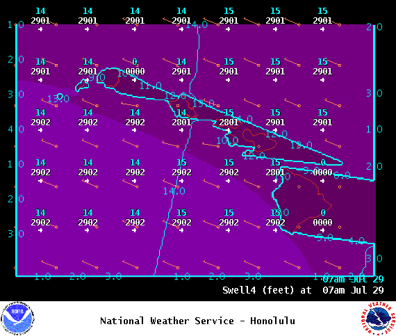
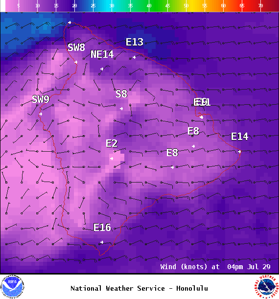
Trade wind swell is forecast to keep moderate choppy surf along east facing shores into early next week. Models are also showing east swells generated by East Pacific tropical cyclones Irwin and Hillary reaching the islands starting this weekend. It’s possible trade swell combined with tropical swell could get above advisory levels. Will keep an eye on it.
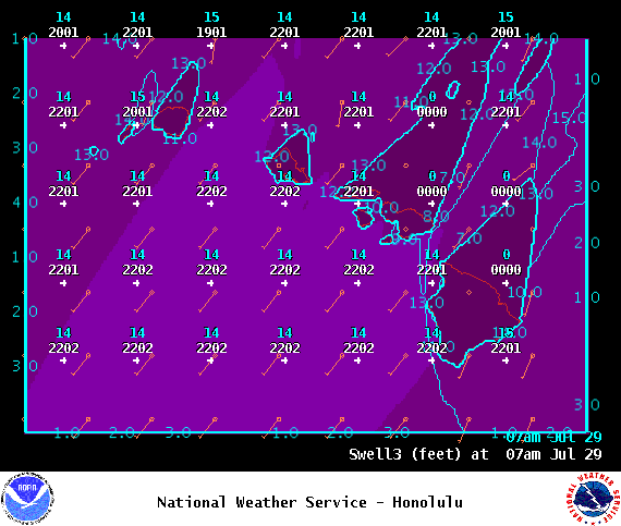
A small west swell generated by a typhoon in the West Pacific is filling in for the weekend. Some west facing spots could see a small pulse. Niihau and Kauai are expected to block much of this energy from reaching west facing shores of the other islands.
ARTICLE CONTINUES BELOW AD
A series of small southerly swells will bring small background surf for most south facing shores through the middle of next week. August 5th a larger swell is expected.
Keep in mind, surf heights are measured on the face of the wave from trough to crest. Heights vary from beach to beach, and at the same beach, from break to break.
This comments section is a public community forum for the purpose of free expression. Although Big Island Now encourages respectful communication only, some content may be considered offensive. Please view at your own discretion. View Comments