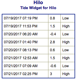
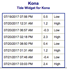
Special Weather Statement: Coastal flooding is possible as spring tides occur. The greatest potential for that will be in the afternoon hours when the tide is expected to be the highest. This coupled with Fernanda swell could lead to higher than usual run-up. This could last for the next few days.
High Surf Advisory: East facing shores of the Big Island and Maui through 6 p.m. Thursday.
Small Craft Advisory: East to northeast winds up to 25 knots through 6:00 a.m. Friday.
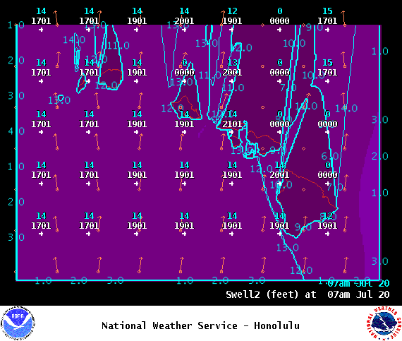
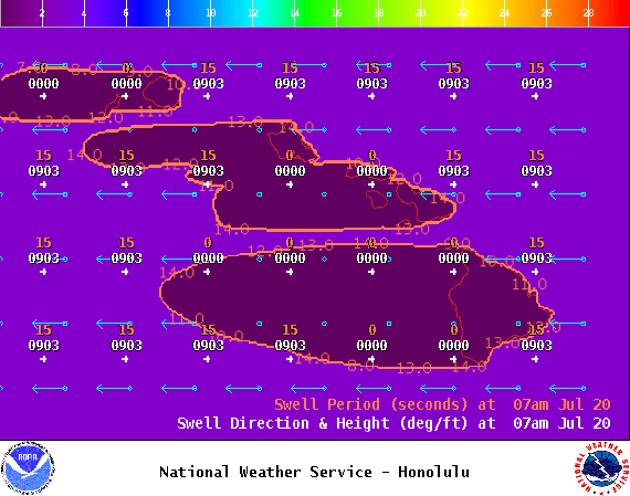
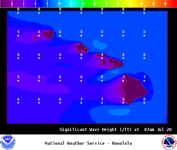
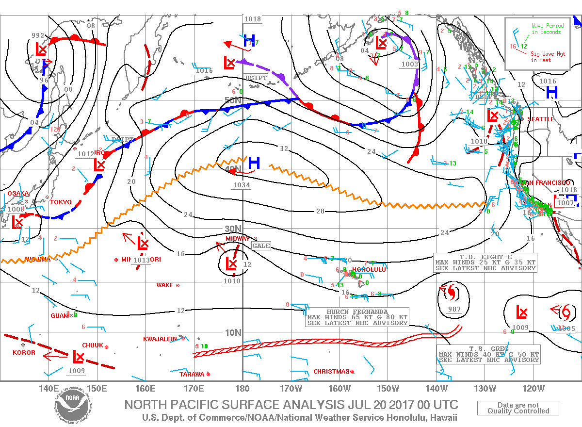
**Click directly on the images below to make them larger. Charts include: Big Island projected winds, tides, swell direction & period and expected wave heights.**
+
SWIPE LEFT OR RIGHT
Big Island Surf Forecast
ARTICLE CONTINUES BELOW AD
Hilo side: Surf heights are expected to be waist/head high today. The best breaks could get up to a bit overhead.
Kona side: Wave heights are expected to be knee/thigh high today. Flat for many Kona breaks not catching the swell.
South: Wave heights are expected to be knee/thigh high today.
No significant swells are expected this week from the South Pacific. A series of small south swells is expected to keep background swell going along southern exposures.
ARTICLE CONTINUES BELOW AD
An east swell generated when Fernanda was a major hurricane will continue to affect eastern exposures. A High Surf Advisory is in place for the east facing shores of the Big Island and Maui through tomorrow afternoon. We’ll keep an eye on swells generated by Fernanda as it continues to approach and then pass to the north of the islands. For now, surf is forecast to peak late Sunday to late Monday. In addition to this our spring tides are happening in the afternoon and evenings for the next few days. That coupled with the Fernanda swell could mean coastal flooding for our usual spots.
Keep in mind, surf heights are measured on the face of the wave from trough to crest. Heights vary from beach to beach, and at the same beach, from break to break.
This comments section is a public community forum for the purpose of free expression. Although Big Island Now encourages respectful communication only, some content may be considered offensive. Please view at your own discretion. View Comments


 Alerts (as of 1:00 a.m.)