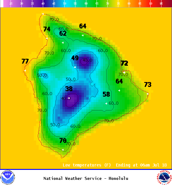
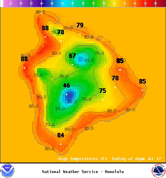
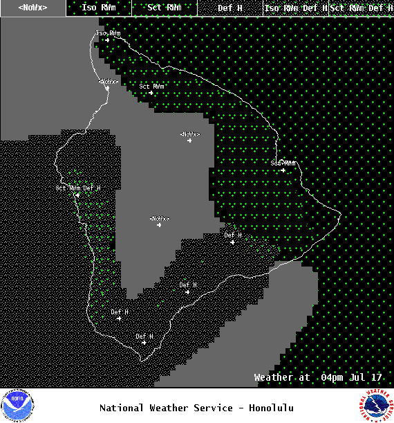
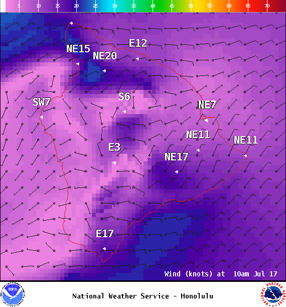
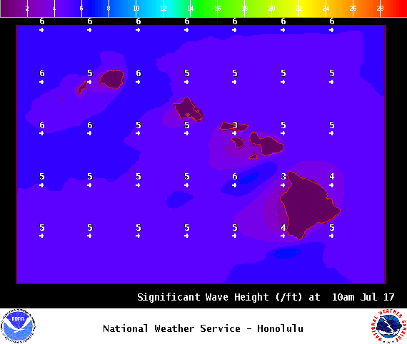
**Click directly on the images below to make them larger. Charts include: Big Island high/low forecasted temperatures, projected winds, chance of cloud cover, projected localized weather conditions, vog/SO2 forecast and expected wave heights.**
+
SWIPE LEFT OR RIGHT
ARTICLE CONTINUES BELOW AD
ARTICLE CONTINUES BELOW AD
Looking Ahead
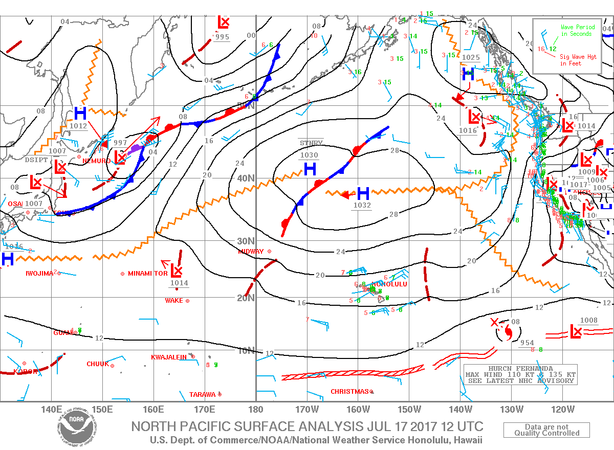
Breezy trades winds are forecast through the work week with clouds and showers favoriting our usual windward and mauka spots, mainly overnight. Total rainfall totals are expected to be light this week. The National Hurricane Center is tracking Hurricane Fernanda far east southeast of Hawaii and moving towards the west. It is too soon to determine what the direct impacts to the state will be at this time. However, an increase in surf is expected Tuesday and a general increase in moisture is possible next weekend.
ARTICLE CONTINUES BELOW AD
Today
We expect east winds around 5 to 20 mph. High temperatures are forecast from 84° to 89°. Partly cloudy skies with scattered showers for the Hilo side. Sunny skies in the morning for Kona with afternoon isolated showers.
UV index at 12 (“extreme” exposure level)
ARTICLE CONTINUES BELOW AD
Tonight
East winds are forecast around 5 to 20 mph. Mostly cloudy skies with showers likely in windward spots, clearing skies for leeward spots. Low temperatures from 73° to 78°.
This comments section is a public community forum for the purpose of free expression. Although Big Island Now encourages respectful communication only, some content may be considered offensive. Please view at your own discretion. View Comments