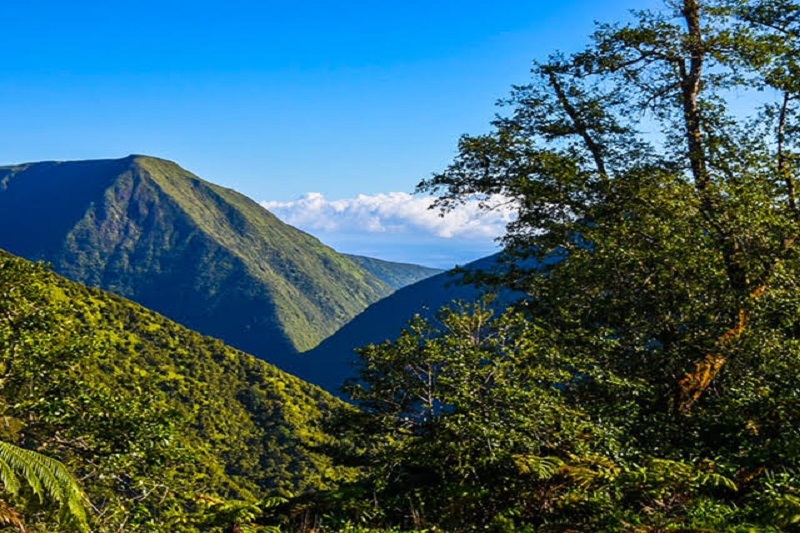
The Stewardship Mapping and Assessment Project (STEW-MAP) seeks bring group North Kona and South Kohala cultural and natural resources care efforts to light by acknowledging and promoting the work done by these numerous citizen groups.
Many citizen groups care for North Kona and South Kohala cultural and natural resources, and their social networks are crucial to the health and well-being of local communities. However, their activities are not always known or easily understood.
STEW-MAP seeks to change that.
ARTICLE CONTINUES BELOW AD
ARTICLE CONTINUES BELOW AD
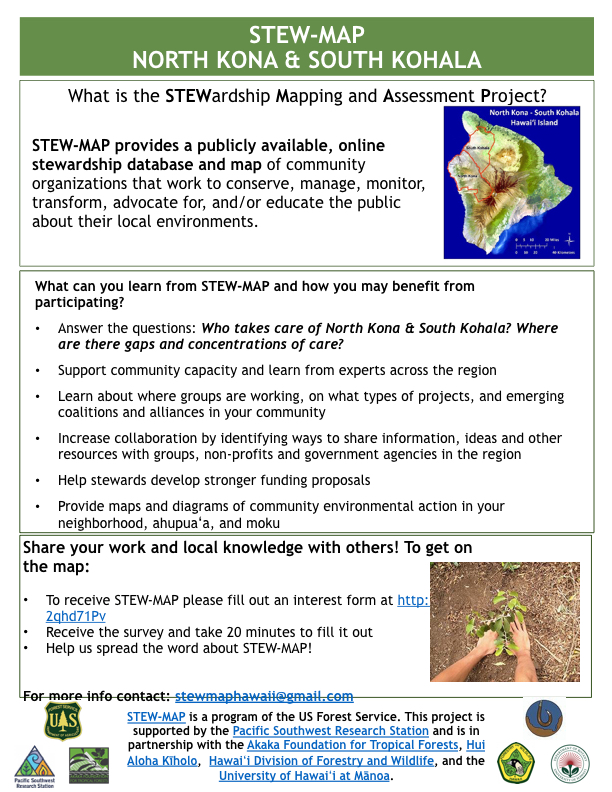
Sponsored by the USDA Forest Service, STEW-MAP features a mapping tool to understand where and how groups and organizations conduct or lead stewardship activities. The data provides information for recognizing and strengthening a community’s capacity to care for its unique lands and waters.
The North Kona-South Kohala STEW-MAP effort is the first in Hawaiʻi with a second STEW-MAP project planned for Honolulu.
ARTICLE CONTINUES BELOW AD
STEW-MAP Hawai‘i encourages local groups and organizations to get involved. The project works by engaging the many groups that conserve, manage, monitor, transform, educate and advocate for freshwater, marine, land, air, waste, food and energy issues.
Groups are invited to share information about themselves and their projects and the areas where they work. Using the STEW-MAP tool, the information is then integrated into a project database and subsequently used to create a publicly accessible online map and group database.
Once populated, the STEW-MAP database can illustrate the many ways community groups care for their natural and cultural resources. The tool can serve as a resource for community groups and partner agencies to effectively communicate and collaborate with each other and can lead to a better understanding and support of the role played by each group. It will also provide a means to identify opportunities for supporting and enhancing the capacities of community stewards.
ARTICLE CONTINUES BELOW AD
Groups working in North Kona and South Kohala are encouraged to get involved. To get your group on the map, email [email protected] or go online to sign up and have a survey sent to you. More information can be found at https://adobe.ly/2qcxTn8.
STEM-MAP was launched in New York City 10 years ago and has since been used in Chicago, Seattle, Philadelphia and Los Angeles; as well as in France, Colombia and China.
About STEW-MAP in Hawai‘i STEW-MAP is a project of the US Forest Service. It is supported by the Pacific Southwest Research Station in partnership with the Akaka Foundation for Tropical Forests, Hui Aloha Kīholo, the Hawaiʻi Division of Forestry and Wildlife and the University of Hawaiʻi at Mānoa.
This comments section is a public community forum for the purpose of free expression. Although Big Island Now encourages respectful communication only, some content may be considered offensive. Please view at your own discretion. View Comments