

Paradise Lost?
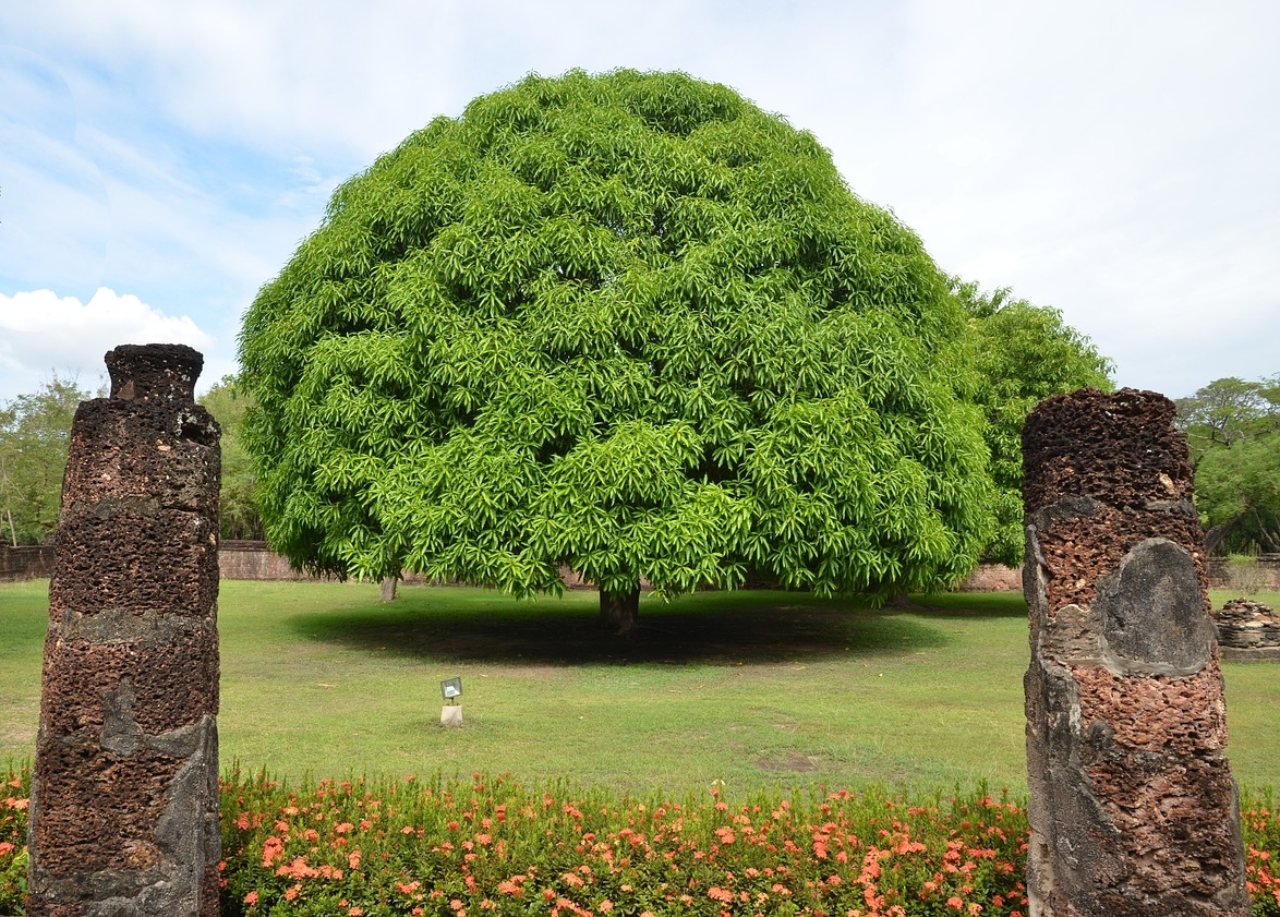
Mango tree with the two posts from the old mill… Big Island Now stock photo.
“Aloha! I am a visitor here to your Big Island. Could you tell me how to get to the Laulau Cafe?”
Ok, sure. Go toward Hilo Town until you cross the turn bridge.
Then go mauka when you see two, big avocado trees.
Follow that road until you come to the white fence with the bus’-up truck in the front.
Keep going past the fence and take a left where the old Suda Store used to be.
ARTICLE CONTINUES BELOW ADARTICLE CONTINUES BELOW ADThen turn left on the dirt road that goes to the big mango tree with the two old mill posts in front.
When you see the tree, go past it, then makai on the second gravel road.
Right there, you goin’ see Laulau Cafe. It’s so ono!
This might be the typical type of reply you’d receive when asking a local person directions—not exactly what you’d expect from your Siri navigation app.
While this type of directions is viewed as a hysterical joke in island locals and long-time kama‘āina, visitors and new residents who are used to street names and addresses might be at a loss—as well as lost—trying to follow Hawaiian-style directions.
But here in the islands, landmark directions are still the most popular method used.
Visitors and new residents might also find it strange that most locals are not even familiar with the street names in the very towns where they grew up and still reside.
So, where did this practice come from? And why mauka and makai instead of simply using N, S, E and W?
In ancient times, the ruling ali‘i (kings) divided the islands into ahupua‘a—pie-shaped pieces of land that ran from the mountains (mauka) to the ocean (makai).
This allowed all communities to have access to all the natural resources needed to sustain their individual communities.
Most roads in Hawai‘i run along the coastline on the islands, so the terms mauka and makai seem to work better than left or right because no matter which way you came from, mauka will always be towards the mountain and makai will always be towards the ocean.
This makes perfect sense for an island community.
And this is likely how landmark directions evolved…
Sugar plantation owners used landmark directions when they began building housing for their immigrant workers. Housing was built in what was known as camps. Each camp started out in the middle of a cane field somewhere and was built for specific groups of immigrants—Japanese camp, Puerto Rican camp, Filipino camp, etc.
As time went by and there were marriages between different ethnic groups, the camps simply blended and became known mostly by the area in which they were located—Haina Camp, Waipunalei Camp, Halaula Camp, etc.
There were never street names within the camps.
But now, with the help of modern GPS technology, Google Maps or other map apps readily available, it is more common to hear locals use street names in directions.
Navigation apps may or may not be more accurate… but Siri will never be more colorful and descriptive than local-style directions that incorporate the history and culture of Hawai‘i.


Sponsored Content

