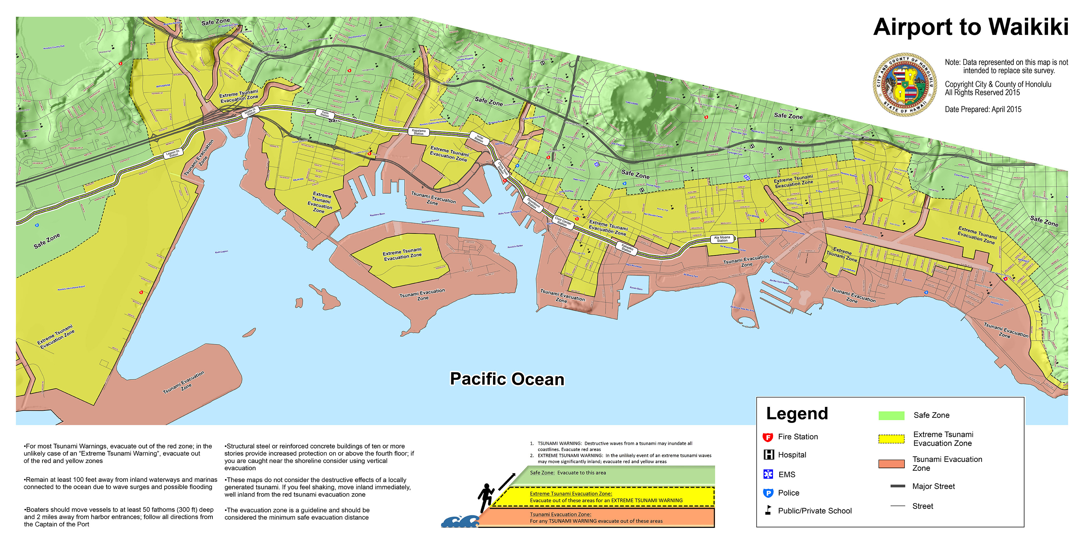
Tsunami evacuation zone/rail route map. City and County of Honolulu map.
This map of the last segment of the Honolulu Authority for Rapid Transportation rail project shows that almost all of it is in very low sea level areas—meaning massive future loss of critical infrastructure and also loss of lives, property, jobs, income and likely lawsuits.
The City Rail and Transit Oriented Development “planners” absolutely refuse to consider any of this in their rail route planning—the actual fraudulence and malfeasance of placing city and federal tax dollars in known and identified sea level rise disaster area and shown on city maps and state and federal flood maps as disaster zones.
Hawai‘i is getting a preview of the coming effects of sea level rise through the weekend.
ARTICLE CONTINUES BELOW AD
ARTICLE CONTINUES BELOW AD
The ongoing result of climate change is combining with some of the year’s highest tides
and a south swell to produce what is predicted to be the highest ocean levels in 112 years
of record-keeping. Volunteers for the University of Hawai‘i’s Sea Grant College Program
are taking to the coasts to document the effects.
A group called Citizen Scientists is working with Sea Grant’s Hawaii and Pacific Islands
King Tides Project to take photos of coastlines all over the state to record the effects of
rising sea levels.
Matthew Gonser, an extension agent with Sea Grant College who works with the
volunteers, said this documentation will help make predictions for what the baseline sea
level could look like in the future, among other research endeavors.
This comments section is a public community forum for the purpose of free expression. Although Big Island Now encourages respectful communication only, some content may be considered offensive. Please view at your own discretion. View Comments