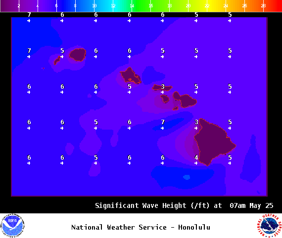
Special Weather Statement: Coastal flooding is anticipated over the next several days along all shores of the Hawaiian Islands due to record level spring (king) tides. Impacts include beach flooding, standing water on roadways and low-lying areas near the coast. A large summer south swell is also filling in Friday and will exacerbate the problem leading to additional beach run up, flooding and erosion.
Small Craft Advisory: ʻAlenuihāhā channel and southeast and leeward Big Island waters through 6 a.m. Thursday.
**Click directly on the images below to make them larger. Charts include: Big Island high/low forecasted temperatures, projected winds, chance of cloud cover, projected localized weather conditions, vog/SO2 forecast and expected wave heights.**
+
SWIPE LEFT OR RIGHT
Looking Ahead
Winds are forecast to slowly weaken through the end of the work week with light and variable winds expected for the Memorial Day weekend. This means muggy, hot conditions with the possibility of haze. Afternoon sea breezes could lead to building cloud cover and some showers. As a weak upper level disturbance passed over the state this weekend some of those showers could get heavy over leeward and interior areas.
ARTICLE CONTINUES BELOW AD
Today
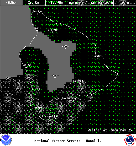
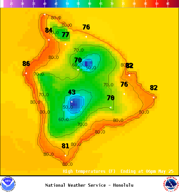
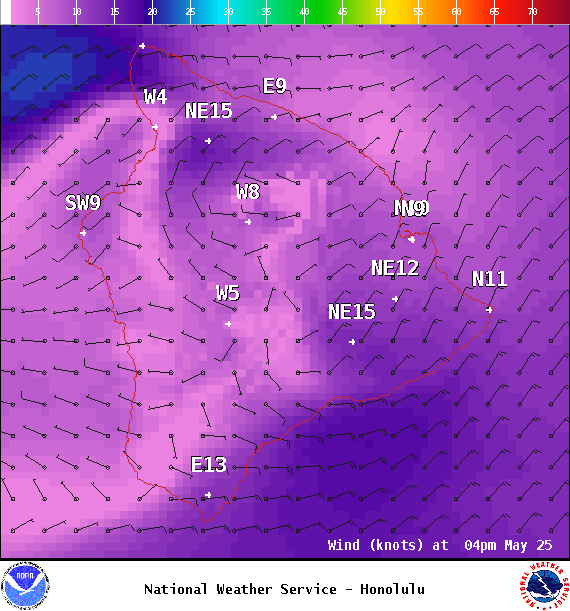
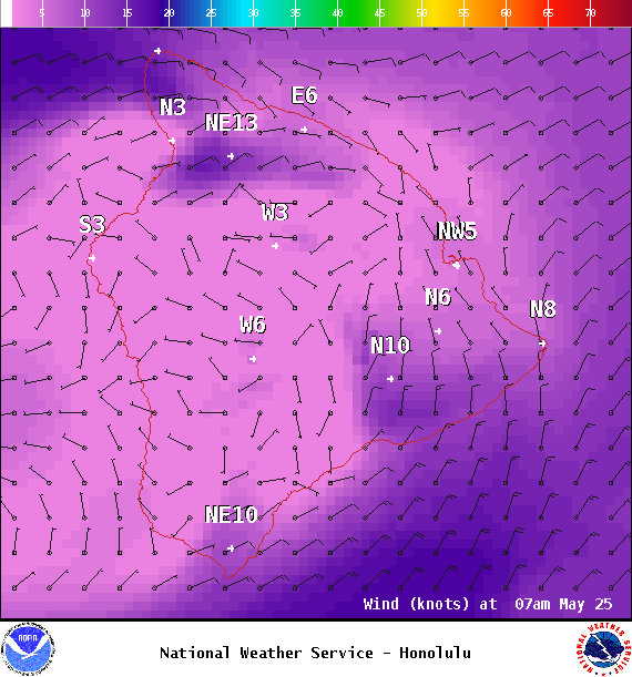
We expect east winds from 5 to 20 mph. High temperatures are forecast from 81° to 86°. Mostly sunny skies in the morning with building clouds in the afternoon and a isolated showers for the Kona side with some haze. Partly to mostly cloudy with scattered showers for windward spots.
UV index at 11 (“extreme” exposure level)
ARTICLE CONTINUES BELOW AD
Tonight
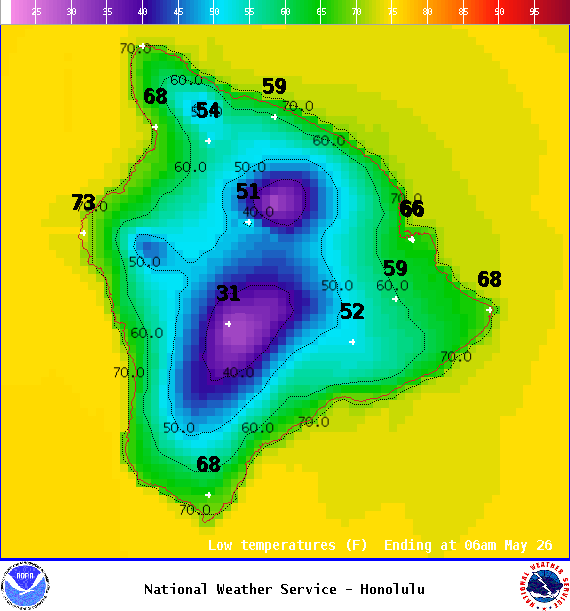
East winds are forecast from 5 to 20 mph. Mostly cloudy skies with scattered showers for windward spots overnight and clearing for the Kona side as the night goes on. Low temperatures from 68° to 73°.
This comments section is a public community forum for the purpose of free expression. Although Big Island Now encourages respectful communication only, some content may be considered offensive. Please view at your own discretion. View Comments