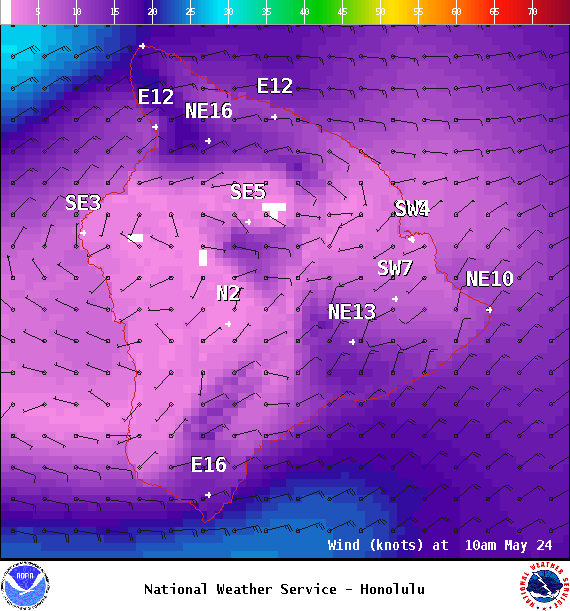
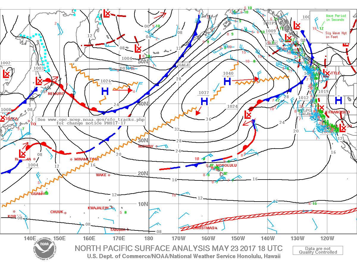
**Click directly on the images below to make them larger. Charts include: Big Island high/low forecasted temperatures, projected winds, chance of cloud cover, projected localized weather conditions, vog/SO2 forecast and expected wave heights.**
+
SWIPE LEFT OR RIGHT
ARTICLE CONTINUES BELOW AD
ARTICLE CONTINUES BELOW AD
Looking Ahead
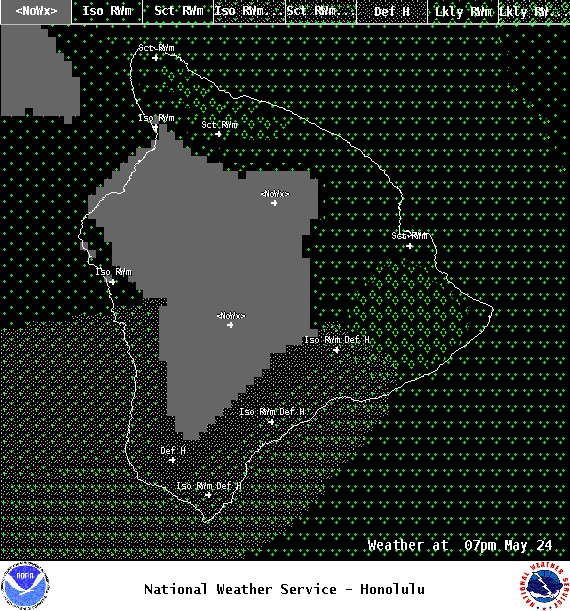
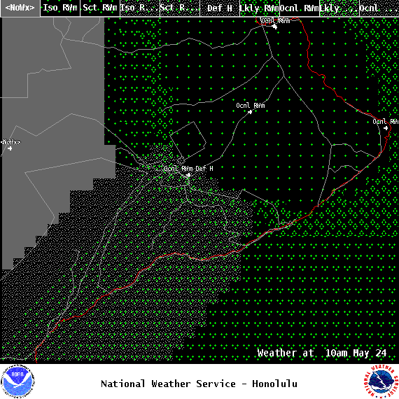
Wet trade wind weather pattern expected through the day Wednesday with showers in windward and mauka spots. Winds are forecast to gradually weaken through the second half of the work week with light and variable winds expected through Memorial Day weekend. Daytime sea breezes and nighttime land breezes are forecast to take over during that time to bring warm and humid weather with some volcanic haze as well. An upper level disturbance will pass over the state this weekend and could enhance afternoon showers as well.
ARTICLE CONTINUES BELOW AD
Today
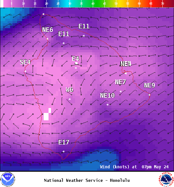
We expect east winds from 15 to 20 mph. High temperatures are forecast from 81° to 86°. Mostly sunny skies in the morning with building clouds in the afternoon and a isolated showers for the Kona side with some haze. Partly to mostly cloudy with scattered showers for windward spots.
UV index at 11 (“extreme” exposure level)
ARTICLE CONTINUES BELOW AD
Tonight
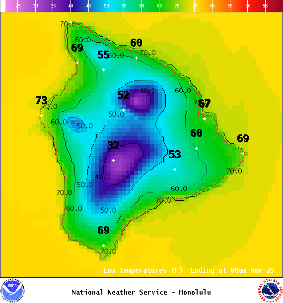
East winds are forecast from 15 to 20 mph. Mostly cloudy skies with scattered showers for windward spots overnight and clearing for the Kona side as the night goes on. Low temperatures from 68° to 73°.
This comments section is a public community forum for the purpose of free expression. Although Big Island Now encourages respectful communication only, some content may be considered offensive. Please view at your own discretion. View Comments