Ka Lae, translated into English to mean “the point,” is known as the southernmost point on the island of Hawai’i and is more commonly referred to as, South Point.
While it is a common misconception to think that Key West, Florida, is the southernmost point in the United States, the actual honor goes to Ka Lae, as it is geographically the southernmost point of the entire 50 states.
+
SWIPE LEFT OR RIGHT
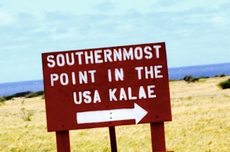
Sign at the fork in the road points you towards Ka Lae. PC: Darde Gamayo
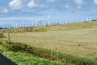
Windmills on way to Ka Lae. PC: Darde Gamayo
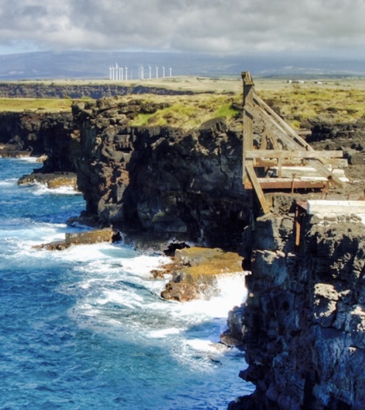
Ka Lae western cliffs with rough seas below. PC: Darde Gamayo
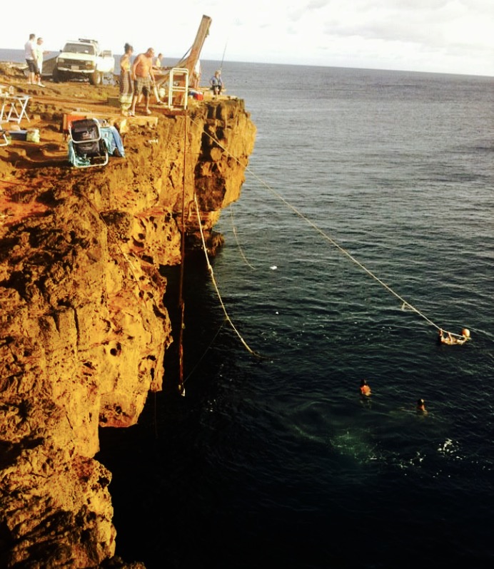
Locals hanging out while their more adventurous friends jump into the ocean from a 40-foot cliff. PC: Darde Gamayo
This area is thought to be the location where the first Polynesians landed as they crossed the ocean on their voyage from Tahiti. This fact is supported as it’s the closest land mass to the island of Tahiti and it also has one of the oldest archaeological records in the island chain.
This fact is supported, as it’s the closest land mass to the island of Tahiti and it also has one of the oldest archaeological records in the island chain.
ARTICLE CONTINUES BELOW AD
ARTICLE CONTINUES BELOW AD
In 1960, anthropologists from the Bishop Museum excavated the area and found significant evidence of ancient civilization. Ruins of a heiau and a fishing shrine can still be found here. It is believed that the ancient Hawaiians drilled numerous holes in the rock ledges to help them moor their canoes to the shore using long ropes.
In 1961, Ka Lae was on NASA’s consideration list as a location to launch manned rockets into space, but was later considered too remote of a location. However, it was later used to launch sounding rockets for the Air Force’s Maui Space Surveillance Center.
Today, there is a NOAA Weather Radio transmitter that broadcasts weather reports from the area as well as a weather station that constantly monitors wind speed.
ARTICLE CONTINUES BELOW AD
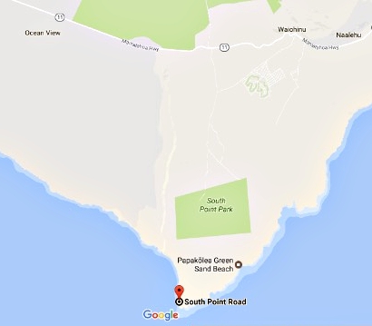
Accessible via South Point Road, the narrowly paved 12-mile road takes you past numerous windmills and the remains of a landing strip and buildings that were once used during World War II, known then as Morse Field, which then leads you right to the ocean.
Many thrill seekers head to the wind protected western side of South Point, as it offers a great spot for cliff jumping. However, it’s not only the 40-foot jump that makes it dangerous, it’s also the strong currents that exist in the area, too. It is worth noting that the water on the Eastern side of the point is frequently rougher than it is calm and is unsuitable for swimming.
While the azure waters offer an attractive spot to snorkel and see tropical fish, there are plenty of other easily accessible spots to snorkel on the island that don’t require you to leap 40 feet into the water. It is always best to err on the side of caution and enjoy the beauty of this area from the top of the jagged rocky cliffs.
ARTICLE CONTINUES BELOW AD
Although off the beaten path, once you arrive here you’ll have to admit that the amazing view on either side of Ka Lae will leave you with memories that you will not soon forget, as well as the right to brag that you stood in the southernmost part of the United States.
This comments section is a public community forum for the purpose of free expression. Although Big Island Now encourages respectful communication only, some content may be considered offensive. Please view at your own discretion. View Comments