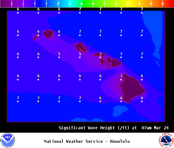
**Click directly on the images below to make them larger. Charts include: Big Island high/low forecasted temperatures, projected winds, chance of cloud cover, projected localized weather conditions, vog/SO2 forecast and expected wave heights.**
+
SWIPE LEFT OR RIGHT
ARTICLE CONTINUES BELOW AD
ARTICLE CONTINUES BELOW AD
Looking Ahead
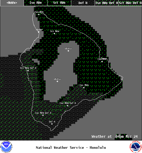
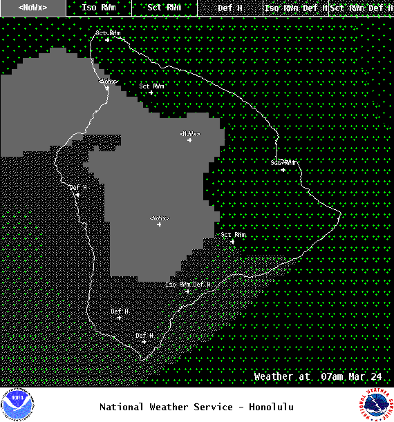
Trade wind weather is forecast through the weekend with windward and mauka showers in the morning and overnight hours. Trade winds should pick up in strength Friday and hold through early next week.
ARTICLE CONTINUES BELOW AD
Today
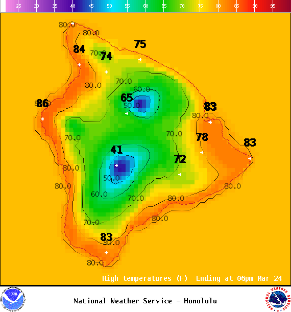
We have east winds today around 15 to 20 mph with higher gusts. High temperatures are forecast from 81° to 86°. Mostly cloudy skies with showers likely in the morning for windward spots and some clearing with scattered showers in the afternoon. The Kona side will be mostly sunny to start with mostly cloudy skies and isolated showers in the afternoon. Locally hazy skies are forecast as well.
UV index at 11 (“extreme” exposure level)
ARTICLE CONTINUES BELOW AD
Tonight
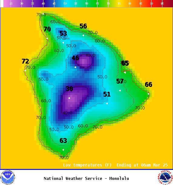
East winds are forecast around 15 mph. Partly cloudy skies are expected for Hawaii County with scattered windward showers and clearing skies for the Kona side overnight. Low temperatures from 69° to 74°.
This comments section is a public community forum for the purpose of free expression. Although Big Island Now encourages respectful communication only, some content may be considered offensive. Please view at your own discretion. View Comments