The U.S. Geological Survey’s Hawaiian Volcano Observatory recorded a magnitude-4.4 earthquake located beneath Kīlauea Volcano’s south flank on Thursday, March 23, at 10:27 a.m.
According to the Pacific Tsunami Warning Center, there is no tsunami threat from this earthquake.
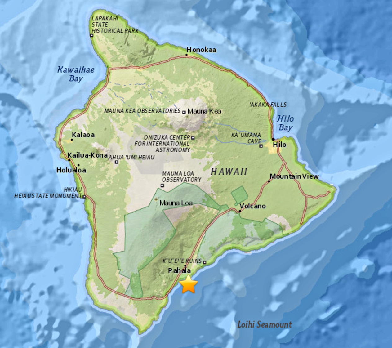
The earthquake, which was widely felt on Hawaiʻi Island , was located about 3 miles WSW of Kaena Point and 12 miles south of Volcano, at a depth of 3.4 miles.
ARTICLE CONTINUES BELOW AD
ARTICLE CONTINUES BELOW AD
The USGS “Did you feel it?” website received 175 felt reports within the first hour of the earthquake. The maximum intensity of shaking reported by Island of Hawaiʻi residents was III on the Mercalli Intensity Scale, indicating weak shaking.
The maximum intensity of shaking reported by Island of Hawaiʻi residents was III on the Mercalli Intensity Scale, indicating weak shaking.
There was one minor (2.6-magnitude) foreshock and several minor aftershocks following this morning’s magnitude-4.4 earthquake.
Kīlauea’s south flank has been the site of 29 earthquakes of magnitude-4.0 or greater during the past 25 years. Most are caused by abrupt motion of the volcano’s south flank, which moves to the southeast over the oceanic crust as a result of magma being injected into the East Rift Zone. The location, depth, and waveforms recorded as part of today’s earthquake are all consistent with slip along or above this south flank fault.
ARTICLE CONTINUES BELOW AD
According to HVO Scientist-in-Charge Christina Neal, the earthquake had no apparent effect on Kīlauea Volcano’s ongoing eruptions.
“HVO monitoring networks have not detected any significant changes in activity at the summit or along the rift zones of Kīlauea or at other Hawaiian volcanoes resulting from the earthquake.”
PREVIOUS POST: March 23, 2017, 11:37 a.m.
The earthquake which occurred at approximately 10:27 a.m. today, Thursday, March 23, 2017, was not large enough to cause a tsunami for the island or state of Hawai’i.
ARTICLE CONTINUES BELOW AD
Preliminary data indicates that the earthquake measured 4.3 on the Richter scale and was centered in the vicinity of Hilina Pali in the Hawai’i Volcanoes National Park.
As with all earthquakes, be aware of the possibilities of aftershocks.
If the earthquake was strongly felt in your area, precautionary checks should be made for any damages, especially to utility connections of gas, water and power.
This comments section is a public community forum for the purpose of free expression. Although Big Island Now encourages respectful communication only, some content may be considered offensive. Please view at your own discretion. View Comments