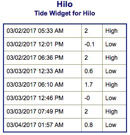
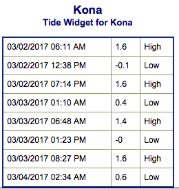
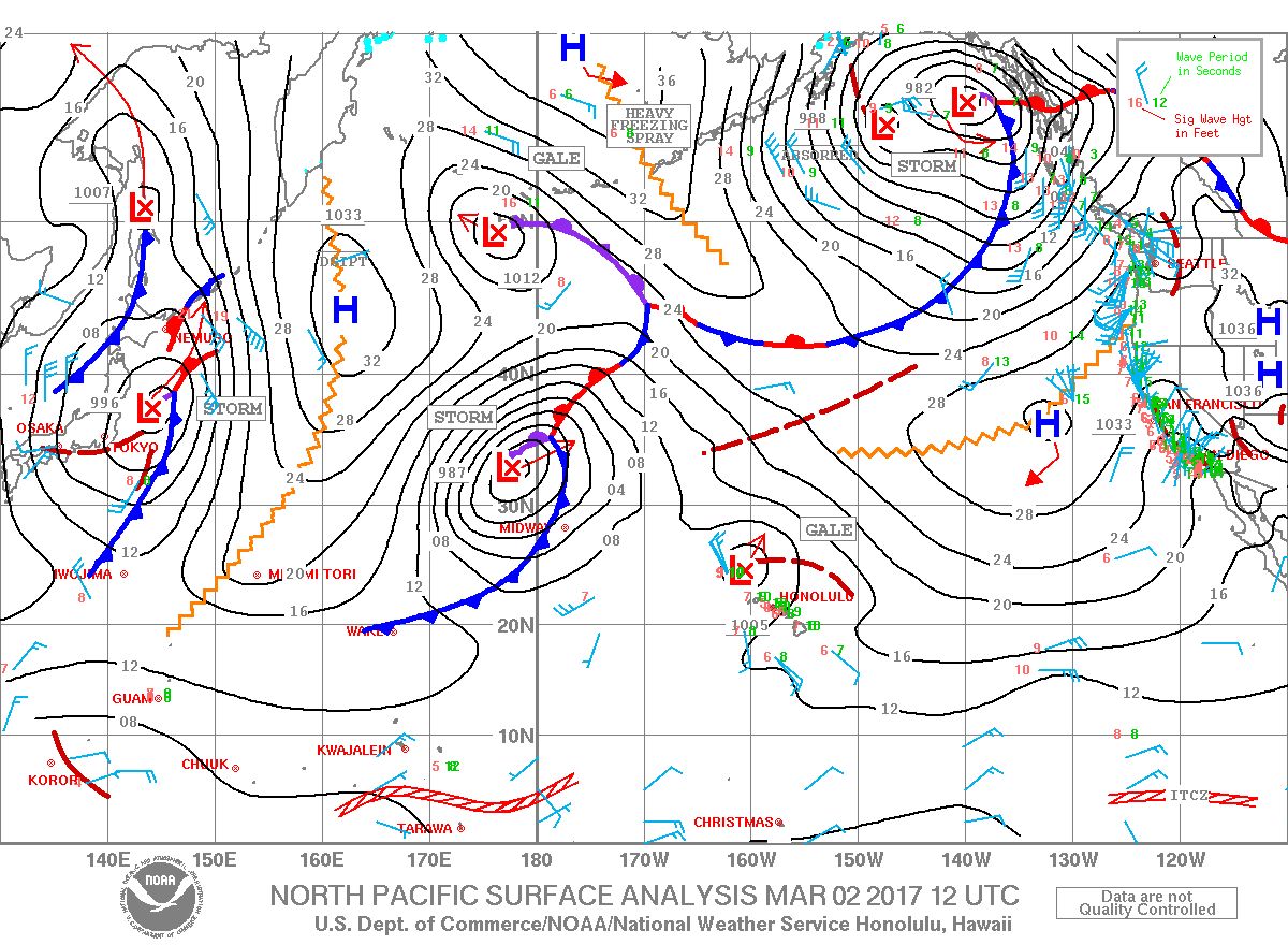
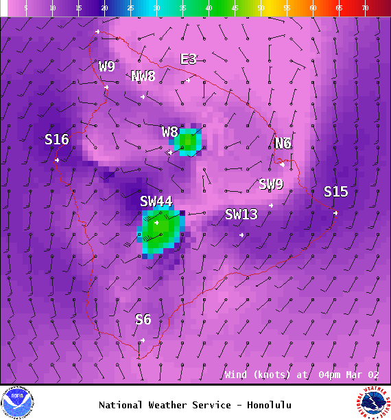
**Click directly on the images below to make them larger. Charts include: Big Island projected winds, tides, swell direction & period and expected wave heights.**
ARTICLE CONTINUES BELOW AD
ARTICLE CONTINUES BELOW AD
+
SWIPE LEFT OR RIGHT
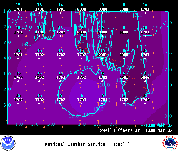
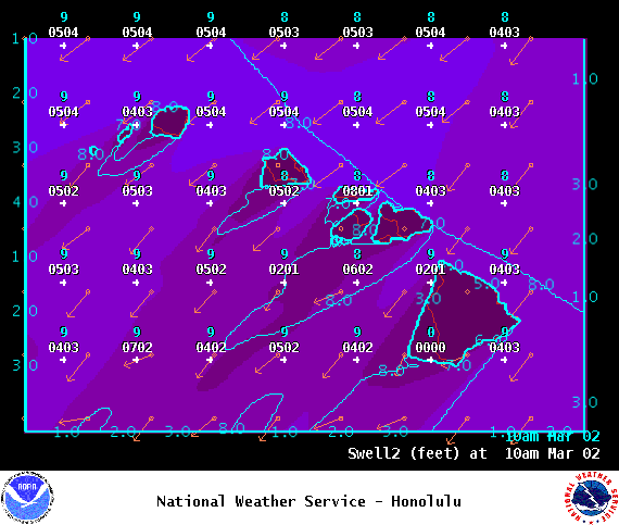
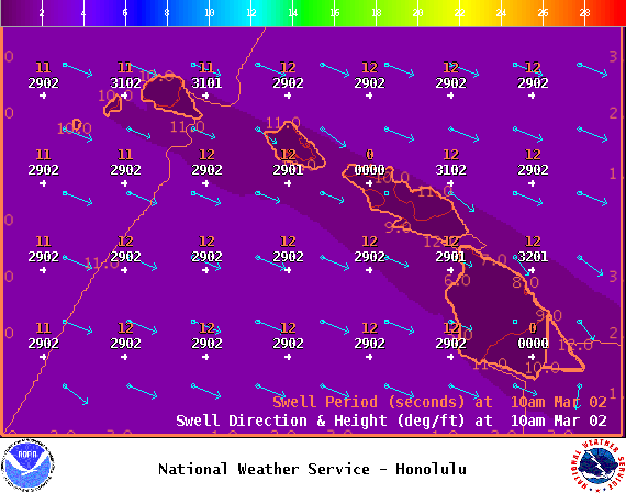
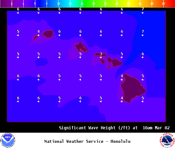
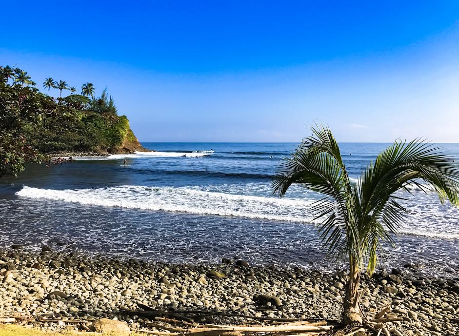
Big Island Surf Forecast
Hilo side: Wave heights are forecast to be shoulder/head high today.
ARTICLE CONTINUES BELOW AD
Kona side: Wave heights are expected to be knee/waist high today with chest high waves on the sets at the best breaks.
South: Wave heights are expected to be knee/waist high today with chest high waves on the sets at the best breaks.
South-southwest windswell showing today up to chest high at the best spots on the sets.
Pretty quiet on the surf front. Moderate west-northwest could show for the weekend, peaking Sunday near advisory levels and holding into Monday. Another pulse is expected for later in the week.
ARTICLE CONTINUES BELOW AD
Nothing significant from the South Pacific. A small southwest is expected for the 7th through the 9th.
Keep in mind, surf heights are measured on the face of the wave from trough to crest. Heights vary from beach to beach, and at the same beach, from break to break.
This comments section is a public community forum for the purpose of free expression. Although Big Island Now encourages respectful communication only, some content may be considered offensive. Please view at your own discretion. View Comments


 Alerts (as of 1:00 a.m.)