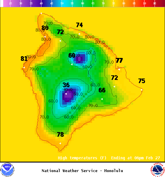
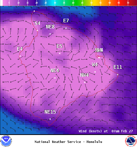
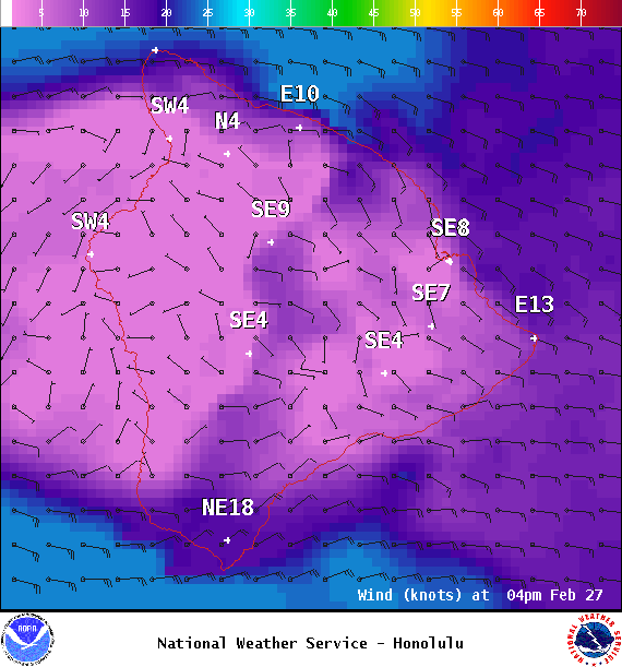
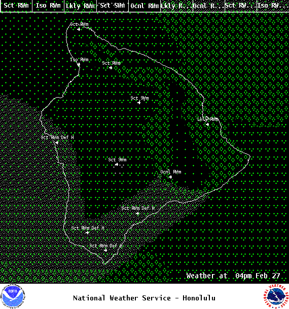
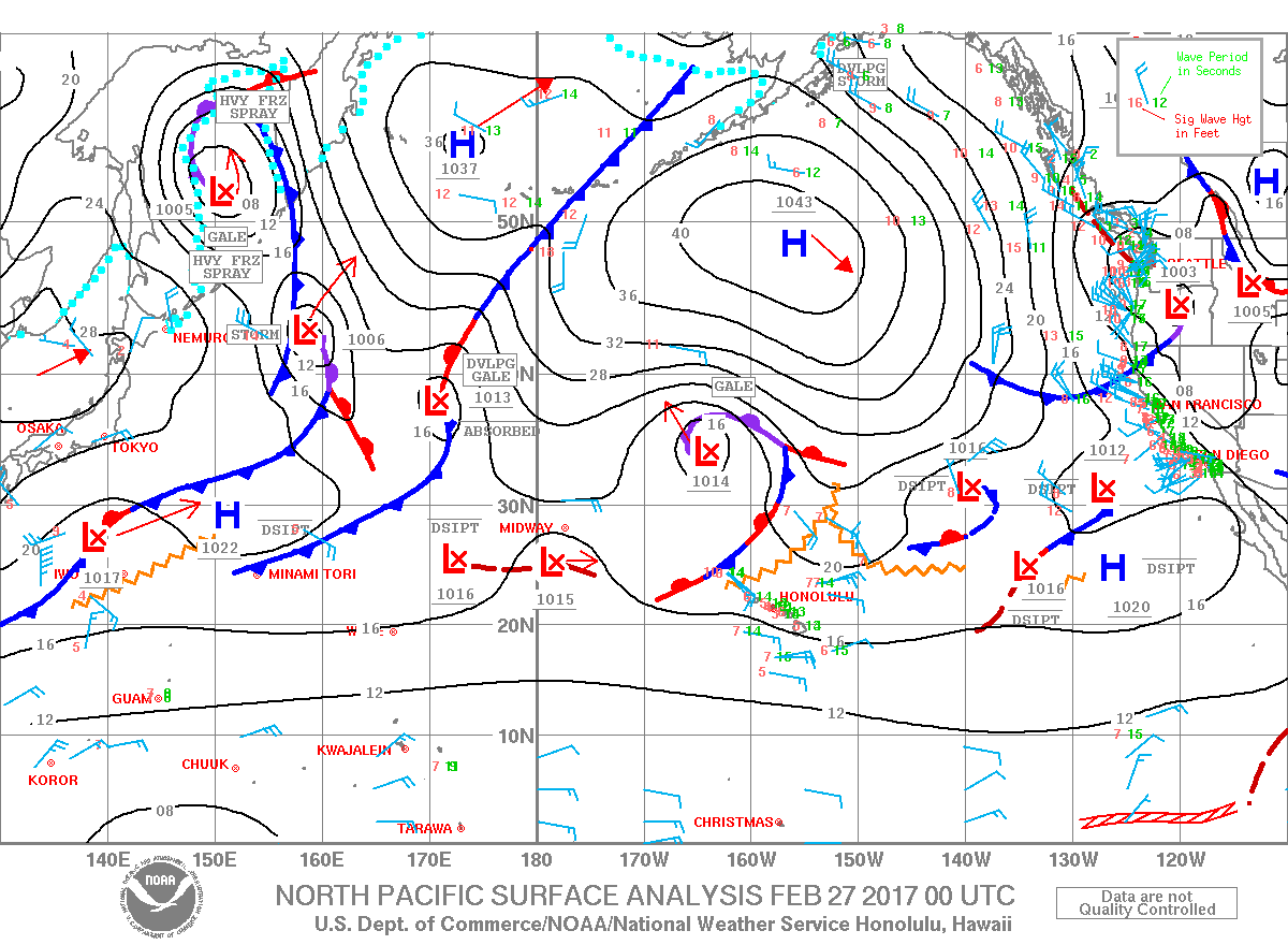
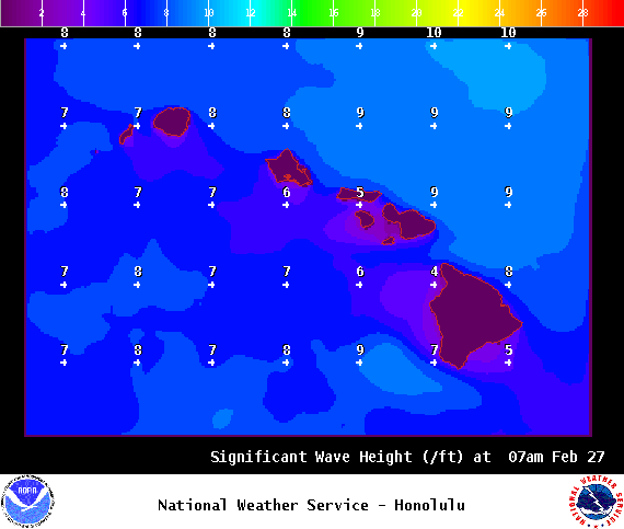
**Click directly on the images below to make them larger. Charts include: Big Island high/low forecasted temperatures, projected winds, chance of cloud cover, projected localized weather conditions, vog/SO2 forecast and expected wave heights.**
+
SWIPE LEFT OR RIGHT
Looking Ahead
East-southeast winds are forecast to strengthen a bit on Monday before dropping off again Tuesday. High clouds are expected Monday through Wednesday with wet, unsettled weather conditions from Tuesday through Wednesday. Heavy rain and thunderstorms are possible during that time. Thursday, weather conditions will again shift with better conditions and light winds expected into next weekend.
ARTICLE CONTINUES BELOW AD
Today
We have trade winds today around 10 to 20 mph. High temperatures are forecast from 77° to 82°. Mostly cloudy skies are expected with windward showers likely and scattered afternoon leeward showers.
UV index at 9 (“very high” exposure level)
ARTICLE CONTINUES BELOW AD
Tonight
Trade winds are forecast around 10 to 20 mph. Mostly cloudy skies are expected with frequent windward showers and scattered leeward showers. Low temperatures from 66° to 71°.
This comments section is a public community forum for the purpose of free expression. Although Big Island Now encourages respectful communication only, some content may be considered offensive. Please view at your own discretion. View Comments