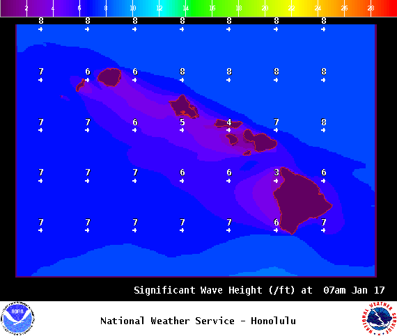
**Click directly on the images below to make them larger. Charts include: Big Island high/low forecasted temperatures, projected winds, chance of cloud cover, projected localized weather conditions, vog/SO2 forecast and expected wave heights.**
+
SWIPE LEFT OR RIGHT
Looking Ahead
Trade winds are expected to slowly build from east to west across the state through Wednesday. The trades will then drop off Thursday and Friday as a front approaches from the northwest. Limited showers will favor windward and mauka areas through the week. A change in weather is expected over the weekend as a front pushes southward through the island chain, bringing an increase in showers and strong trade winds to the Aloha state.
ARTICLE CONTINUES BELOW AD
Today
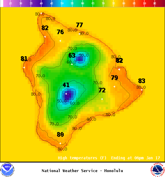
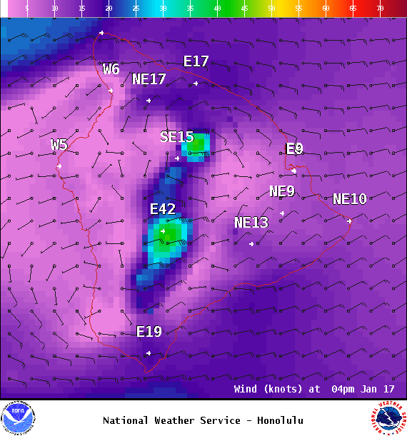
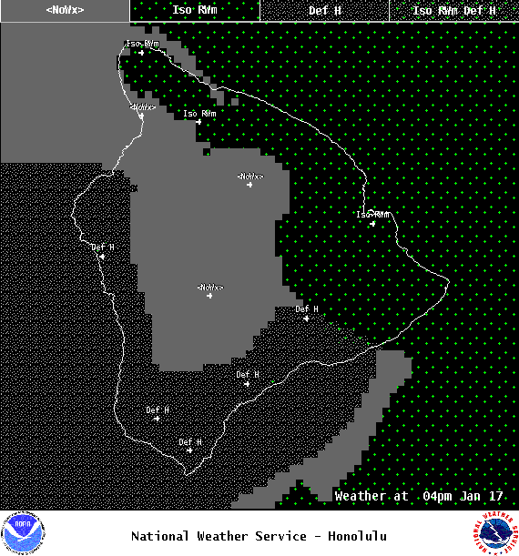
We have northeast winds today from 10 to 25 mph with high temperatures from 79° to 84°. Partly sunny skies are forecast for windward and mauka spots with isolated showers and mostly sunny skies for the Kona side with some clouds building in the afternoon.
UV index at 8 (“very high” exposure level)
ARTICLE CONTINUES BELOW AD
Tonight
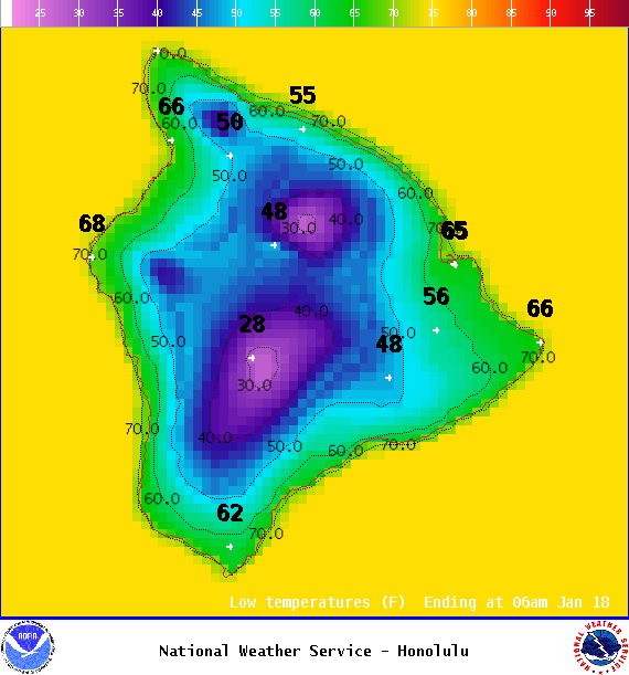
Northeast winds 10 to 25 mph tonight. Scattered windward showers with clearing skies for the leeward side. Low temperatures from 69° to 74°.
This comments section is a public community forum for the purpose of free expression. Although Big Island Now encourages respectful communication only, some content may be considered offensive. Please view at your own discretion. View Comments