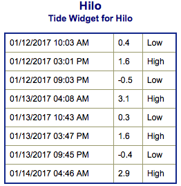
**Click directly on the images below to make them larger. Charts include: Big Island projected winds, tides, swell direction & period and expected wave heights.**
ARTICLE CONTINUES BELOW AD
ARTICLE CONTINUES BELOW AD
+
SWIPE LEFT OR RIGHT
Big Island Surf Forecast
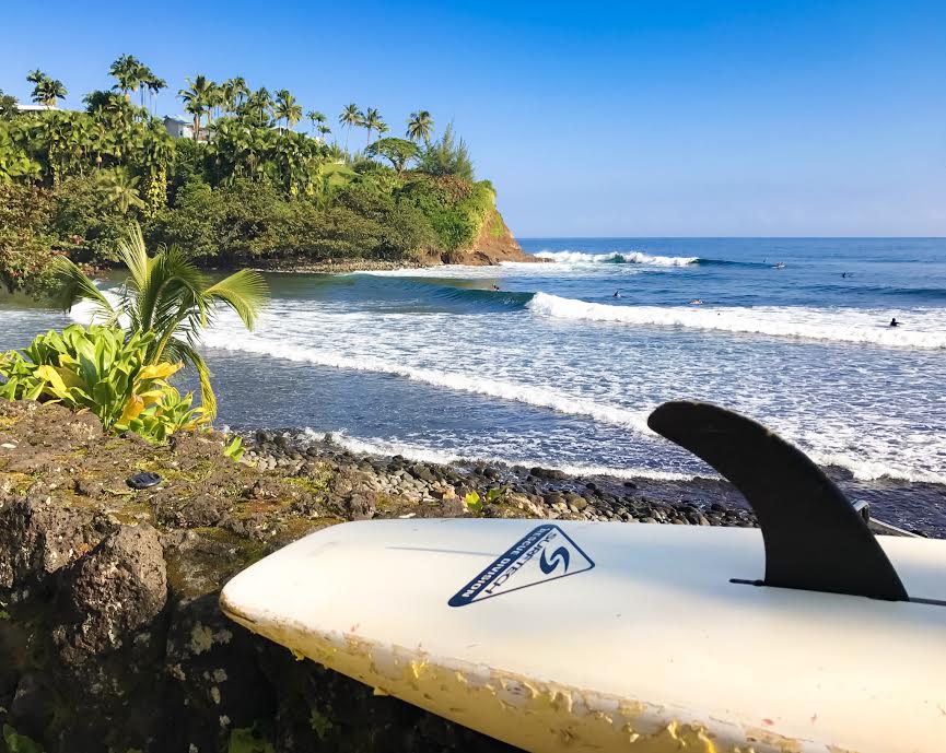
Hilo side: Wave heights are forecast to be chest/head high today for good breaks with sets getting overhead at the best exposures.
ARTICLE CONTINUES BELOW AD
Kona side: Wave heights are expected to be waist/chest high today with shoulder high waves on the sets. Wrap from the northwest swell is also mixing in today up to about knee/waist high.
South: Wave heights are expected to be waist/chest high today with shoulder high waves on the sets.
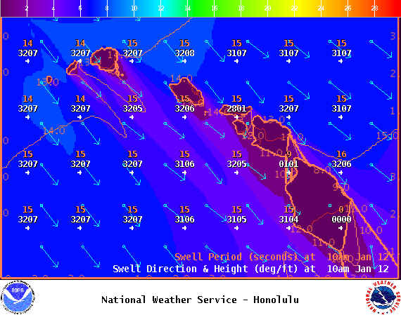
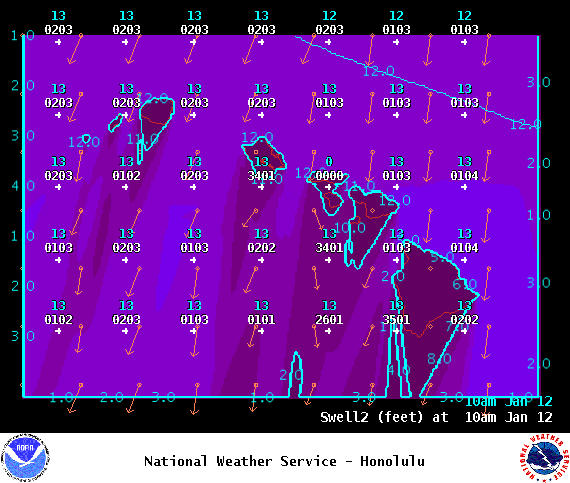
Our current north-northeast swell is fading over Thursday and Friday with some northwest wrap mixing in. New northwest swell builds Thursday, peaks in the afternoon and holds through Friday.
A longer period west-northwest swell is expected to build Friday, peaks late Friday night and into Saturday morning up to double overhead at the best breaks.
ARTICLE CONTINUES BELOW AD
Our current south-southwest holds through Thursday and fades Friday and into the weekend.
Keep in mind, surf heights are measured on the face of the wave from trough to crest. Heights vary from beach to beach, and at the same beach, from break to break.
This comments section is a public community forum for the purpose of free expression. Although Big Island Now encourages respectful communication only, some content may be considered offensive. Please view at your own discretion. View Comments


 Big Island Surf Forecast
 Our current north-northeast swell is fading over Thursday and Friday with some northwest wrap mixing in. New northwest swell builds Thursday, peaks in the afternoon and holds through Friday.