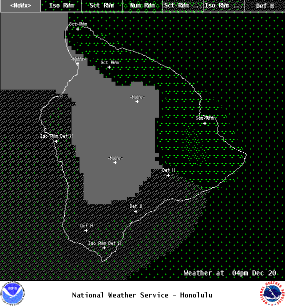
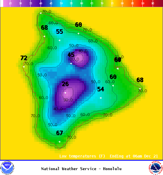
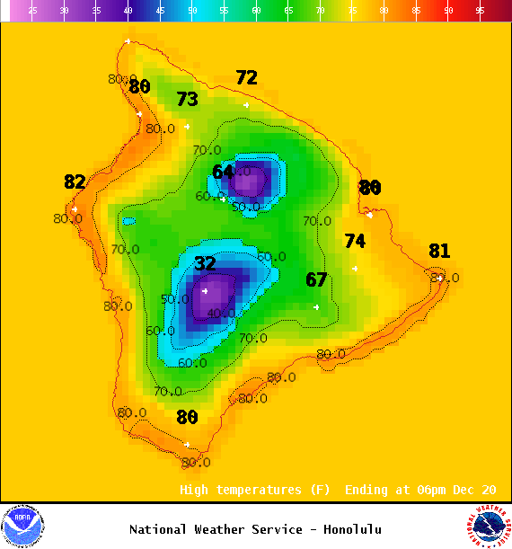
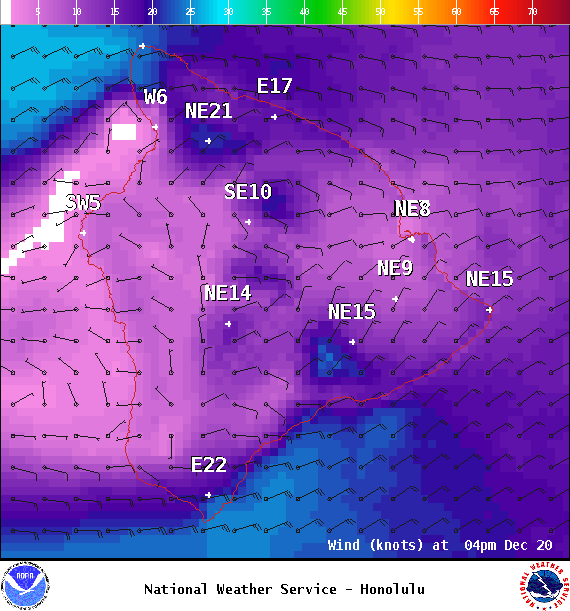
**Click directly on the images below to make them larger. Charts include: Big Island high/low forecasted temperatures, projected winds, chance of cloud cover, projected localized weather conditions, vog/SO2 forecast and expected wave heights.**
+
SWIPE LEFT OR RIGHT
ARTICLE CONTINUES BELOW AD
ARTICLE CONTINUES BELOW AD
Looking Ahead
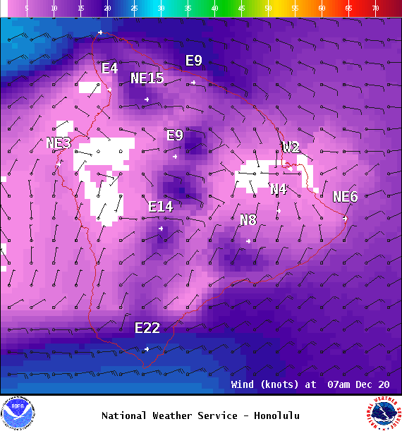
Trade winds are forecast to bring our usual windward and mauka focused clouds and showers. Trade showers are expected to increase during the second half of the work week after rather limited amounts of rain early in the week.
ARTICLE CONTINUES BELOW AD
Today
Mostly cloudy skies are expected with scattered showers for windward and mauka spots along the Hilo side. Hazy for the Kona side with clouds building in the afternoon and isolated showers. High temperatures from 78° to 84°. Winds will be east around 15 to 20 mph.
UV index at 6 (“high” exposure level)
ARTICLE CONTINUES BELOW AD
Tonight
East winds are forecast 15 to 20 mph. Mostly cloudy skies for windward spots with showers likely and mostly clear for the Kona side with just isolated showers. Low temperatures from 66° to 72°.
This comments section is a public community forum for the purpose of free expression. Although Big Island Now encourages respectful communication only, some content may be considered offensive. Please view at your own discretion. View Comments