A Flash Flood Watch is posted for the Big Island through Sunday afternoon.
A Winter Storm Warning is posted for Mauna Kea and Mauna Loa above 8000 feet. Up to 12 inches of snow are expected Saturday and an additional 12 inches Sunday and Sunday night.
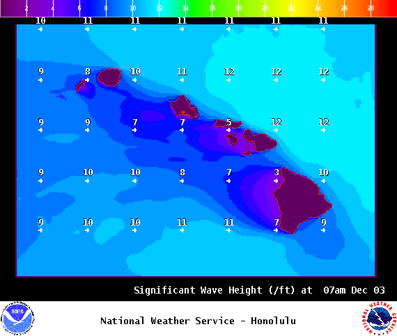
A High Surf Advisory is posted for east facing shores until 6 p.m. Saturday.
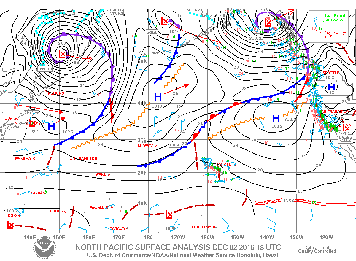
A Small Craft Advisory is posted for all windward Hawaii County waters and channels through 6 p.m. Saturday.
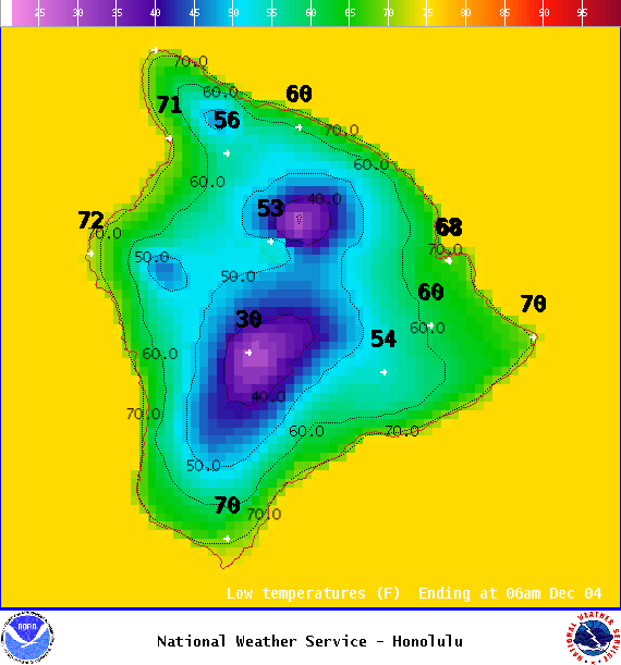
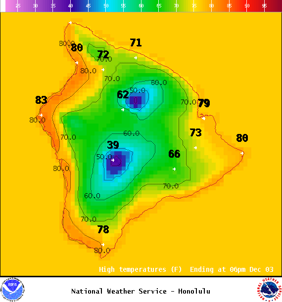
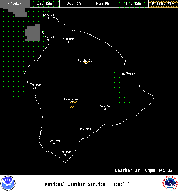
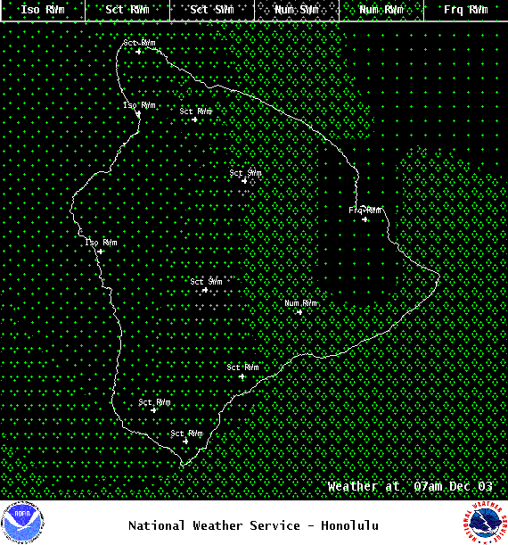
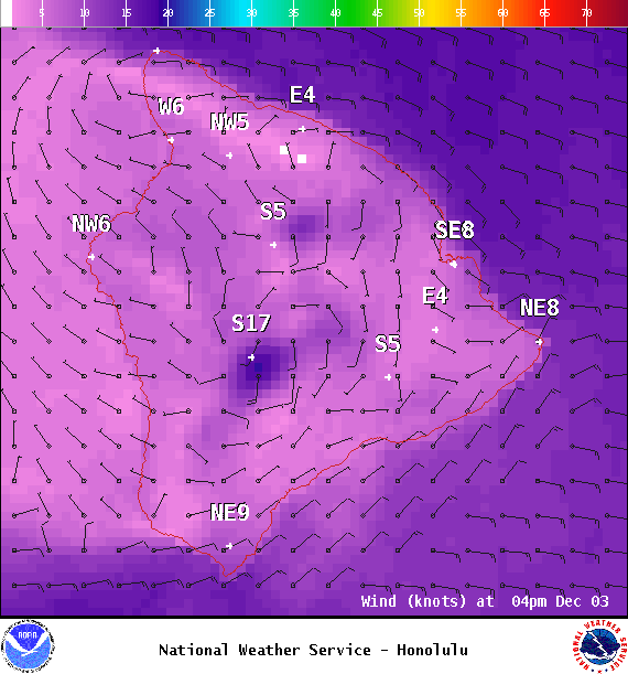
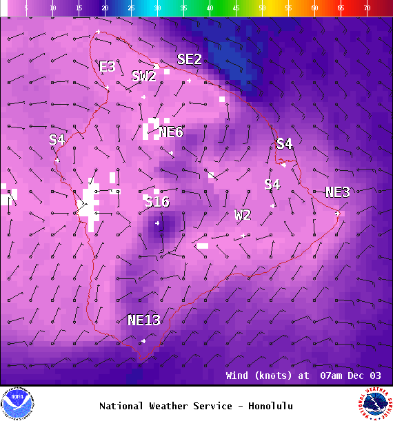
**Click directly on the images below to make them larger. Charts include: Big Island high/low forecasted temperatures, projected winds, chance of cloud cover, projected localized weather conditions, vog/SO2 forecast and expected wave heights.**
+
SWIPE LEFT OR RIGHT
Looking Ahead
The potential for active weather remains through the weekend as a couple of disturbances high in the atmosphere combined with a deep moist southerly flow possibly interact. Locally heavy rainfall and thunderstorms will be possible at times. The weather may calm down briefly Monday and Monday night, though more troublesome weather may return throughout rest of next week.
ARTICLE CONTINUES BELOW AD
Today & Sunday
Mostly cloudy for windward spots with scattered showers. Kona side can expect sunny skies in the morning with building clouds in the afternoon. High temperatures from 79° to 84°. Winds will be out of the southeast around 15 mph and becoming light and variable. Sunday the chances for locally heavy rainfall and thunderstorms increases.
UV index at 6 (“high” exposure level)
ARTICLE CONTINUES BELOW AD
Tonight & Sunday Night
Winds will be variable around 15 mph. Mostly cloudy with numerous showers in windward spots. Isolated showers for leeward areas. On Sunday night the chance of thunderstorms and locally heavy rainfall increases and winds veer out of the southeast. Low temperatures from 68° to 74°.
This comments section is a public community forum for the purpose of free expression. Although Big Island Now encourages respectful communication only, some content may be considered offensive. Please view at your own discretion. View Comments