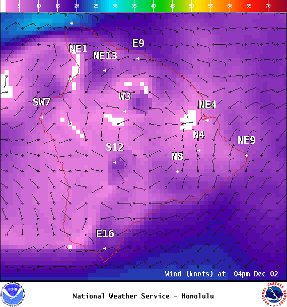
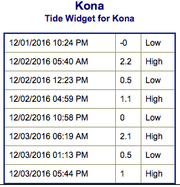
**Click directly on the images below to make them larger. Charts include: Big Island projected winds, tides, swell direction & period and expected wave heights.**
+
SWIPE LEFT OR RIGHT
ARTICLE CONTINUES BELOW AD
Big Island Surf Forecast
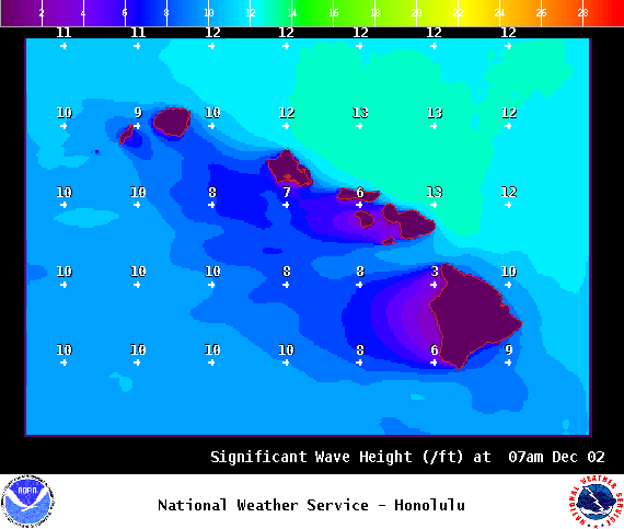
Hilo side: Wave heights are forecast well overhead today for the best breaks.
Kona side: Wave heights are expected to be waist high this morning and building to chest high by sunset.
ARTICLE CONTINUES BELOW AD
South: Wave heights are expected to be waist high this morning and building to chest high by sunset. Spots that are more open to the northwest wrap will be bigger.
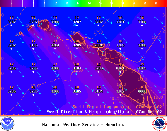
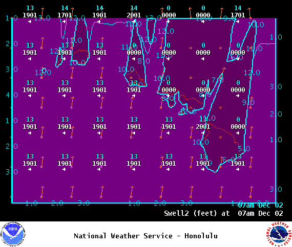
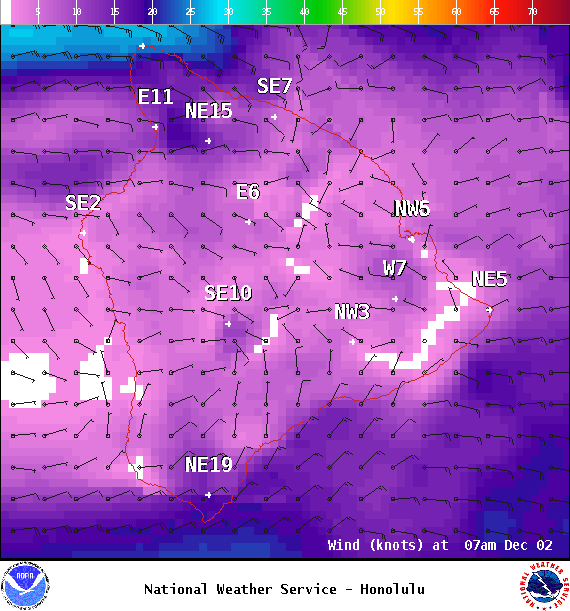
East-northeast trades are creating a trade wind swell for the Hilo side through the next few days.
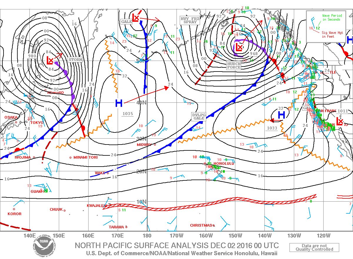
A solid northwest is expected to build today before easing on Saturday into Sunday.
Our current south-southwest swell is expected to be down to leftovers by Friday. A small southwest is expected to build Sunday and Monday.
Keep in mind, surf heights are measured on the face of the wave from trough to crest. Heights vary from beach to beach, and at the same beach, from break to break.
This comments section is a public community forum for the purpose of free expression. Although Big Island Now encourages respectful communication only, some content may be considered offensive. Please view at your own discretion. View Comments


 Big Island Surf Forecast
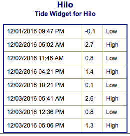 East-northeast trades are creating a trade wind swell for the Hilo side through the next few days.