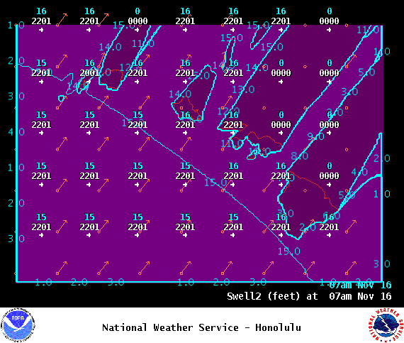
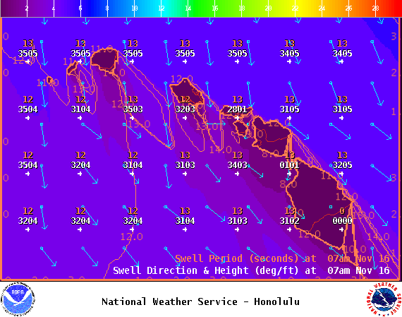
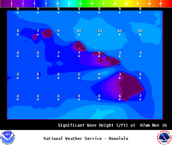
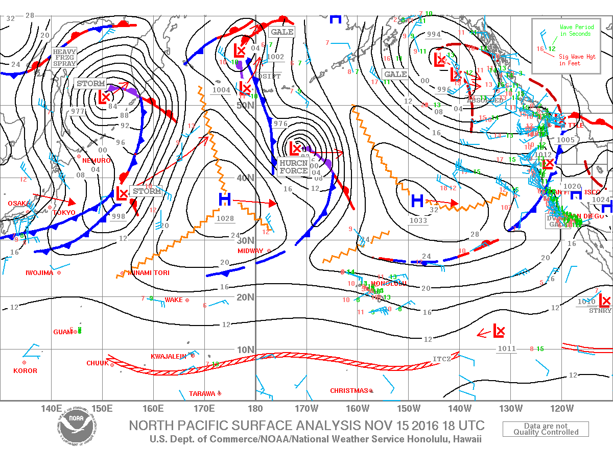
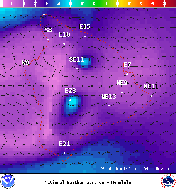
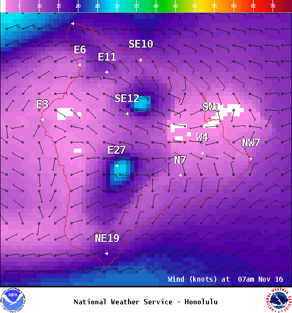
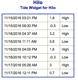
**Click directly on the images below to make them larger. Charts include: Big Island projected winds, tides, swell direction & period and expected wave heights.**
+
SWIPE LEFT OR RIGHT
ARTICLE CONTINUES BELOW AD
Big Island Surf Forecast
Hilo side: Wave heights are forecast from head high to slightly overhead today for the best breaks and fading through the day.
Kona side: Wave heights are expected about knee/waist high today with chest high sets at the best exposures and fading through the day.
ARTICLE CONTINUES BELOW AD
South: Wave heights are expected to be knee/waist high today from the northwest wrap and fading.
Our current northwest swell is forecast to continue fading on the Big Island and should be down to traces by Thursday. Another possible swell is expected for the 18 / 19th.
Nothing significant is expected out of the SPAC with minimal leftovers expected this week.
Keep in mind, surf heights are measured on the face of the wave from trough to crest. Heights vary from beach to beach, and at the same beach, from break to break.
This comments section is a public community forum for the purpose of free expression. Although Big Island Now encourages respectful communication only, some content may be considered offensive. Please view at your own discretion. View Comments


 Big Island Surf Forecast
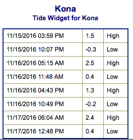 Our current northwest swell is forecast to continue fading on the Big Island and should be down to traces by Thursday. Another possible swell is expected for the 18 / 19th.