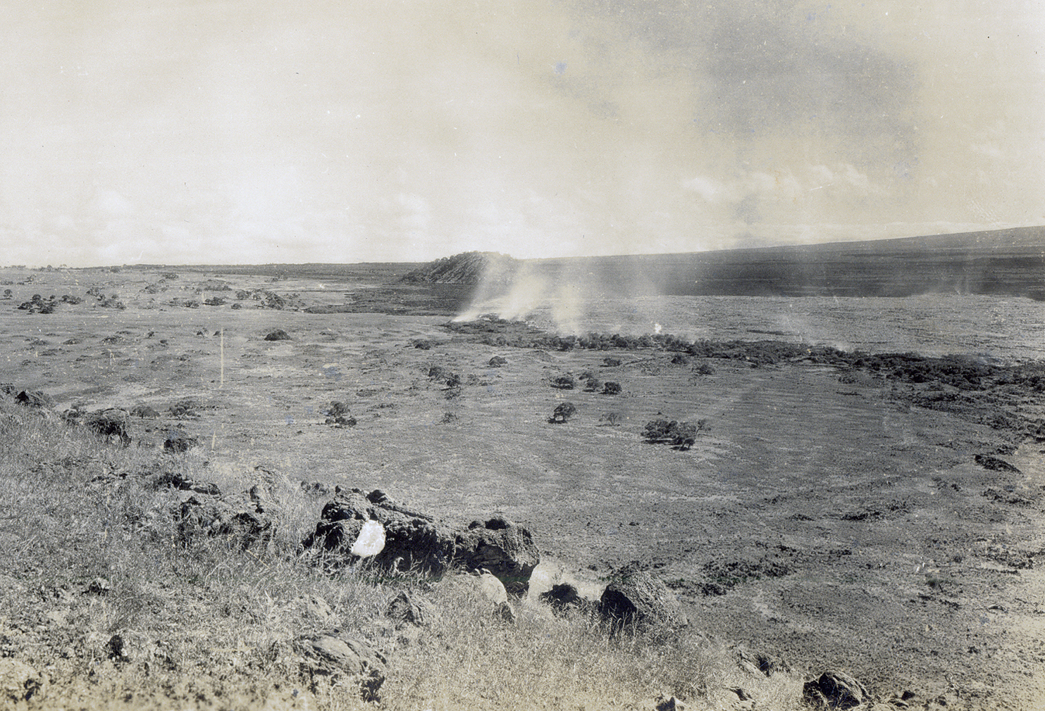
This photo, taken by Thomas Jaggar on Dec. 21 during the1935 Mauna Loa eruption, shows the Humu‘ula pāhoehoe flow ponding and slowly expanding eastward. The image looks east-southeast toward Puʻuhuluhulu from the southernmost Omaokoili cinder cone in the vicinity of today’s Saddle Road and Mauna Kea Access Road juncture. USGS photo.
After working for 20 years building the Hawaiian Volcano Observatory, Thomas Jaggar had achieved almost everything he set out to do. He had directed continuous observations of Kīlauea Volcano, installed seismic monitoring instruments at four locations around the Island of Hawaiʻi and published these findings regularly. His budget for the fiscal year 1931-32 from the U.S. Geological Survey (USGS) was his largest ever—$35,000.
But these were the years of the Great Depression. Over the next two years, HVO’s budget was slashed to $6,000, forcing a reduction in publishing and requiring supplemental funding from HVO’s private funding source, the Hawaiian Volcano Research Association, to pay salaries.
While government funding was being cut, volcanic and seismic activity on Hawaiʻi did not diminish. In late 1933, a six-week-long swarm of earthquakes culminated in a 17-day-long eruption within Moku‘āweoweo, the summit caldera of Mauna Loa. Almost a year later, Halemaʻumaʻu Crater at the summit of Kīlauea erupted for a month.
On March 26, 1934, Jaggar gave a bold speech titled “The Coming Lava Flow,” in which he predicted—based on analyses of 60 years of Mauna Loa eruptions—that, “A lava flow from Mauna Loa, or else another summit eruption, is expected within two years.” He further predicted that, if it was a Mauna Loa lava flow, it would break out along the Northeast Rift Zone and flow in the “likely direction” of Hilo.
Jaggar also pointed out that, despite the coming lava flow, HVO had been reduced to two staff, including himself. He further campaigned for increased membership in HVRA to hopefully make up for the federal funding cuts.
ARTICLE CONTINUES BELOW AD
ARTICLE CONTINUES BELOW AD
The HVRA funding did not come, and as of July 1, 1935, HVO was transferred from the USGS to the National Park Service under what was then known as Hawaii National Park. While this looked like defeat for Jaggar, it may have been a blessing.
Edward G. Wingate, a USGS topographical engineer, had worked at HVO for two years before being selected as HNP superintendent in November 1933. After HVO was transferred to the park, he was able to provide Jaggar with additional staff and funds when needed. So, when Mauna Loa erupted on Nov. 21, 1935, as Jaggar had predicted, Wingate directed park staff to the eruption site to make observations and relay information to HVO.
The 1935 Mauna Loa eruption started from a 4-mile-long fissure that extended from the summit caldera down the Northeast Rift Zone. Several lava flows moved northward down the flank of the volcano toward the Saddle area between Mauna Loa and Mauna Kea.
Contrary to Jaggar’s prediction, these flows would probably flow toward Kona if they continued, not toward Hilo. Still, Jaggar’s predicted time frame and location of the eruption source were spot-on.
But then, on Nov. 27, smoke was observed from a patch of ground east of the 1935 lava flows, well away from the Northeast Rift Zone, at the 8,500-foot elevation. ʻAʻā lava (later called the Humu‘ula flow) soon issued from that location and flowed north into the Saddle area. It stalled, but was followed by a pāhoehoe flow that ponded in a flat area between Mauna Loa’s 1843 ʻaʻā flow and Puʻuhuluhulu, an ancient cinder cone.
ARTICLE CONTINUES BELOW AD
After ponding for two weeks, the Humu‘ula flow began moving and advanced eastward past Puʻuhuluhulu. The increasingly steep slope resulted in a narrow flow advancing at an alarming rate of 1 mile per day.
Fearing that the flow would reach the headwaters of the Wailuku River, which supplied water for the town of Hilo, Jaggar called on the Army Air Service on Dec. 22 to bomb the lava flow source. His hope was that the lava tubes or channels could be destroyed, robbing the advancing flow to feed another flow that would re-cover the same area. The flow was bombed on Dec. 27 and the flow stopped during the night or early morning of Dec. 30-31.
Despite severely reduced funding and staffing, Jaggar made an important and successful prediction based on Mauna Loa’s past pattern of eruptions. Whether or not the bombing caused the 1935 lava flow to stop is still a controversial topic.
Volcano Activity Updates
Kīlauea continues to erupt at its summit and East Rift Zone. During the past week, in concert with summit inflation and deflation, the summit lava lake level varied between about 52 and 120 feet below the vent rim within Halema‘uma‘u Crater.
ARTICLE CONTINUES BELOW AD
On the East Rift Zone, the “61g” lava flow continued to enter the ocean. The lava flow does not pose an immediate threat to nearby communities.
Mauna Loa is not erupting. Seismicity remains elevated relative to the long-term background rate, with earthquakes occurring mostly in Mauna Loa’s south caldera and upper Southwest Rift Zone at depths less than 3 miles. Global Positioning System measurements show deformation related to inflation of a magma reservoir beneath the summit and upper Southwest Rift Zone, with inflation occurring mainly in the southwestern part of the magma storage complex.
Four earthquakes were reported felt on the Island of Hawaiʻi this past week.
On Sept. 7, 2016, at 2:03 p.m., HST, a magnitude-2.7 earthquake occurred 1 mile southwest of Kīlauea’s summit at a depth of .7 miles.
On Sept. 6 at 4:25 a.m., a magnitude-4 earthquake occurred 2.2 miles south-southeast of Mauna Loa’s summit at a depth of .7 miles.
On Sept. 3 at 8:05 p.m., a magnitude-3.3 earthquake occurred 3.2 miles southeast of Waimea at a depth of 9.3 miles.
On Sept. 1 at 12:11 a.m., a magnitude-3.7 earthquake occurred 15.5 miles southeast of Waimea at a depth of 24.6 km (15.3 mi).
Volcano Watch is a weekly article and activity update written by U.S. Geological Survey Hawaiian Volcano Observatory scientists and affiliates. Call for summary updates at (808) 967-8862 (Kīlauea) or (808) 967-8866 (Mauna Loa); email questions to [email protected].
This comments section is a public community forum for the purpose of free expression. Although Big Island Now encourages respectful communication only, some content may be considered offensive. Please view at your own discretion. View Comments