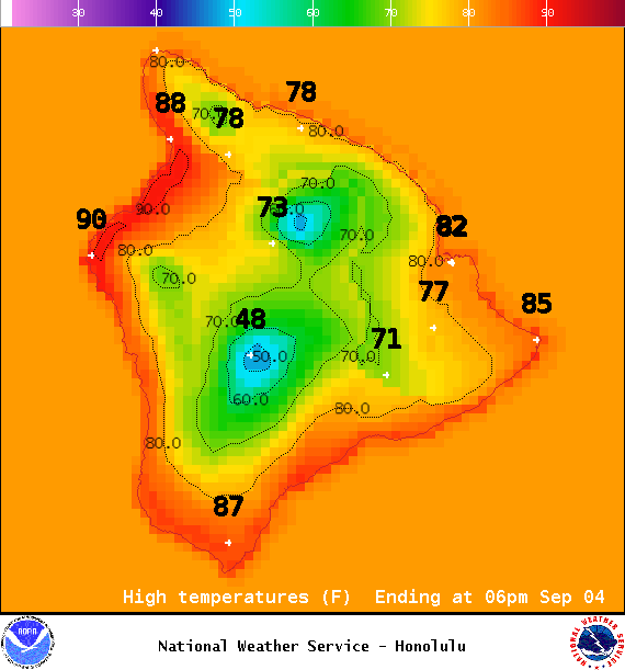
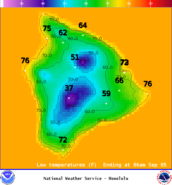
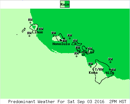
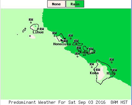
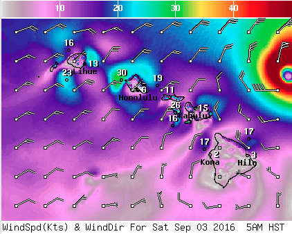
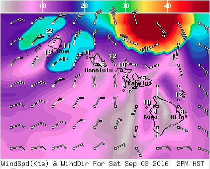
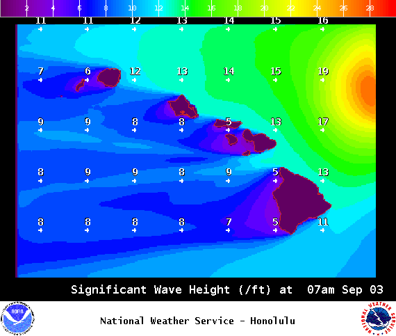
**Click directly on the images below to make them larger. Charts include: Big Island high/low forecasted temperatures, projected winds, chance of cloud cover, projected localized weather conditions, vog/SO2 forecast and expected wave heights.**
+
SWIPE LEFT OR RIGHT
ARTICLE CONTINUES BELOW AD
ARTICLE CONTINUES BELOW AD
Looking Ahead
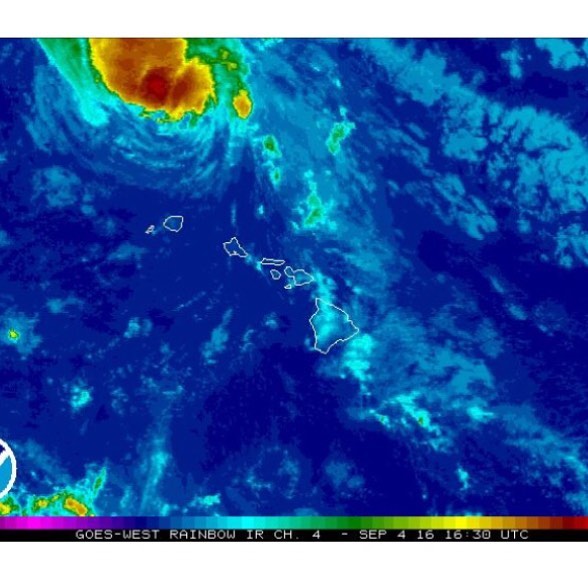
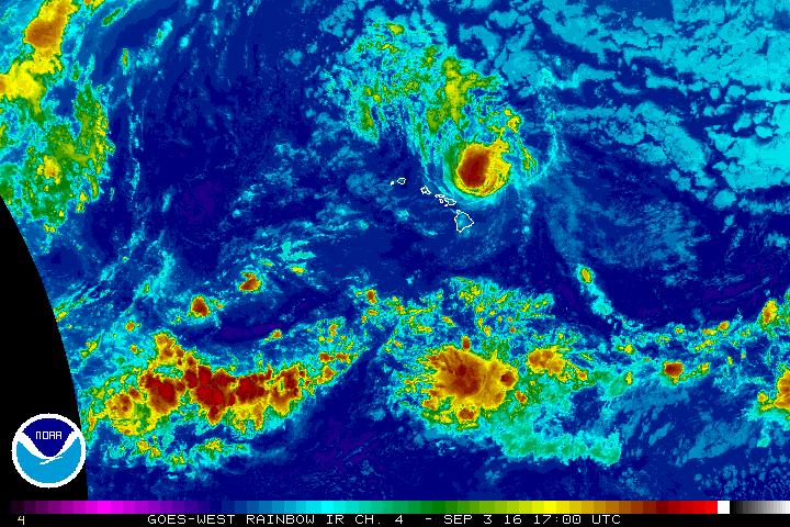
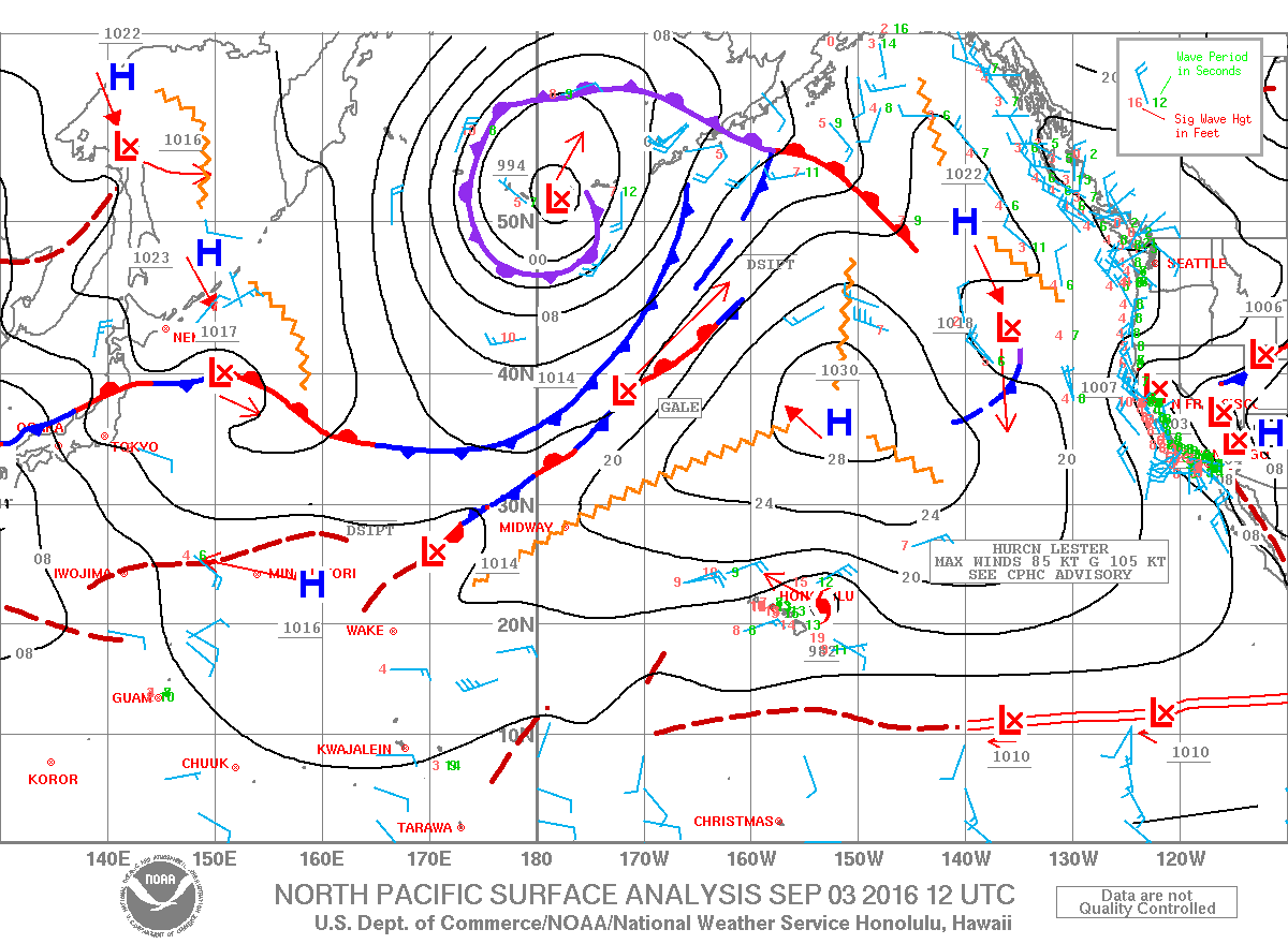
Sunday, there is a north to south band of clouds and showers trailing Lester that will bring more showers including a slight chance of a thunderstorm for the smaller islands, the leading edge of this band made landfall a couple of hours ago on the Big Island’s eastern shore. This band will continue westward finally clearing Kauai County by mid Monday morning. Afternoon convection could again bring some heavy showers and thunderstorms to the Big Island.
By this time tomorrow, all islands will be under stable, moderate to locally strong trade wind regime. Showers will be present with this flow, favoring the windward and mountain areas. The frequency of the showers will highest during the nights and mornings. The strength of the trades will be switching between moderate and moderate to locally strong during the new work week. An upper level disturbance may enhance some the trade showers during the second half of the week.
ARTICLE CONTINUES BELOW AD
Sunday
Mostly sunny this morning. This afternoon, mostly cloudy skies with scattered showers and a slight chance of heavy showers and thunderstorms. Locally heavy rainfall is possible. High temperatures from 84° to 89° and feeling warmer because of the high humidity. Winds will be easterly around 10 mph.
UV index at 10 (“very high” exposure level)
ARTICLE CONTINUES BELOW AD
Sunday Night
Winds will be northeast around 15 mph. Sunday, partly cloudy with scattered windward showers and isolated showers for lee spots. Low temperatures from 73° to 78°.
This comments section is a public community forum for the purpose of free expression. Although Big Island Now encourages respectful communication only, some content may be considered offensive. Please view at your own discretion. View Comments